Sunday, 29 May 2011

Geldie Munros

An Sgarsoch from Carn Ealar
An Sgarsoch summit
Carn Ealar from An Sgarsoch
Monadh Mor and Beinn Bhrotain
Another shower, another rainbow
Linn of Dee and more showers


Geldie Munros, Saturday, 28 May 2011
Distance: 40 kilometres, 
Ascent:   1050 metres, 
Time:      9 hours 48 minutes

Carn Ealar        994metres    4hrs 50mins
An Sgarsoch   1006metres    6hrs 7mins


I had agreed earlier in the week to have a long walk with Mark but the mountain weather information service mwis was predicting strong winds, heavy showers and freezing temperatures at Munro height. The original intention to head to Glencoe was axed late on Friday and as I began to think of alternatives I remembered that the Geldie Lodge Munros were still on the to-do list. They are some of the most remote Munros, although less difficult to reach than Luirg Mor, Fisherfield or Knoydart.

They involve a long walk in from the Linn of Dee but there would be minimum time on the tops in the strong winds. I had climbed these hills twice before from Linn of Dee, once in December, but only on walking to Geldie Lodge did I remember that I had cycled in on both previous occasions.  Cycling in took about an hour on the gravelly tracks and slightly less time on the descent compared to a two-and-a-half-hour walk that would have to be repeated at the end of the day. But any Munro round requires days like this and the hills themselves are nothing special as the photographs confirm.

The real attractions on days like today are to escape the daily routine, start early, exercise hard, enjoy conversation, the wildlife, crazy weather and to have an adventure with no limits. Linn of Dee is a favourite haunt for starting big walks into the Cairngorms and the car park was full on a bank holiday weekend despite the frequent showers, high winds and forecast of more of the same.  The track to White Bridge and then along the Geldie Burn is long and we had to wade knee-deep across one of the burns. The ford at Geldie Lodge was a torrential patch of water and we headed upriver to find a less aggressive reach of water.  We managed across without mishap and retreated to a sheep shelter to escape the rain, wring out socks, empty our boots and eat some lunch before starting out on the very well-made footpath westwards towards Carn Ealar.

The showers were passing through quickly and in between the light conditions were good.  The ascent up the northeast flank of Carn Ealer was over boggy ground with heather slowing progress but we were in the lee of the hill and only in the last kilometre were we exposed to the wind.  A few ptarmigans were croaking and circling me as I passed their nest sites. After a quick stop for some food and drink at the summit we realised that we would not be down until after 7pm, we had already been walking for almost 5 hours.

There is an easy descent to the southeast for a couple of kilometres before dropping steeply to the bealach and then just a long steady climb to An Sgarsoch.  It seemed relentless as it had on the previous 4 visits, two in each direction, and we reached the summit to find another three walkers who had opted for a similar long day, although one had wisely cycled up to the lodge.  We descended the long heather slopes and followed the boggy course of a burn back to Geldie Lodge, a substantial ruin in a remote location.

After a last stop for water, it was time to wade the rivers and begin the long slog back.  We were treated to more showers and some spectacular rainbows before we reached Linn of Dee. We were tired from the exertions but pleased to have completed these challenging hills in inclement conditions. They are a benchmark against which the good days can be truly appreciated.  We read the notice warning us about the risk of the river crossings and danger on the hills and realised that taking risks is one of the reasons why we continue on days like today.

Tuesday, 24 May 2011

Integrated Transport

The quest for the Holy Grail of Integrated Transport was achieved last night in Edinburgh.  The gale force winds that had whistled through the Central belt all day had resulted in all trains being cancelled during the rush hour so I was grounded at Haymarket along with thousands of others.  I had brought an umbrella which had proved useful in the walk to the station in the morning, despite turning inside out at every gust, but it soon joined the jetstream of hats, bags and umbrellas departing from Haymarket platz.  It was a wet walk with the wind at my back to the centre of Edinburgh in the hope of finding a bus at St James' centre but the bus station closed just before I got there.  We were told to go to Princes Street to find buses but the bus stops were blocked off by the tram works and the crowds were similar to Hogmanay but without any anticipation of fireworks.  Edinburgh is the least pedestrian friendly city that I know and the only compensation is the normally excellent bus service that caters for those of us that choose to avoid visiting the city by car.

I began the walk back along Princes Street wondering if the trams would have survived the gales assuming they ever became operational.  I eventually decided to get a local bus to the airport but this got caught up in a traffic jam and was virtually static for half an hour.  My patience was exhausted and I got off the bus by the Gyle and walked and jogged past thousands of cars, the RBS HQ and the airport to get to the motorway at Ratho.  It was closed, a lorry had overturned, and it would be several hours before it reopened according to the police who suggested I phone home and get someone to come to Broxburn to pick me up. Knowing that this defeated the object of reducing journeys and simply put more people at risk I elected to get a bus if any could be found. A trickle of buses began to emerge from the congestion and I jaywalked to the outside lane to wave them down but they were all full and after 12 sailed past me I decided to hitch a lift.

I keep getting e mails to car share and frequently give lifts myself surely this was payback time.  Forget the fleets of BMW and Mercedes, they never stop.  A couple of hundred mainly single occupied cars dawdled past - I had already walked or jogged past them and they had no intention of picking up a bedraggled man with no coat and little obvious sense.   It was raining cows and sheep and the wind was so strong that only the island flights were taking off from the airport.  With my umbrella having soared off into the Edinburgh skies, my suit was like blotting paper and I seemed to be the only person walking.  There was a sense of anarchy about the evening, this was confirmed when my daughter phoned from Manchester where she had just met John Cleese in a gym and told him I had that I had insisted on making her watch Monty Python and Fawlty Towers as a child. His parting words to her were "send my love to your dad'.

In short the entire transport system was fully integrated last night - nothing worked. I blame Keith Brown, the new transport minister, who was telling us not to travel.  I began to reflect on the justification for a second Forth Road Bridge - the biggest item of transport expenditure in the rapidly declining public spending plans.  It seemed utter lunacy and as pointless as the trams - it would be closed by the wind too.  Investing in improvements to the inadequate existing infrastructure for pedestrians, cyclists and in new public transport vehicles would make much more sense.

On occasions like this there is only one solution: the goodwill of humankind, and so it proved. As I crossed out of Edinburgh into West Lothian a car stopped (a Renault) and I had a lift to Polmont.  We discussed politics, the proposed Forth Bridge and the economy and the friendship that developed was translated into an offer of a trip to Falkirk which I politely declined.  I then stood at the motorway roundabout for a further 15 minutes in another squall until a second car stopped (a Vauxhall), it was a car delivery driver who was used to hitching.  He had driven all the way to Edinburgh to collect his wife and as someone who had spent many hours on motorway roundabouts, albeit clutching a set of number plates, he wanted to return the favours that he had received whilst hitching.  He proved this by taking me all the way to my car at the park and ride in Stirling.

So what are some lessons from this. When trains and buses are not running, motorways are closed and the trams are still £700m and 5 years disruption of the city away, the only truly integrated transport is walking and the generosity of kindly folk.  And like thousands of others, I didn't have the patience or time to pursue whoever it is that runs the trains nowadays to refund my ticket.

Sunday, 22 May 2011

Yell, Arisdale Hill

Summit Cairn

Burravoe

Education Blueprint for Burravoe school closure gets a message

Towards Fetlar

Mid Yell
Mid Yell beach

Thursday, 19 May 2011

Ascent:                 240 metres  
Distance:              10 kilometres
Total Time:          1 hour 10 minutes

Hill of Arisdale    210 metres        40 minutes      

After 4 days of round-the-clock work, I needed a break so I left Lerwick at 5pm to drive up to Yell and walk its highest hill. I missed the ferry by a few minutes after being delayed by the rush hour traffic exiting Lerwick and then by a low loader collecting a digger blocking the road. It was a happy set of circumstances as I was able to watch an otter patrolling the bay by the ferry terminal at Toft and miss a passing shower whilst on the ferry.

The hill of Arisdale is the highest point of a long ridge that runs south to north and provides the backbone of Yell. Its snout overlooks Burravoe.  I parked by a track leading to the Catalina aircraft wreck and followed the track for a while until tempted as always to strike out and take a direct route onto the ridge.  The hillside was well populated by Shetland sheep and lambs. As I hit the ridge I saw two wild-looking dogs, they started to bark and approach but then bolted in the opposite direction as I shouted to them. Shortly afterwards I reached the ridge, it was Great Skua (Bonxie) territory and for the next 15 minutes until I reached the summit cairn I was circled by several pairs of Bonxies as I passed through their nesting areas.  Fortunately, it was still too early in the nesting season for them to start strafing me.

The evening was getting better all the time and the views from the summit included views to the adjacent isles of Whalsay and Fetlar as well as back to the mainland where the profile of Ronas Hill was the focal point of a long north-to-south ridge. The flares of Sullom Voe and the glint of fishing boats in Whalsay flickered across the sounds. They were the twin symbols of the wealth of Shetland through oil and fishing.  

It had taken half an hour to climb the hill and I had to decide whether to run down and try to catch the ferry back or enjoy the evening, watch the birdlife and take a leisurely drive around the coast of Yell, I decided on the latter and as I descended the flank of the hill, two red-throated divers flew past. I descended to the northwest with the hope of seeing the crashed Catalina and on reaching the glen I met a farmer carrying a large rifle and looking for a pair of wild dogs.  He told me that they had been on the run for 3 days and a couple of lambs had been killed.  He assured me that the rifle was for the telescopic sights so I gave him directions of where the dogs had been heading.

I arrived back with an hour to spare so I drove through Burravoe, where the local primary school had been approved for closure by the Council two days earlier as part of an Education Blueprint.  Burravoe is a rural idyll on an early summer evening.  It was a long drive over the Heogals and then on the roller coaster over the flank of other hills to the dispersed settlement of Mid Yell, although there were splendid coastal views to the east all the way.  When I arrived in Mid Yell there was time to look around the schools and visit the local beach where Grace Ann, a swimming instructor whom I  had given a lift from the airport to Lerwick on a previous visit, had taught children to swim before the days of 'fancy leisure pools'.

It had been an evening to enjoy and I drove back on the perfect roads empty of traffic to catch a ferry to the mainland.  As I arrived back in Lerwick I was summoned to the pub for a drink with Professor Peter McKiernan and Gary Bowman from St Andrew's University, whom I had engaged to prepare a scenario plan for Shetland. After a couple of beers, I suggested some fish and chips from the Fort and we arrived just as it closed its doors for the night. We were given what was left.  I must have been a good customer but then the generosity of Shetlanders is legendary.

Sunday, 8 May 2011

Fetlar


Gutcher Geese

Vord Hill - not the most exciting 

But the Bonxies gave some low flying excitement

Summit of Vord Hill -wow

Funzie Bay

Tresta and Papil Water

Tresta

Tresta Church x

Sunday 8 May 2011

Fetlar is one of the more distant islands which requires a ferry to Yell first and then a drive across to Gutcher where the geese welcome the cars and visitors with squawks and pecks. It was to be my first visit to Fetlar and Ann drove us there so she could climb Vord Hill. A visit to the Wind Dog Cafe is a good way to start any day and escape the geese. The tea and scones served mid-morning were most welcome even if the Sunday papers had yet to travel this far north.  The ferry is the same one that goes to Unst but every third crossing takes in the longer crossing to Fetlar.

Vord Hill is one of Shetland's 19 Marilyns but one of those hills that sets the pulse plummeting. The tediousness of the climb was only lifted by the occasional circling of low-flying bonxies.  Fortunately, they were not nesting yet so there were no near misses - they just gave the impression of drones ready to strike. The summit held no great attraction, a solitary trig point was the only blot on a flat hill and the views were obscured in poor light.

We returned to the car via Skutes Water, a bird sanctuary and one-time location of the UK's only Snowy Owls.  A visit to the fetlar interpretive centre provided a fascinating insight into the history and natural history of the island whilst a shower passed through. The community-run museum was a fine example of how to enthuse visitors and engage them in the history of this most remote island.

With another couple of hours until the return ferry, there was an opportunity to drive to Funzie Bay at the far eastern extremity of the island where the seas were being whipped up by strong winds.  The area is notable for one of Britain's rarest birds - the red-necked phalarope - and there is a nature reserve here.  Unfortunately, there were none immediately visible and another passing shower dissuaded me from wanting to explore.   But equally exotic was a new house which was under construction for a Frenchman.  It looked as if no expense was being spared to entice his partner to this wild location.  A walk along the beach and to the headland blew away the cobwebs and allowed the scale of the waves to be appreciated. It was certainly more enjoyable than the tramp up Vord Hill.

And finally a visit to Tresta Bay with a walk along the strand and then a circuit of Papil Water which is the home to many pairs of Bonxies.  A derelict cottage had a garden full of rhubarb which looked as if it needed stewing or to be made into jam so we picked large armfuls and carried back to the car as a souvenir from Fetlar.

The return ferry arrived late, which is unusual, and then we were told that there would be a delay for some spares to be fitted to repair a mechanical problem. I met a charming American lady who had been dropped at the ferry terminal and was to be collected at the other side by someone from her bed and breakfast.  I lent her my mobile to get a message through of the delay and arranged to give her a lift back to Lerwick if need be.  The intention had been to climb the Hill of Arisdale on Yell on the return journey but we were delayed by a couple of hours and decided to save the hill for another day.  We called in on Alistair at Weisdale on the return journey, dumped some of the Fetlar Rhubarb and had some coffee before driving back to Lerwick. Early the next morning 4 jars of Rhubarb Jam were delivered to the house by my driver.


Elections

Strange Days indeed.  For the first time in my life, I had failed to vote.  I had not registered a postal vote and I was to be working in Shetland. I failed to register a proxy vote in time so my 100% voting record going back to 1966 was broken. It was the Scottish Parliament election plus the much-derided referendum on the Alternative Vote. This was destined to fail because of its timing and the failure to properly explore all the various forms of proportional voting, something that the UK parliament needs to examine. This option was no more than the proposal the Labour Government had made in 2009 but was rejected by the Lib Dems. They wanted something more likely to give more proportional representation than the alternative vote but they accepted the same deal 2 years later when they were at the nadir of their unpopularity and have become poodles to the Cameron-led government. As an example of political mismanagement by the Lib Dems, it does not auger well. Perhaps this explains why they are failing to moderate the public spending cuts. 

Although I knew the Scottish Parliament candidates for the SNP, Conservative, Lib Dem and Labour parties and respected them all for different reasons, I could not get excited by this election.  The events of recent years make me despair of politicians making decisions which are holistic and in the long-term interest of the population and the economy.  Governance has become too complex and when ill-considered and populist manifesto promises are married to short-term public expenditure forecasts the outcome is seldom optimal.  

The Scottish Parliament has been far too focused on creating unsustainable institutions and agencies which are in hock to the Parliament.  It has failed to deliver the parity of esteem between local and national government that was promised and localism or place management or whatever you call local democracy nowadays has been much diminished.  This is no reason for not voting but the internecine warfare between political parties at Holyrood is a self-destructive force that is damaging the good governance of Scotland and, indeed, this seems to be reflected at all levels of government. The multi-member wards introduced at the local government level in Scotland and the additional members at the Scottish Parliament level have also created tensions that add to the friction between parties. Not least by reducing the imperative of elected representatives to represent the whole of their electorate.

Thursday, 5 May 2011

Royl Field

East and West Burra and Foula beyond

West Voe and West Burra

From Royl Field looking east to Bressay and Noss

Tuesday, 3 May 2011

Royl Field  293metres,  distance 8km, ascent 170metres, time 1hr 12mins

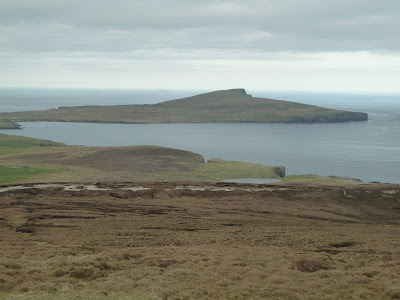
Arriving at Sumburgh is not normally a balmy summer evening experience but it was today. I was torn between making the short drive down to Sumburgh Head to see the Puffins or driving north towards Lerwick and crossing the peat and heather moors to Royl Field with the promise of a sunset over the Burras emerging as the ridge was breached.  The Puffins could wait, there are too few days like today. Inverness had been resplendent in the pristine sunshine and the views of the Caithness coast and the Orkney Isles had made Google Maps seem like a badly printed comic.  The plane had landed at Sumburgh as if the tarmac were eggshells, a far different experience than the usual rough landings. I headed north up the A970 and parked on a track leading in the direction of the Ward of Veester near Sandwick and met my walking partner who had driven from Lerwick.

The walk was waymarked towards the memorial to a Mosquito aircraft that had run out of fuel and glided into the steep slopes of Royl Field whilst making its way to Sumburgh on the return from a U-boat sortie off the Norwegian coast in November 1944.  The boggy heather and peatlands were unusually dry and as the apex of the ridge was reached the sun was low in the sky and lighting up the spectacular coastline of East and West Burras. Away to the East, the hooloovoo horizon was interrupted by the outlines of Bressay and Noss. With the addition of Royl Field, I had completed 10 of the 19 Marilyns on Shetland and some of the best were yet to come. Time was at a premium so I did not descend to the memorial but breathed in the views, listened to the birdlife, and enjoyed the serenity and company of my Shetland friend.  I managed to get down in time to collect some food at the supermarket and be in residence by 10:00 p.m. 

Bressay, Ward Hill


Ward Hill, Bressay from the ferry
Lerwick across Bressay Sound from Ward Hill
Summit Cairn
Noss
The vibrant Primary School murals inspire visitors and locals alike

Wednesday, 4 May 2011

Ascent:        250 metres
Distance:    12 kilometres
Time:          1 hour 10 minutes

Ward of Bressay  226m    36 mins

It was a dry, cool, overcast day and it seemed a good opportunity after work to make the short ferry crossing to Bressay for a run-up Ward Hill; an outing that I have been intending to do for the last month. The Ward of Bressay is visible from Lerwick and is littered with an array of masts and ancillary buildings, which detracts from its appeal but it is one of the 19 Marilyns of Shetland.

Immediately after work at 6:15pm, I jogged down to the ferry that had the late commuters on board and we ripped across the sound in 7 minutes. As I ran off the loading ramp the intimacy of island life was immediately evident.  I ran around the coast road through the scattered village until Grindiscol from where a track ascended the hill with an ever-increasing gradient.  The field pattern showed a long history of farming, there were several abandoned quarries where stone had been abstracted and the hillside was flush with rabbits and sheep.

The track twisted its way to the summit which was overcrowded with radio and TV masts and various buildings.  I circled the summit absorbing the sea views and freshness of the Bressay air before deciding to descend down the hillside in the direction of Noss, it was steep at first but provided the best views. There was a hollow of peat hags leading to West Hill where I found a track leading northwards. It was slow going and when it became apparent that the tracks were taking me too far north, I cut across the many small fields dotted with ruins and enclosed by fences, and ditches. I reached a road by a large modern bungalow and from there descended to the main road through the village. The primary school displayed some splendid exterior murals that satirised island life.

I noticed that the ferry had been in quite a while and there was not another one for an hour. I began to panic and engaged a Forrest Gump pace to reach the jetty with just 3 minutes to spare. As I disembarked, the waft of frying from the Fort Fish and Chip shop reeled me in for the superb fresh haddock which was a suitable reward for quite a long run.

Meall na Leitreach

Ready, Steady, Go

Drumochter Pass with A9

Looking South to  Schiehallion and the Glen Lyon munros
Monday 2 May 2011
Distance:     6km
Ascent:        425metres
Time:           1hr  56mins
c    Meall na Leitreach      775m     

Mundane hills sometimes make the best of all outings.  I was travelling north to Inverness in the late afternoon against the flow of the bank holiday traffic returning from a long weekend of perfect weather in the north.  I had studiously avoided the A9 and travelled on the scenic route via Killin, Kinloch Rannoch and as I joined the A9 at Trinafour I remembered that there was a Corbett at the start of the Drumochter pass.  I parked and thought it would be worth spending a couple of hours on a perfect evening ticking off Meall na Leitreach which is a modestly understated hill.  I was mistaken, it was quite spectacular and the walk and views lifted the spirits.

I crossed the main railway line as three intrepid cyclists came from the opposite direction, they had spent 6 days travelling across Scotland from Mull and were ecstatic about their trip.  The farmstead buildings had been recently restored and must be about the highest habitations in the UK at almost 400 metres.  I followed the river and came to an area of intricate drainage works with small dams and levees and a bridge to the foot of Meall na Leitreach.  I found a track that was well used by quad bikes and ascended the snout of the hill.  There were sheep and rabbits and a plentiful number of grouse in the heather.  Eventually the track curved round and I hit the summit ridge and found a small cairn which gave way to a dip and then a steeper clamber to the summit. 

The views to the south embraced Schiehallion and the Glen Lyon hills.  The distant familiar outlines in the west were Glencoe and the Mamores, and to the north west the Ben Alder range. To the north were the plateaus of the Drumochter hills bisected by the A9 which hummed with traffic.  A mountain hare appeared and stayed long enough for me to capture it on camera before it zoomed off into the heather clad slopes below.  There was a fresh gentle breeze and I galloped down through the heather disturbing more grouse and hares.  I discovered a new wooden bridge to get back and beyond another set of farmsteads were undergoing what looked like an expensive refurbishment which included a splendid granite block wall.  This may be one of the most remote settlements but it had an attraction that I could never have imagined.  I arrived back at the car with a sense of privilege at exploring this unvisited oasis of tranquility and all within a couple of hours.