 |
| The last leg to Cnoc Coinnich |
Ascent: 765 metres
Distance: 11 kilometres
Time: 3 hours 4 minutes
c Cnoc Coinnich 763m 1hr 46mins
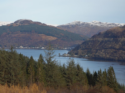
The surveyors had recalculated the height of this hill and it was a metre higher so Cnoc Coinnich was added to the table of corbetts earlier this year. Fortunately it is quite near home and it is an interesting area boasting splendid views down Loch Long and Gairloch to the Clyde estuary. I had crossed the flanks of this hill during a mountain marathon 25 years ago but corbett means corbett so a visit to the summit was now necessary.
It was the coldest morning of the year, -4°C, as I left home and a cold fog accompanied the frost. By the time I was driving up the A82 alongside Loch Lomond the skies were blue and it looked a perfect day for walking. I turned off the Rest and be thankful road at the visitor centre and followed the single track road for 3 or 4 miles to a car park at the foot of the Coilessan burn. The car park had been taken over by forestry contractors; massive dumper trucks, earth movers and equipment were assembled. There was major road construction taking place and the forestry tracks would have been impossible mud tracks had it not frozen hard in the overnight frost and the temperature wasn't going to get beyond freezing today.
I crossed the bridge beyond the car park and turned right to follow the construction road through the forest. There was a lot of activity and I had to jump off the raised road every time a lorry carrying ballast came chugging up the incline. There is a long section where the trees have already been felled as the road climbs to 350 metres before a footpath signposted for the Cowal Way begins a far steeper climb rising 150 metres to the top of the forest and on to the col between Cnoc Coinnich and the Brack, the adjacent corbett to the north.
There is a gate that leads onto the open hillside at 450 metres. The snow level had started at about 400 metres but from the gate it was deep soft snow all the way to the summit. There were deep footprints from a walker that took a good line so I followed them to the start of the summit ridge that runs south-east for over a kilometre. It was hard going in the soft snow and after a week with a heavy cold, I was in no hurry. I coughed and wheezed enough to clear my airways and hope that recovery is now assured. A fresh north easterly breeze was also beginning to blow through me and the sweat from the lower slopes became a fond memory. I had not bothered with an ice axe but there were sections with slabs of ice below the snow that made it necessary to use a walking pole to avoid sliding down the slope. I reached a col below the final ridge and the last 200 metres of climbing was steep but served to provide vigorous exercise to keep the cold at bay.
The summit was in the grip of deep snow on all sides but provided a superb viewing platform for the Arrochar Alps, the sea lochs draining into the Clyde estuary and the less familiar hills behind Lochgoilhead. The wind had stiffened and I had to find some shelter below a swirling outcrop of schistose rocks at the the summit to enjoy a flask of coffee.
I managed to take a few photos from the summit before beginning the return, pleased to be escaping from the freezing conditions and nursing some circulation into my hands. It was easy walking with snow lubricating the descent. I was soon off the summit ridge and plodding through the deep snow to the top of the forest. Conditions here were benign, so hat and gloves came off as I sauntered down, eating an apple and dodging the occasional dumper truck of grey gravel. I was back at the car before 2pm, something of a record, and home by 3pm. It had been the perfect outing to resume exercise after a winter cold.
 |
| Start of the walk at the Coilessan car park: Loch Long |
 |
| Dumper on Coilessan track |
 |
| The gate at the top of the forest |
 |
| Loch Long, Loch Lomond and Ben Lomond |
 |
| At the summit, Beinn Ime and the Brack |
 |
| Clyde Estuary |
 |
| Loch Long and Gairloch |


No comments:
Post a Comment
thanks