Friday, 31 May 2013

Beinn Airigh Charr

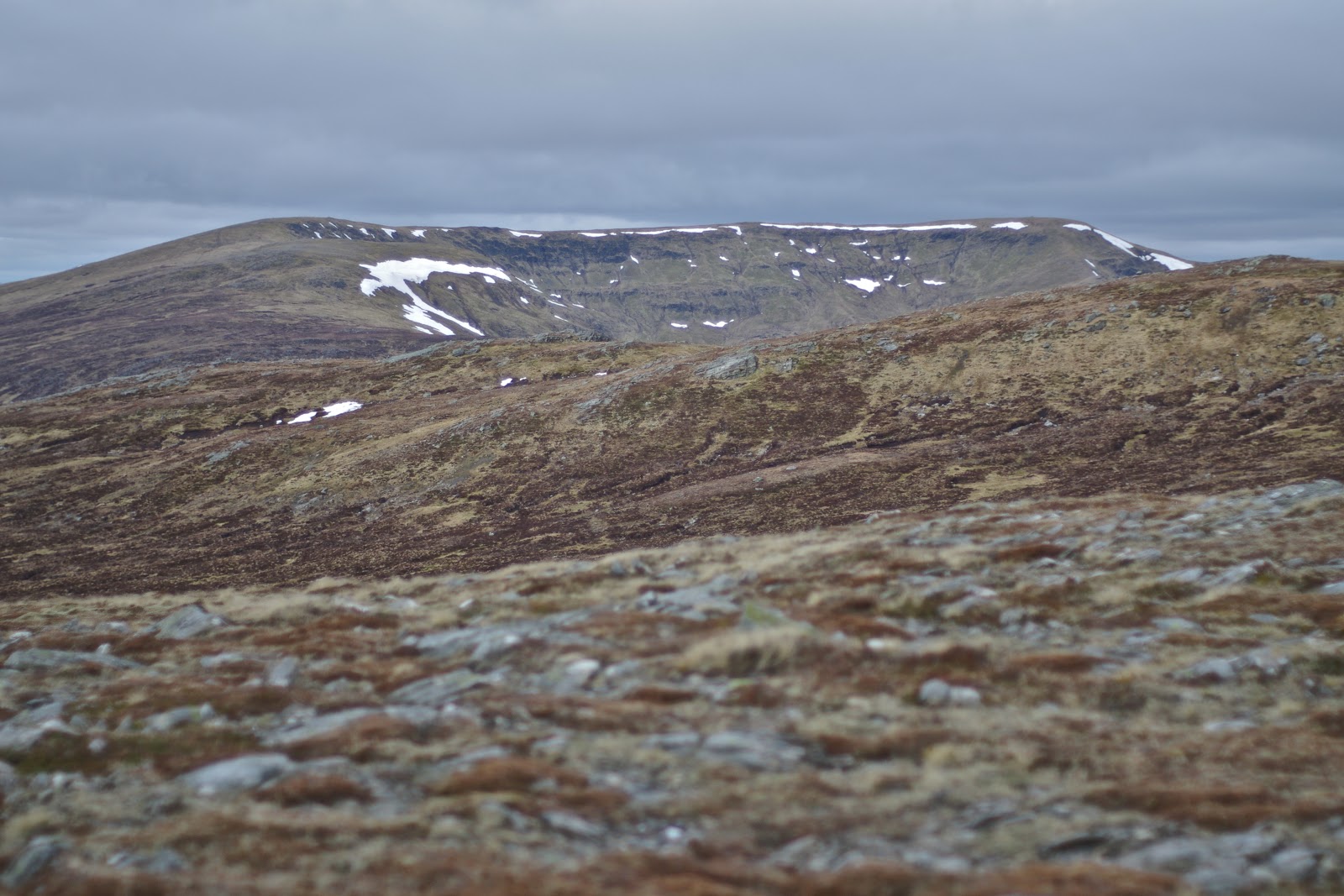
Beinn Airigh Charr from Kernsay

Moorland path, Beinn Airigh Charr ahead

Primroses at 550 metres

At 600 metres on the ascent

Beinn Airigh Charr summit final approach

Slioch

 Fionn Loch causeway with A'Mhaighdean as the dominant peak

Looking south east to the Torridons

Loch on the walk in to Carnmore, Ben Lair ahead

Wednesday, 29 May 2013

Ascent:       1065 metres
Distance:    24 kilometres
Time:          6 hours 4 minutes

c  Beinn Airigh Charr      791m    3hrs 25mins    

Arriving back from London late on Tuesday, I had a phone call from Keith Adams about the possibility of a trip to Fisherfield in the morning. He was nearing the end of his fifth round and this was the last two/three-day walk that he had to do. I immediately said yes, this is one of my favourite walks, but he then called round to the house after 10:00pm on his way back from a day walk to say that he might not be able to make it and could we do a walk nearer home. The weather was to be good in the northwest for two days and I wanted to make the best of it and started making alternative plans. Keith arrived on Thursday morning and the excellent weather forecast had converted him to the Fisherfield plan. We loaded my car and set out just after 10:00am.

After stopping at Inverness for diesel and some macaroni cheese, we were going to be in the wilderness for 48 hours, we drove on to Poolewe. The sun was shining as we drove past Loch Maree and Slioch was a shimmering sentinel. The coastal scenery from Gareloch to Poolewe was stunning and it felt like we were in for a great adventure. There is a good parking area just over the bridge in Poolewe. We repacked our rucksacks and set off at about 4pm for the long trek into Carnmore, where we intended to wild camp for a couple of nights.

We walked along the road beside the river Ewe which was sparkling in the afternoon sun. There is a good road/track for the first 5 kilometres to Kernsary where perfect green pastures fall to the loch side and deer graze like domestic herds. Shortly afterwards a track leads into the forest and there is a fairly boggy couple of kilometres to negotiate before emerging on a good moorland path that snakes along past numerous small lochans for 8 or 9 kilometres to Carnmore.

I had suggested that we climb the Corbett, Beinn Airigh Charr, on the way to Carnmore. It looked tempting, so we cut across the moorland and began a fairly direct ascent after dropping our rucksacks. Rather than taking the path, we continued to climb at a steady rate cutting underneath the 705m top, walking through a hillside of yellow primroses and making for the grass and scree slopes to the west of the summit. For the first of many occasions in the next 24 hours, we were blessed by the perfect conditions. I took photos and sent messages, surprised that phone reception was better here than in many urban areas.

We set out back at a strong pace hoping to pick up the sacks at 8pm which would mean we could reach our camp location before 10pm. Stupidly I had put my phone down at the summit after sending pictures to friends whilst I took photos with my camera. I only realised this when down to 600 metres, and I could not find my phone for another picture opportunity. I hollered to Keith who was ahead that I was returning to the summit where I spent 10 minutes searching for my phone but to no avail. I must have dropped it on the descent. It was almost 8:30pm by the time I reached the rucksacks. Keith had been waiting for half an hour and was starting back up the hill to look for me. I had climbed an extra 170 metres and walked 2 kilometres on my futile search.

We sharpened our pace for what was another couple of hours on the track. Initially, the lochans, the magnificent scenery and the sense of exhilaration fuelled our walking but it dragged on and by the time we crossed the causeway between Fionn Loch and Dubh Loch, we were relieved to call it a day. There is a short climb and then some good camping spots near to the house and barn at Carnmore, four other tents were pitched. We had enjoyed some spectacular views and it looked like the weather would hold. A thrifty supper of soup and cous cous and I was ready for sleep.

The loss of my phone had a happy ending when I arrived home on Friday. Aileen had taken a random phone call from someone who had found the phone near the summit. He had flown home to Southampton and, having obtained my address from Aileen, put the phone in the post. It arrived on Saturday morning, a tribute to the honesty and kindness of outdoor enthusiasts and the speed and efficiency of Royal Mail. It also saved friends the agony of sitting at work on Thursday and seeing my photos of Fisherfield in all its glory appear in their inboxes. One of the joys of retirement.

Wednesday, 22 May 2013

Cam Chreag and Maol a' Mhuic: Glen Lyon's reclusive hills

Cam Chreag ridge
Cam Chreag the approach track

Stuc an Lochain above Loch an Daimh dam

Ben Lawers group from Cam Chreag

Meall Buidhe from Cam Chreag

Towards Schiehallion and Carn Gorm from Meall a' Mhuic


Ben Lawers group from Meall a' Mhuic

Over Loch Rannoch to the distant Cairngorms
Ascent:       950 metres
Distance:    16 kilometres
Time:          4 hours  46 minutes

c  Cam Chreag          880m    1hr   50mins
g  Meall a' Mhuic     746m    3hrs 55mins

I had planned to climb Garbh Bheinn in Ardgour and was packed and ready to leave at 7:30am to catch the bus from Crianlarich to Corrour. I then checked the Met Office forecast, which suggested clouds below the summits. I had always promised myself a good day for Garbh Bheinn, so another plan was needed. I looked at the maps of my Corbetts and Grahams on walkhighlands and discovered a Graham (hill between 2000ft and 2500ft with a drop of at least 500ft) reasonably close to my last unclimbed Corbett, Cam Chreag, in Glen Lyon. The weather looked more promising than in the west, so I headed for Glen Lyon, taking the road over the bealach between the Tarmachan and Ben Lawers.  I parked at the excellent car park provided by the Meggernie Estate at Innerwick. The estate has upped its game in recent years and the helpful information boards and toilets make Glen Lyon a welcoming as well as beautiful place. It had been an estate that was hostile to walkers in the 1990s.

Leaving the car park, there is a good track that heads north, climbing steadily before crossing the river and turning west. Then a long haul below and parallel to the long ridge of Meggerine hill to the south. This leads to Cam Chreag, which is itself an almost flat ridge overlooking a large peat-infested bealach. When I reached 520 metres on the track, I decided to head for the ridge and subjected myself to half an hour of tramping over boggy heather across Corrie Odhar before finding a steep gulley to climb the scarp and emerge on the ridge.

The views opened to the south and west with Meal Ghaordaidh dominating the foreground, with the dam below Stuc an Lochain another focal point. Meall Buidhe was a long ridge in the foreground, a Munro that is much easier to climb than Cam Chreag. The dry short grass along the ridge made for an easy saunter over to the summit. The skies were still grey, but looking westwards, it looked as if Glencoe was in the cloud, so I was pleased about not heading for Garbh Bheinn. There were still patches of snow below the summit, and I looked askance at the route across to Meall a' Mhuic. The Grahams I have climbed are normally by being en route between munros or are significant local hills like Ben Venue. This was a deliberate decision. Am I getting the Graham obsession?

My heels had blistered in new Brasher boots. Did I really want to subject myself to a traverse over boggy heather? The answer was no, but once started, I almost always complete walks and after years when at least three Munros were expected from every outing, a lone Corbett seemed a bit of a cop-out. The descent was down the steep scarp slope to the north, and as I arrived in the uninspiring corrie below Meall nan Maigheach, the rain arrived. I spent another 45 minutes plodding over ground never designed for walking. Even the herd of deer I disturbed seemed to struggle over it. I had to drop down to 490 metres to cross a steep ravine before I could begin the climb up Meall a' Mhuic. This was a remote country but it seemed familiar; I must have run through it during the 1990 KIMM event.

A 250-metre climb up steep slopes is never enjoyable, but has to be done so with head down. I pushed myself relentlessly to the airy summit. The views were surprisingly good in all directions. I made myself comfortable by the cairn, eating some lunch in the warm sunshine before spending a few minutes taking photographs. I appreciated the comfort and practicality of a new Montane Ultra Tour 22 rucksack with its well-fitting back, stretch pockets and lightweight. It has replaced a couple of KIMM sacks, both over 20 years old and veterans of hundreds of walks. They are held together by hope as well as much repair work of tape and stitching, and should really be scrapped.

The descent was direct to the south-facing Ben Lawers hills, of which An Stuc was the most prominent, with its isosceles triangular shape reminding me of its tricky descents. The walk was over easy grass and heather that was easy on the feet, which were now well shredded by the boots, it's back to running shoes for future outings. I had to cross a dastardly ditch, six feet deep in places, which could have served as a trench in the Great War. It provides a trap for the unwary, and when snow-covered could be lethal.

Red grouse whirred on take off as I crunched down the heather, and a Land Rover was descending the track below. When I reached the track, I passed a caged crow which squawked at me. I considered releasing it, but the cage had a couple of lamb carcasses, which suggested that there was a reason. I followed the track to the confluence of two burns, which I crossed before climbing two high gates and getting back on the track to the car park. I had been the only visitor in the morning, but there were now half a dozen cars taking advantage of the Meggernie Estate largesse. The drive home was in bright sunlight; Killin was heaving with early summer visitors. With time on my side, I did the tourist thing and took photos of the Dochart Falls, and I was home by 4pm.

Dochart Falls, Killin

Tuesday, 21 May 2013

Ray Manzeric, The Doors...The end


Sad to hear that the Doors keyboard and pianist player Ray Manzerak died yesterday. The Doors first album was probably my favourite and most played album of all time. Whilst Jim Morrison was the controversial heroic vocalist and poet who is celebrated following his early death, Ray Manzerak provided the unique sound that was the Doors. No one else could make a keyboard rock with dark rhythms and mood that epitomised the Doors.

His playing is most evident on Crystal Ship as well as their great hit Light my Fire which is found on this Tribute to Ray Mancerek. But he was just as mesmeric on the later Riders on the Storm. I played The Doors CD today and it is as fresh as ever.  The last track on the album, The Doors, provides prescient lyrics that are now immortalised. "Beautiful friend, this is The End", 

As Jim Morrison said, "A friend is someone who lets you have total freedom to be yourself."

Wednesday, 8 May 2013

Gaick Pass Corbetts


 Edendon Water
Start of the track from the A9 by the Trinafour junction
An Dun and Maol Craig an Loch from the track to Sronphadruig Lodge
Starting the climb up Maol Creag an Loch
Maol Creag an Loch: the real summit*
Looking over Loch an Duin to the plateau of An Dun from Creag an Loch
Toad in descent
Allt Loch an Duin braided burns
Maol Creag an Loch from An Dun ascent
From An Dun summit the south end of  Loch an Duin
Edendon glen  from An Dun
Sronphadruig Lodge

An Dun, so now for the cycle out
Tuesday, 7 May 2015
Ascent:        1025 metres
Distance:     27 kilometres (13km by bike) 
Time:           5 hours 41 minutes

c     Maol Creag an Loch        875m      2hrs 13mins
c     An Dun                            827m      3hrs 58mins

Another rare good day was forecast, and I thought it a good opportunity to climb Garbh Bheinn in Ardgour, a mountain I had been saving for a good day. However, the morning forecast suggested that the visibility would be hazy and I would have to wait 3 hours for the evening bus back to Crianlarich at the Corran Ferry. So my next option was to look at the Gaick Pass munros, steep and difficult hills at the head of the Edendon Water, just off the Drumochter pass. Although up at 6:30am, I faffed about loading the bike and gathering lightweight gear for the warm weather predicted. In the process, I forgot to put my jacket in the car, so I had to hope the forecast would hold. 

I stopped at Perth for diesel and had a look at the new Tiso store sitting at the start of the A9 leading out of Perth. It was well-equipped, but sadly, I am not currently looking for gear. Needless to say, the A9 was playing its usual tricks, lorries that drove at 45mph on the single lane sections and then accelerated to 60mph on the dual carriageway sections, thwarting any overtaking. The Scottish Government contractors had chosen the morning busy period to close some of the dual carriageway sections for grass cutting and then brought traffic to a halt for a patching operation on the single lane section. It took well over an hour to travel the 45 miles or so to Dalnamein Lodge, where I mistakenly parked and cycled a couple of kilometres up the track before realising I should have parked at Dalncardoch Lodge, just by the Trinafour road. It was one of those days, and this was confirmed when I cycled up the most travelled track at the first junction and ended up at a private house. I doubled back and found the track up to Sronphadruig Lodge.

Once on the track that runs along the quite splendid Edendon Water, I was relaxed and happy. I met three Dutch walkers who told me they loved the tranquillity, solitude and altitude, although they came from a town below sea level, minus 20 metres apparently, and they seemed to be struggling for oxygen. I remained open-minded about which way to climb the two corbetts until almost reaching the derelict Sronphadruig Lodge. I decided to cut up to the right before the fenced forest and then climb the less steep Maol Creag an Loch first. It was tough going with thick heather and steep ground, but the views across to An Dun were good. The colours were startling: the grey-brown of the hillsides from the dormant heathers, the straw coloured the grasses, the deep blue of the loch and the patches of snow, brilliant in the sunshine.


There is a long convex summit plateau, the type where you never quite see the top and having walked along the ridge overlooking the loch, I was confronted with a drop and climb to what I assumed was the summit. There was no cairn visible, and when I arrived, I could see why. It was possibly the smallest cairn on the flattest ground that I have encountered. I had some lunch and noticed a bigger cairn about 600 metres away to the south-east. I remembered reading that other walkers had been confused by the true summit. I felt obliged to walk over and check it out, during which I was buzzed by a low-flying helicopter. The big cairn is 10 metres lower than the mini cairn and apparently marks the boundary between the old Perthshire and Invernessshire. The highest point is definitely the mini cairn at the grid references shown on the OS map.

I headed off to the north west with Meall Chuaich acting as my lodestone whilst admiring the Cairngorm summits through the haze to the north. Trying to find a suitable route down to the wonderful topography of the Allt Loch an Duin, where it drains Loch an Duin, was not easy. The slopes are relentlessly steep, and there is much debris on the many landslips. I had difficulty finding a place to cross the river and had to walk back almost to the loch before crossing. I then faced 375 metres of excruciating ascent, so steep that I was using my hands on some sections. A descending toad gave me a chance to have a breather, and I was mesmerised by the braided burns forming a wonderful natural design on the valley floor below. 

Reaching the ridge was a relief, and there was a gentle incline onto the plateau. It was formed with a spirit level and gave an easy walk to the cairn, which sits at the southern end. This is an armchair viewpoint for the resplendent Edendon Glen below. The Highlands in all their majesty are splayed out in map form with Sronphadruig Lodge sitting proud at the head of the glen.


The descent is steep, but there is a twisting path through the heather that eventually leads to the small dam across the Edendon Water. I crossed this and walked back down the west bank, enjoying the gorgeous sound of the river, the late afternoon warm sunshine and admiring the Lodge, which is sadly dilapidated.  I eventually came to the new concrete ford, crossed and walked back up the other side of the Edendon Water to collect the bike. 


The descent was fairly brisk, although the track surface was mainly coarse gravel; the front suspension took a real hammering, as did my hands, which were numb by the time I crossed the A9 and headed down the Trinafour road, where I had parked. For once, the A9 was traffic-free so it was a remarkably easy journey south as the sun played with the landscape and made the journey home unusually relaxing.


Glorious view back at the end of the day

Tuesday, 30 April 2013

Stob an Aonach Mhoir and Beinn Mholach

Ben Alder and Beinn Bheoil from Stob an Aonach Mhoir
Road to Corrievarkie

Uphill shadows

Carn Dearg and Sgor Ghaibhre to Ben Alder

Loch Ericht and Rannoch from Stob an Aonach Mhoir

Loch Ericht and the Fara from Stob an Aonach Mhoir


Three cairns on Beinn Mholach

Beinn Mholach from Beinn Bhoidheach

Schiehallion across Loch Rannoch
Ascent:         1320 metres
Distance:      22 kilometre cycle, 19 kilometre walk
Time:            6 hours 35 minutes

c   Stob an Aonach Mhoir      855m      2hr 2mins 
u   Glas Mheal Mor                830m      3hrs 15mins
c   Beinn Mholach                  841m      4hrs 25mins

These two corbetts have been niggling me for the past year, could they be done together and if so from where?  It is probably quicker to drive up the A9 and start from Dalnaspidal Lodge but Loch Rannoch is a much more scenic approach and avoids the dreaded A9. The forecasts were showing a brief respite from the showers and wind that have been battering us for the last few days. I was up at 6:30am and away by 7:30am after loading the bike for the two hour drive to Bridge of Ericht at the western end of Loch Rannoch. It was cool but the wind had abated and the blue skies had a whiteness to them which suggested some fickle weather later in the day. I arrived at the Bridge of Ericht surprised to see the gate missing on the private road to Corrievarkie. The man in the adjacent cottage told me there was no problem in parking or cycling up the road which was metalled and a better surface than many local roads.

The gradient was steady although it rises from 200 metres to 600 metres over the 11 kilometres to the start of the walk. The views were ever changing with the white capped hills from Carn Dearg to Ben Alder provided a panorama of many previous adventures. After leaving the forest where a giant steel pipe crossed the river below, there was another gate and then the Loch Ericht dam came into view. After the turn off to the dam the road curves to the right and steepens again but it was all perfectly rideable. I was a bit surprised to find a vehicle parked a couple of kilometres further along. Judging by the gear on the seats, a walker had obviously taken advantage of the open gate and saved themselves a few hours. I abandoned the bike and started the walk at a point just south of Stob an Aonach Mhoir where the road begins its final ascent before dropping to Corrievarkie House.

I figured that I would climb Stob an Aonach Mhoir first whilst the blue skies prevailed and then cut across to Glas Mheal Mor  en route for Beinn Mholach. It meant walking another 400 metres or so up the road but then I headed onto the hillside climbing almost due north for the first hill. The ground was boggy and flutes of wet snow slowed progress as each step involved sinking into the wet snow. My goretex running shoes were not much of a defence in these conditions. I watched in awe as a couple of mountain hares, still in their winter whites, accelerated up the hill as I approached. I was thinking that this is good eagle territory. I made for a rock scarp just below the summit and on climbing it came face to face with a golden eagle no more than 30 metres away. It had flown and was several hundred metres away before I retrieved and fired the camera.

The ascent may be a bit of a plod up undistinguished slopes but like all corbetts there is always something good.  Here it was the view, one of the very best. Loch Ericht was a rich cobalt blue and across were Beinn Beoil with its splendid corrie yoked together as one with Ben Alder, both hills resplendent in their dazzling white caps.  The views up and down Loch Ericht were equally stunning, I loitered for a while, eating an early lunch and rotating my head mesmerised by the views and watching out for the return of the eagle.

The descent was quick and easy. I crossed the road about 800 metres north of where I had left the bike. It was tricky going over the peat hags and burns swollen with snowmelt that made for difficult walking. I headed roughly for the shoulder of Glas Mheal Mor and as I started to climb a herd of 50 or 60 deer scarpered southwards. There was a large snowfield which I tramped through and then, still feeling frisky, I decided to climb the extra 50 metres or so to Glas Mheal Mor. It is the dominant hill from the north west but unclassified in the annals of Scottish hills which are based upon the minimum drop of 150 metre rule rather than any sense of relative importance.

The route across to Beinn Mholach was tedious with lots of peat hags as I traversed under Beinn Bhoidheach. The burns were all covered in snow and crossing them was a game of chance. Finally 200 metres of climbing eastwards to the summit of Beinn Mholach and there seemed no redeeming features. Until reaching the summit, what a magnificent cairn! It is superbly constructed and set next to a forlorn looking trig point with the daddy of all cairns, Schiehallion, looking on from the south east.

If the walk up Beinn Mholach was tedious the descent was worse, I went to the south of Beinn Bhoidheach, which was mistake, and then had to cross 3 kilometres of peat bogs and snow fields to get back to the bike, it seemed interminable. The day had been clouding over and a wind had sprung up from the south west.

The cycle out was mainly downhill but against the wind with several climbs as well. On the descents my eyes were watering and I tried to avoid using the brakes which worked until the bend with the road to the dam when I had to decide between a ditch and the brakes and the brakes won. The last few kilometres flew by helped by some lapwings practising their manoeuvres and peewitting to each other. I hurtled down the final section and despite stops, the ride out had taken only 35minutes. On the journey home I was mesmerised by the views of Loch Rannoch, watched over by the magnificent Schiehallion. It looked like a giant toblerone but maybe I had not taken enough food for the day. It rained as I drove back through Fortingal and along Loch Tay, I had judged the day perfectly.


Saturday, 27 April 2013

Bute: a full day

Mount Stuart House
In the days of integrated transport

Wemyss Bay, a splendid Victorian station

Spring rising in Mount Stuart

Mountstuart from the east

Looking over the Clyde to Largs

Mountstuart grounds
Rhododendrons and Almond blossom in the wee garden

Mountstuart coastal walk

Goat Fell on Arran from Scalpsie on Bute

Rothesay sea views

Rothesay with Arran peaks behind
Some days take on a life of their own, and today was one of those. The early morning sun was unusual, and I suggested a day on the coast rather than going for a run or heading for the hills. We decided to go to Bute and visit Mount Stuart House, the restored ancestral home of the Marquess of Bute. It was only opened to the public in 1993 as an attempt to arrest the decline in visitor numbers to Rothesay, which had occurred in the 1980s as Scotland fell on hard times and foreign holidays diverted expenditure away from Scotland's traditional holiday resorts on the Clyde.

I had visited Bute often in the 1970s, either 'going doon the watter' on the Waverley paddle steamer, catching a train to Wemyss Bay and hiring a bike to cycle around the island or sailing into Rothesay to collect one of the crew for a weekend sailing event on the Clyde. Alas, I had not been to Rothesay for over thirty years. I had never visited Mount Stuart before, despite its growing reputation as one of Scotland's finest buildings. 

Mount Stuart House is 5 miles south of Rothesay and sits in well-tended grounds that look over the Clyde estuary to the east. It is an absolutely exquisite neo-Gothic building constructed with the finest Italian marble and Dumfries red sandstone, fitted out with English oak and containing an art collection that would be the envy of most national art galleries. The house replaced one that had been razed to the ground in 1877. It was conceived by the third Marquess of Bute (1847 - 1900). He was an antiquarian, scholar, polymath, linguist, philanthropist and architectural patron. He commissioned Sir Robert Rowand Anderson to prepare plans for this second Mount Stuart in 1879.

Construction began in 1880 with a jetty and horse-drawn rail track constructed first to bring in the stone, marble and timbers. It was built by a massive assembly of British craftsmen. They continued until 1912, well after the death of the third Marquess. Shortly afterwards, it became a field hospital during the Great War. It was the first house to be designed to use electricity, it had central heating, a marble swimming pool and contained four chapels. No expense was spared; this level of investment was only possible because of the huge wealth of the Bute family, who, through several generations of canny marriages, owned large parts of Sussex, South Wales, Bedfordshire and Dumfries as well as the Island of Bute. 

It was a mightily impressive and informative tour of the house, and the pleasure continued during a five-mile walk around the grounds and gardens and then back along the beach. The sea was benign, and all plant life seemed to be bursting with scent and colour. It was 4pm, and there was time to drive around the island, admiring the soaring peaks on Arran, the rich grazing lands, which support llamas and alpacas as well as sheep and cattle, and the glorious beaches. We returned to the faded charm of Rothesay, which is littered with fine Victorian and Edwardian villas and hotels. It was quiet, and the buzz of yesteryear had disappeared along with the day-trippers. The reward was a good fish supper from the Sqab Lobster cabin on the seafront, eaten in one of the shelters. I tried to visit the magnificent Victorian urinals on the harbour, but they had closed early.

The evening ferry back to Wemyss Bay allowed us a full appreciation of the Clyde estuary. We took the less travelled coast road past the Clock lighthouse, through Gourock and West Greenock with their splendid houses sparkling in the evening light. Then, we went through the depressing town centre and former industrial sites that were home to shipbuilding and sugar refineries, but now support Tesco and other unattractive retail activities that could be anywhere. The roundabout by the town hall is an exemplar of everything that is wrong about town centre redevelopment: people and buildings sacrificed to vehicles. But, amidst all of this carnage and post-industrial developer tat, the views across the Clyde towards the Cowal peninsula reminded us that the rich industrial heritage that had flourished in the first half of the twentieth century was matched by some of Scotland's best coastal landscapes.

Victorian Urinals in Rothesay - pissing heaven

Friday, 26 April 2013

Baroness Thatcher: Zeitgeist or Mammon?

Well, that's one perspective

We have been exposed to the life and times of Mrs Thatcher incessantly for the past week, and the funeral has taken place. Her ability to ensure diametrically opposed views has never been in doubt, nor has the impact she made on life in Britain in the 1980s. Living and working in Scotland, it was easy to blame her for the collapse of traditional industries and the deepening social malaise that ravaged the country.

It would not be totally fair to attribute the economic decline to her government; industries were already collapsing, and a new direction was needed, but not the one she took. Throughout her period in office, Scotland was in the doldrums, as were several other regions in the UK that had hosted traditional manufacturing industries. The recovery of the economy in Scotland, as with much of the north of England, took a lot longer than in the southeast of England. It did not materialise in Scotland until the late 1990s after public services were given a reprieve following the 1997 election. This period of sustained growth and improvement lasted until 2008, when the testosterone-charged financial sector dumped the UK into a double recession. 

On the spread of social malaise, Mrs Thatcher's government was totally culpable: high unemployment, underinvestment in education, health and the public infrastructure, increasing crime and growing inequalities were all a consequence of her doctrinaire government's decisions.

The main question about the Thatcher legacy is whether there really was a revitalisation of the UK economy and, if so, whether it could have been achieved by a less doctrinaire approach with a greater focus on Scotland, Wales, Northern Ireland and the regions of England other than London and the southeast. One that worked with the grain of the Scottish work ethic and its sense of community rather than one which endorsed free markets, outsourced or privatised public services and encouraged the making of money rather than tangible assets.

There are lots of ways to consider her impact but there are some common themes that emerge whichever way you look at them.

The GDP of the UK stagnated during her premiership. In practice, it plummeted during the first three or four years and slowly recovered during the "loads of money" phase before dipping again. At the end of her period of office, our manufacturing sector had been reduced to just 15% of the economy. Britain, unlike Germany, Italy or France, puts a little premium on safeguarding our key manufacturing industries. Mercedes, Bosch, Fiat, Indesit and Renault have survived and thrived as have the key public infrastructure organisations in other parts of Europe. In direct contrast, Britain under Thatcher vested its trust in the markets and serving Mammon. Instead of reversing this aggressive neoliberalism, the heirs of Thatcher's economic policy- Major, Blair and Brown- were all culpable of continuing to place their trust in the financial markets and outsourcing services.  

Contrast that with Germany or Italy, where more consultative industrial relations saw the maintenance or growth in manufacturing by investing in productivity. Germany nurtured its manufacturing industries and made it Europe's strongest economy today. In Britain, many of the industries that were sacrificed were state-owned. They needed new investment to improve productivity but selling them off was more of a doctrinaire fire sale with little attempt to secure long-term investment from bidding companies that were often seeking to break up the business and sell off the disposable assets. They had little commitment to securing the future of the industries or the communities that were dependent on them.

Her government was far less active in the encouragement of research, design and innovation, which are the drivers of a more sustainable economy. Instead, there was a far greater emphasis on marketing and selling, wheeling and dealing, sponsoring and leveraging. Enterprise requires confidence, and the consumer confidence index ended up at the end of her premiership pretty much where it started at -25%, after a sharp but short-lived peak amid the Lawson inflationary years of 1988-89. And despite the extravagant increase in the wealth of many citizens, the UK had a slower rise in living standards per capita than either France or Italy, and we lagged 17% behind that of Germany by 1990.

The sale of Council Housing, which allowed over a million households to transfer to owner-occupation, is often cited as her most popular policy.  For those tenants who lived in a desirable area and had long tenancies, this was the case. But for many other tenants, the policy denied them a transfer to a better house and retained them in residual and unloved estates. For future needy tenants, particularly the young and the mobile workforce, it consigned them to a poorly regulated private rented sector or to staying at home. Council housing became more stigmatised, and social polarisation intensified. Social rented housing made up 34% of the UK housing stock in 1979 but dropped to 26% in 1990. Social housebuilding declined by 70% over the Thatcher years.

There was a commensurate rise in owner-occupation from 55% to 66%. But even private house building rates dropped by 20% during her premiership to 203,000 in 1990.  House prices rose by 61% in real terms, spurred on by the shortages that were becoming manifest. So whilst the cost of housing was rising, the construction sector was in decline. It was the estate agents, banks, surveyors and private landlords who benefited. In other words, the middlemen made huge gains from the vastly increased expenditure on housing, which was inflated by the unsustainable but ready access to credit.

Our public services of Education, Health, Transport, and Water were starved of investment, and this created a mood of disillusionment from the long-suffering parents, patients, and customers, as well as the increasingly maligned public sector workforces. They were being softened up for privatisation, followed in the 1990s for water, rail, waste collection and disposal, residential homes, airports, road and building maintenance, and numerous other functions. Many public services were transferred to what often became private monopolies. The long-established links and mainly effective links between local small and medium-sized businesses and local public services were lost, whilst costs from the large nationwide contractors and their financiers were ratcheted up

Crime soared along with the increase in unemployment, and many cities were ravaged by riots. Stable communities that had grown up around the extraction or utilisation of natural resources became ghost towns as profits and jobs migrated to the southeast.

On the world stage, she did holler for Britain, and the victory in the Falklands gave her a reputation for ruthlessness which restored Britain's status as an aggressive power not yet willing or having the nous to find a new role in the world order.  This was less a victory than a relapse that prevented Britain from taking a lead in fighting apartheid, tackling world poverty or safeguarding the environment. Was it sustainable or sensible for Britain to continue to spend the third-highest proportion of its GDP on defence, after the USA and Russia?

So Mrs Thatcher may have been a conviction politician. She raised the profile of the UK abroad by playing her cards with an assurance that was not always prudent or likely to win friends. But at home, the growing social polarisation, the failure to invest in public services or to trust localities and the encouragement of a culture of untrammelled wealth for the middlemen made her the mother of a two-nation Toryism who was blind to any alternative strategy.

Her government did free some entrepreneurial activities, but she brought discord where there was once partnership between the public and private sectors, and havoc where there had once been harmony. She created a license for private finance to rip into public sector budgets and to take an ever-increasing share of increasingly ring-fenced budgets. The losers were local businesses, taxpayers and the recipients of services who were now funding the middlemen as well as those who delivered services. The middlemen behaved like a post-industrial nation of shopkeepers as they milked their customers not once but twice, first on fees and then on annual charges.

She gambled away North Sea oil and allowed the financial sector to play footsie with our pensions. The hope and aspirations of more affluent households might have been realised through share issues, housing inflation, easy credit and tax reductions. Conversely, many millions more were unable to afford to get on the ladder of prosperity stoked up by share issues, rampant inflation and deregulation. Growing inequality, outsourcing and the decline of public services rather than the restoration of the glory days were her undisputable legacies.

So, as we watch her once disloyal and rumbustious cabinet of 1990, who removed her from office, engage in an extravagant bout of sycophantic sophistry about her achievements, those who were the victims of the era have remembered the damage her policies inflicted on their lives. It may have appeared unseemly and callous behaviour when they protested before and during the funeral, but they were not for turning. They had seen no good or greatness emanating from the Iron Lady; their views were based on an annuity of authentic anger. It was a more honest response than the gratuitous praise heaped on her by her cabinet and fellow travellers.

Nil Magnum Nisi Bonum