Friday, 21 July 2017

Inaccessible Pinnacle/ Sgurr Mhic Choinnich

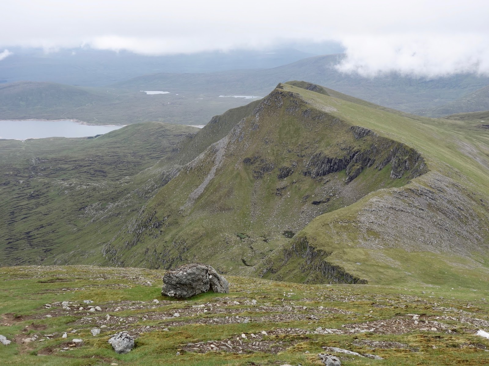
In Pinn done, start of abseil 
Tuesday, 18 July 2017

Ascent:   1338 metres
Distance: 11 kilometres
Time:       9 hours 2 minutes

Sgurr Derag Inaccessible Pinnacle  986m   3hrs 32mins
Sgurr Mhic Choinnich                     948m   5hrs 35mins

The Glen Brittle Youth Hostel dawned to blue skies, today I could be Helios following the path of the sun with the Inaccessible Pinnacle my midday objective. We had a lazy breakfast, hydrating with the assistance of a large institutional pot of tea. We were still amongst the first to set out at 8:30am from the path by the sheep pens beyond the mountain rescue post. A mountain guide and party of three were 10 minutes ahead of us as they crossed the footbridge over the Allt Coire na Banachdich.

Dave set the pace and after an ascent of 250 metres we had caught the group ahead. The guide was Jonas Jones, who became a familiar figure as the day progressed. In addition to his three charges, he was exercising the mountain rescue dog so we were in good company. As the slopes steepened on the ridge ahead I took the lead and forced the pace to the summit. There was a long section of screes but the path eased us through them and then several sections of scrambling near the summit provided some fast forward entertainment. I was anxious to beat any queues for the In Pinn. When attempting the whole ridge in a day we arrived to find a small crowd and had to wait over two hours to set foot on the climb.

The visibility was excellent with views down to the small isles and the Rum Cuillins. The sinuous Skye ridge was visible in its entirety and exhibited its angular complexity that Sorley MacLean had captured in his epic poem of 1939, 'The Cuillin'. He used his intimate knowledge of the Cuillins as a series of metaphors to describe the descent of humanity through the political conflicts leading to the second world war.

"I am the great Clio of Skye,

Far, far distant, far on the horizon,
I see the rocking of the antlered Cuillin,
beyond the sea of sorrow, beyond the morass of agony,
I see the white felicity of the high-towered mountains."

Although there was a steady breeze it helped keep us cool during the ascent. My fingers were losing their prints on the rough gabbro and it made me focus on the climb ahead. I had climbed the In Pinn on four previous occasions, twice leading the climb, but I had not climbed for ten years and I had been apprehensive about the climb up the In Pinn. However the conditions could not have been better and eager anticipation overcame any false fear.

We reached the adjacent summit of Sgurr Dearg and the In Pinn loomed large above us. Three climbers were beginning their ascent so we waited our turn, sorting equipment for the climb and then edging down the ramp of bare rock to the start of the climb. Dave led the climb putting in some slings before reaching the crux, a vertical face of fractured rock and no obvious footholds. He established a belay above the normal place and it was my turn to climb, I made steady progress to the crux. By this time Jonas had wasted no time in starting to climb behind me, leading the first of his customers. I had struggled to retrieve a sling on a nut, which he recovered for me. He waited for me to climb over the crux and up to Dave's belay before climbing past us. Dave was meticulous in clipping me to the belay and sorting the gear before he continued to the summit. This part of the climb is fairly straightforward although the exposure to a 250 metre vertical drop to the east is formidable and best ignored. We waited at the summit for Jonas and his customer to abseil off and then set ourselves up to make our descents.

I went first and reaching the lip of a slight overhang I saw that three other climbers were watching from where our rucksacks had been left. I shouted down for one of them to retrieve my camera and get some photos of the abseil. Something that I had missed on previous descents. They obliged and I had half a dozen photos of the abseil. Although my climbing was not as fluid or carefree as in the past the climb was not difficult and the abseil was thrilling as I surveyed the surrounding peaks and took in the views to Rum and the small isles glistening over the sea. Dave followed me down to the base of the In Pinn where we chatted to the other climbers, swapped e mail addresses to get photos, sorted and packed the gear and made light of lunch..

Dave was having doubts about our intention to climb Sgurr Mhic Choinnich and then taking Collie's ledge to Sgurr Thearlach and over to Sgurr Alasdair. Nevertheless we started the steep descent down the ramp of rock slabs that were lubricated with loose scree. Dave had hurt his feet over the two days and it took a while to reach the low point before beginning the climb to Bealach Mhic Choinnich. I was worried about time so immediately began the climb from the bealach. Dave called me back and said that he could go no further and would go down the stone chute. He lent me his guide book to the routes ahead and I continued leaving Dave to return to Glen Brittle where I agreed to meet him at 6pm.

I was surprised by the steepness and scrambling ahead, I had always enjoyed climbing Mhic Choinnich but had not remembered it as quite so challenging. However as I discovered later on the descent I had kept to the ridge line rather than following an easier route to the left. It required more exposed climbing on rough gabbro blocks. About 50 metres in altitude below the summit I met another walker who looked as if he was searching for the route down to the start Collie's ledge. I asked if he wanted to wait whilst I climbed to the summit so we could go together. He replied saying he had not yet been up Sgurr Mhic Choinnich and it looked a bit tricky. He asked if I would guide him to the summit. I agreed and we took our time over the steep final scramble. He was carrying a SLR camera and photographing all of the route.

We reached the summit where we chatted easily whilst basking in the warm afternoon sun. He was an IT manager for an American bank and made annual pilgrimages to Skye for the walking. Mhic Choinnich was his penultimate summit on Skye. He cogitated about Collie's ledge but decided it was a step too far so I agreed to lead back to the bealach from where we would be able to descend via the stone shoot. He  offered me some money for guiding him up Mhic Choinnich, perhaps I have missed my vocation. Instead I invited him to come and have a pint with us at the Carbost Inn but he decided to stay at the bealach to take more photos as the afternoon shadows lengthened. I began the descent with another walker who had just completed all of Skye and was to finish his munros on Ben More on Mull the following week. He was moving well having driven up from Glasgow in the early hours after his nightshift as a printer for the Daily Record. Like everyone else that I had met today he was ecstatic about the conditions.

My shoes had filled with stones during the descent so I stopped on the pillows of basalt that hold Loch Lagan, emptied the shoes of stones and the rucksack of food. All that remained was a walk out by the path, rocky at first but becoming easier on the feet as I dropped down. I was back down to the car where Dave had only just arrived after sitting for an hour above the Eas Mor falls in the late afternoon sun watching some Germans enjoy a bathe in the pool.

We drove to Carbost where we rehydrated with pints of water and beer, Jonas came over and congratulated us on the climb. He had done it 1441 times. We had booked the last room at the B&B in the Carbost Inn from where we watched the sun set on the Cuillins as we had an evening meal. It had been a wonderful two days and the most difficult summits on the Skye ridge were now ticked off.


Don't look now

What a day for a daydream

Dave's descent
Across Lota Coire
In Pinn and Surr Banachdich from Mhic Choinnich
 Oh Happy Day
Sgurr Thearlaich and Sgurr Alasdair from Mhic Choinnich
Sgurr Mhic Choinnich
Great Stone Chute
Sgurr Mhic Choinnich and Sgurr Alasdair from Beinn Dearg
Stone Chute from  Bealach Mhic Choinnich
Loch Lagan
A hard day's skyline

View over my beer from Carbost Inn

Thursday, 20 July 2017

Am Basteir & Bruach na Frithe

Sgurr nan Gillean, Am Basteir,  Bruach na Frithe from Sligachan path

Monday 17 July 2017

Ascent:       1305 metres
Distance:    16 kilometres
Time:          7hrs 40mins

Bruach na Frithe     958m     2hrs 35mins
Am Basteir              934m    3hrs 55mins

After the awful weather of June and early July, there appeared to be two days of reasonable weather according to the Met Office weather forecast that allows you to obtain forecasts for the location of individual hills. I have come to trust this much more than the mountain weather information service, whose forecasts cover too wide an area to provide any reliable accuracy. On a hunch, I contacted a climbing friend who had offered to lead the climbs on Skye last year but we had never found a suitable weather window when we were both available. I hit the jackpot, Dave was not only free but keen to go to Skye as he wanted to get a few days climbing before a trip to the Alps the following week.

I picked Dave up at 7:30am in Stirling and we drove non-stop amidst the ever-growing convoy of camper vans through Fort William and on to Skye, where we made a quick stop for coffee and cake. Scotland and Skye, in particular, are awash with tourists this year. The collapse in the value of the £ and the high cost of holidaying abroad have brought both foreign visitors and UK residents charging to Skye. It has become one of the coolest (in both senses) vacation spots in the UK.

We parked at Sligachan, kitted up with climbing equipment, and we were walking by 1:30pm. The morning clouds were dispersing, and the tops of the northern parts of the Skye ridge, the peaks that we were aiming for, were emerging from the cloud. We decided to tackle Bruach na Frithe first in the expectation that conditions would continue to improve as the afternoon progressed. A cooling breeze made for pleasant walking on the path alongside the Allt Dearg Mor. There were lots of families and day walkers enjoying the low-level walks alongside the waterfalls and enticing pools along the river.

After we reached an altitude of 300 metres, we crossed the river and began the steeper walk into Fionn Choire. Above 500 metres, we had a short rest and decided to climb the northern ridge of Bruach na Frithe rather than continuing into the Coire. It is a spectacular ridge with superb views over the main ridge to the south and the summits of Am Basteir and Sgurr nan Gillean to the east. We also had clear skies whilst the main ridge was still partly capped by clouds rolling in from the Atlantic.

We took advantage of the conditions and spent 20 minutes or so having a late lunch on the summit of Bruach na Frithe whilst enjoying the remarkable vistas. It is quite an easy descent down a rocky path towards Am Basteir, but once below the Bhasteir Tooth the path steepens and the loose rocks make for a difficult descent that continues down to 750 metres. The foot of the slope takes you round the foot of the rock precipice that is Am Basteir, and then there is a hundred-metre climb up a loose scree path to Bealach a' Bhasteir. From here the route is westwards climbing up the black gabbros and basalt dykes. We reached the bad step, a 4-metre descent down very polished holds. it was a bit of a risk, so we headed back a hundred metres and found a much fractured, exposed basalt terrace to climb down and along. There is a final steep scramble to the exposed summit of Am Basteir that sits directly above the adjacent Baistir Tooth. It was a balmy evening with excellent visibility, and the winds of the day had abated. Occasions like this on the ridge are all too rare, and we sat and absorbed the exposed serenity of this gabbro balcony.

The final descent to the bealach and the climb up the West ridge to Sgurr nan Gillean should have been the easiest ascent of the day. On my last visit, we had waltzed up in half an hour with no ropes or climbing equipment. There was just a very exposed step across a deep chasm where the gendarme used to be before collapsing. This time we chose to climb Nicholson's chimney partly because we had lugged ropes, helmets, harnesses and climbing gear with us and partly because Dave intended to abseil back down and return via the Coire below. I intended to continue to the summit of Sgurr nan Gillean and descend via the longer tourist route.

I had forgotten how much time it takes to gear up for a climb, and when Dave reached the crux of the climb, the double rope had run out, so he would be unable to abseil without climbing another pitch. It was almost 7pm and we decided that food called, last orders were at 9pm. He abseiled down, we packed the gear and began the descent over the difficult rock-strewn ground of the Coire until we reached the path down from Pinnacle Ridge.

It was a glorious evening, but time was against us, and I ran the last couple of kilometres back to the Sligachan hotel to get in before last orders for food. The place was awash with holidaymakers, and no tables were available inside, so we sat outside draining our beer and waiting for the food to arrive in the company of midges until an inside table became free. We made the Youth Hostel in Glen Brittle just after the 10:00pm deadline. We were the last to arrive, but the warden was welcoming, although our mixed dorm was already darkened with people sleeping. We showered and then found the last remaining top bunks before allowing the exercise and dehydration of the day to ensure an undisturbed slumber.

Fionn Choire
Looking south along the ridge from Bruach na Frithe
On the summit of Bruach na Frithe
Start of the Bruach na Frithe descent
Am Basteir and Bhasteir Tooth
Sgurr Mhadaidh
Sgurr nan Gillean and Bla Bein from Am Basteir
At the foot of Nicholson's chimney


Thursday, 6 July 2017

Swirl How

Brim Fell and Dow Crag
Wednesday, 5 July 2017

Ascent:        800 metres
Distance:     14 kilometres
Time:           3 hours 59 minutes

Grey Friar       773m              56mins
Great Carrs     785m        1hr 19mins
Swirl How      802m        1hr 29mins
Wetherlam      763m        2hrs 9mins

We decided to squeeze in another walk between the end of the morning rain and dinner with friends. Gregor decided to climb Hard Knott and Harter Fell followed by Dow Crag so I got a lift to the Three Shires stone on the Wrynose Pass from where I could do a round of hills from Grey Friar to Wetherlam and then walk/run back to Langdale. It was still grey clouds as I set out just before 3pm with the ground soggy from the incessant rain of the last 24 hours. There is an good path that climbs steadily up Wet Side Edge to the long ridge leading to the Carrs. I was making good time and found a faint path that traversed to the col at Fairfield below the easy ascent to Grey Friar. The clouds were slowly slipping away from the tops but the Scafells were still capped in cloud. The summit is a lovely flat plateau decorated with with scattered rocks.

Then a quick descent and ascent to Great Carrs where I came across the cairn to a Halifax Bomber that had crashed here in 1944. The sun had broken through and made for some easy walking across to the nearby summit of Swirl How. Coniston Old Man was still in cloud but Dow Crag was looking sharp. Coniston lake snaked below the hills and Levers Water looked foreboding. It is a rough descent and then a longer ascent to Wetherlam. The skies were becoming grey again.

The descent from Wetherlam was tricky, broken rock that was steep and still slippy from the rains. I had wrongly calculated that I would reach the track to Little Langdale in half an hour but I missed the path down and ended on Birk Fell. The direct route from here to  the track required was a 400 metre descent through bracken and boulders and there was no time for an easier alternative. The track was fairly level and allowed me to jog towards Slater's Bridge. It is a relic of local industry where we had picnics with the children in the 1980's, it always inspires happy memories.

A path runs from here back to the Three Shires Inn from where I took the high path through Wilson's Place to Great Langdale, it involves another 80 metres of ascent but I was  in full flow and reached the house at 6:55pm. Time for a shower before driving to Ambleside for a pint of Wainwright's exquisite golden ale before a meal.

Scafells from Grey Friar
Halifax Bomber cairn on Great Carrs
Swirl How from Great Carrs
Great Carrs from Swirl How
Levers Water and Coniston from Swirl How
Wetherlam from Swirl How
Slater's Bridge, Little Langdale

Tuesday, 4 July 2017

Sheffield Pike, Ullswater

Ullswater from Sheffield Pike

Monday, 3 July 2017

Ascent:         753 metres
Distance:     9 kilometres
Time:           2 hours 36 minutes

Glenridding Dodd     434m          24mins
Sheffield Pike            680m          59mins
Hartside                     756m   1hr 39mins


The joy of walking in the Lake District after long hard days in the Scottish hills is always appreciated. We had visitors for the first two days of Langdale so walks were on the flat but Monday morning brought a chance to escape to the fells. It was raining as we left at 9am but the forecast promised that it would be dry later in the day. We had more visitors arriving at 1pm so we had decided to drive to Glenridding for a short outing to climb its Dodd and Sheffield Pike. These two were part of Gregor's remaining Wainwrights, he has only a couple of larger groups of hills and they are in the nether regions so it is an exercise of tidying up hills one by one.

We parked on the Greenside road to the former lead mine and found the narrow steep path that begins just before a row of slate cottages. It is a relentless incline up the rake on a grassy path though the deep bracken but we were feeling fresh and soon standing on the summit admiring the long view of Ullswater to the north east. Apparently this was a favourite viewpoint of the Victorians. The path has languished since then and is unusually untrampled for the Lake District.

We returned to the top of the rake and began the longer climb up the craggy ridge towards Sheffield Pike. There is a flatter section over boggy ground before the final rise to the summit. We met a couple of older walkers at the untidy cairn and exchanged banter before Gregor sauntered off to get a better photo of Ullswater. He provided the focus for me to get an even better shot of Ullswater from the summit. We had made excellent time so I suggested that we attempt Hartside, another of Gregor's remaining hills. Although it would add an extra 4 kilometres and 200 metres of climbing we could still make it back for 1pm.

There is a hundred metre to drop to a col before a steady climb to Glencoyne Head and then a traverse along a boggy path to the distant ridge of Hartside. It would not rank in the top 200 of Wainwright's  list of 214 hills that he had defined without any guiding rules about the minimum cent between hills. We wasted no time at the mere bump of a summit and returned to the col from where we took the route down to the former lead mines through bog, rock bands and disused tips. We passed a second group of teenage girls who were labouring up the path with packs that would demoralise them for future walking. We reached the lead mine cottages and buildings before noon.

I was reminded of reading a book by the late Brian Redhead, the presenter of the Today programme until 1992. He had been evacuated from Newcastle to here during the war and wrote about his love of the Lake District. He described his role as chair of the friends of national parks as being "not ours but ours to look after" for the benefit of future generations; a fine sentiment that should be enshrined in other public appointments.

He would have been pleased at the refurbishment of the buildings of the lead mine and the nearby Youth Hostel. Walkers of all ages and nationalities were sampling the delights of Greenside as shafts of midday sun began to light the skies and green the hills. We were back at the car by 12:15pm and in Langdale 10 minutes ahead of our deadline. A good morning's walk to sustain us for an afternoon stroll in the valley.

On Glenridding Dodd towards Ullswater

Helvellyn

Lead Mines

Greenside

Glenridding

Wednesday, 21 June 2017

Fannaichs

Sgurr nan Clach Geala summit towards Sgurr nan Each

Monday/Tuesday, 19/20 June 2017

Ascent:       2720 metres
Distance:    38 kilometres
Time:          13 hours 21 minutes

An Coileachan                       923m      2hrs 51mins    
*Meall Gorm S.E. top           922m      3hrs 33mins
Meall Gorm                           949m      3hrs 50mins
*Meall nam Peithireen           974m      4hrs 21mins
Being Liath Mhor Fannaich   954m      5hrs 15mins
Sgurr Mor                             1110m     6hrs   8mins
*Carn na Criche                     961m     6hrs 44mins
Meall a' Chrasgaidh               934m     7hrs 28mins    
Overnight camp                     847m     7hrs 51mins
Sgurr nan Clach Geala          1093m    8hrs 25mins
Sgurr nan Each                       923m     9hrs  8mins

* top

At last, a sortie into the munros, the first this year, although I have climbed a dozen or so corbetts as I approach their compleation. All my remaining 25 munros, apart from Tarmachan, are in the far north or on Skye. The Fannaichs were the last remaining group of hills; all the rest, other than Skye, are singletons. I had been waiting for a weather window in what has so far been a terrible June. It was to be wet on Monday, but clearing mid-afternoon. Tuesday morning was to be dry but with fog at the start of the day. It would be possible to climb them with an overnight camp on the ridge, which is my favourite way of walking the longer ridges. It has provided some wonderful outings and rich pickings during this round of munros. During overnight camping walks, I have bagged big hauls of munros at South Cluanie (9), Five Sisters and Four Brothers (8), Knoydart (3 and 4) Cairngorms (9 and 6), Glen Afric and Mullardoch (9), Seana Braigh and Beinn Dearg (5), Fisherfield (5) and Lochnagar (7).

If I made an early start from the tent on Tuesday, I could also be back to meet a long-standing academic friend from Warwick University who was working in Scotland for a couple of days. The trip was on. The 190-mile journey north was in mainly dry weather, and I was inured to the frustrations of the A9. There were no stops until 1pm at the friendly transport refreshment bar at Tarvie, north of Contin. A cup of tea and a chat with the motorcyclists who were starting the North Coast 500-mile drive put me in the mood for the walk, even though the rain clouds were hovering over the Fannaichs. I parked at the end of Loch Glascarnoch, and after some friendly banter with three young Singapore tourists who were enjoying a twelve-day holiday in Scotland, I was walking by 1:30pm.

I had climbed the seven Fannaichs from the Loch Fannaich side on one occasion but knew from other visits into the eastern Fannaichs that the route to An Coileachan was long, typically 3 hours, and unforgiving through the boggy ground with a steep final climb to the ridge. A light rain prevailed for an hour or so, but I found the good track through the plantation to a bridge over the Abhainn a' Ghiuthais Li, which was in spate from the summer rains of recent days. I continued on the track for a while before realising that it was not going to turn back to the second bridge, so I had to drop down 60 metres to the bridge across the burn. I could find no path after crossing the bridge, so I made a beeline for Loch Gorm and eventually found a faint path running above it to the start of the steep north flank of An Coileachan. I made good progress to Bealach Ban, where I dumped my rucksack before attacking the final 150-metre climb to the summit. For the first time since the start of the walk, the sun had made an appearance. I was 15 minutes ahead of my schedule.

The views had cleared over the past hour, and as I began the long walk along the ridge, it felt as if I had made a good call. I could see the whole of the ridge ahead, with Sgurr Mor looking like a bright green volcano. Beinn Liath Mhor Fannaich was a long diversion away from the main ridge. There was a strong westerly wind blowing into my face, although it did not slow progress. There were no other walkers out and about. The moorland birds and the occasional herd of deer were the only company.

It is easy walking over to Meall Gorm, there is a top the same height as An Coileachan and then a long flat ridge to the highest point. It is another pleasant stroll to Meall nam Peithireen, which nestles under the armpit of Sgurr Mor. I followed the path that traverses under Sgurr Mor to the ridge leading out to Beinn Liath Mhor, where I dumped my rucksack and had a short break for food and drink before starting the 3 kilometres out and back route. I followed the path that took me to the opposite side of Beinn Liath Mhor, a mistake, and then had to climb the slabs from the opposite side of the hill to the summit.

I found a more direct descent down the slabs, and the walk back was fairly swift. I collected my rucksack before climbing the final 150 metres to the rather desolate and untidy summit cairn on Sgurr Mor. I spent 10 minutes or so at the summit admiring the moody evening skies with rain clouds coming in from the west and shafts of light picking out bright enclaves of green along the ridges. It was getting quite cold, so I added a jacket for the descent. It was over rough, broken rock and probably the slowest section of the walk despite going downhill. The climb up to the outlying top of Carn na Criche was on a winding grassy path.

From the summit, I began to search for a camp spot. It looked as if there might be running water near the top of the steep slopes above the crags leading down to Loch Mhadaidh. After some searching, I found a relatively flat patch, never easy in the hills, and pitched the tent. I had not brought a stove, so it was a few cold potatoes and chicken before venturing out at 9:30pm to climb Meall a' Chrasgaidh. Dozens of deer scattered from the skyline as I climbed the hill. It was no more than a 185-metre climb, and the return trip was achieved in 45 minutes, including some time for taking in the views from the summit. Unfortunately, there was no glorious sunset, just overlapping clumps of grey clouds, but the rain held off.

It was a chilly night, but the tent was pitched in the lee of the slope to avoid the wind. I was woken by the morning light and the plaintive cry of golden plovers at 4:00am. It had rained and the boggy ground had seeped water into the tent, but I managed to doze for another couple of hours, waking at 6:45am. I had intended to be walking by 7am, so it was a quick cold breakfast -  jam sandwich, some cereal biscuits and a banana. There was a thick fog, and visibility was down to about 100 metres. I was walking by 7:10am, compass ready to guide me to the lochan at the foot of the slope to Sgurr nan Clach Geala. I was fortunate that the low cloud began to disperse, and the mountain loomed out of the cloud ahead. It is a steep haul, and I found the path that strikes up the sharp edge and then follows the ridgeline. I had once described the route into a dictation machine as I climbed. It was the only time my PA never managed to produce a word-perfect script, my poor Gaelic pronunciation and panting making that impossible and convincing her that I really was slightly mad.

I reached the summit in less than half an hour from the tent, not bad for 290 metres of climbing in claggy conditions. The 300-metre descent to the bealach leading to Sgurr nan Each was slowed by poor visibility and being unable to see any hill ahead. Had I taken the wrong route? I had left the map in the tent, so my compass was of little use. I persevered as the path seemed to know where it was going. As I neared the bealach, the shapely profile of Sgurr nan Each appeared ahead. I had lost a few minutes, but it is an easy ascent to the fine summit ridge that overlooks Loch Fannaich. I had seen three golden eagles here on a previous visit with my son, but today it was a lonely outpost. I doubt there was anyone within 5 miles.

I was still on schedule, but could have done without the return up the 300 metres to Sgurr nan Clach Geala. As it happened, the morning energy rush got me up in 25 minutes. I lingered at the summit, an untidy small cairn and a broken trig point are not really adequate appreciation for this most imposing of summits. The descent to the broad bealach was accompanied by the melodic tweets of the plovers, and a couple of chicks ran away as I disturbed their home ground. A large erratic boulder acted as a lodestone to find the tent and pointed the way up Meall a' Chrasgaidh. I was pleased that I had knocked that off last night. I had achieved my intention to be back at the tent by 10:00am. It took about 15 minutes to drop the tent, pack and root out any remaining food from my rucksack.

The descent was far from relaxing. Below the tent were slippy rock terraces, so I had to veer to the northwest and follow a burn down to Loch a' Mhadaidh. Loose rock, boggy ground and numerous streams called for concentration. I found a reasonable route across the undulating ground to the north of the Loch and saw two walkers heading in my direction. I figured that they were probably on a path. They were, but they warned me that the path came and went. I was able to follow it for about 3 kilometres until reaching a stalker's track. It was another 6 kilometres back to the car. Easy walking, although I felt some concern for a Belgian couple who were clutching a badly written guidebook for a walk to Sgurr Mor. I had just descended most of the route, and I would not wish the descent, let alone the ascent, on anyone. I thought of warning them off, but they seemed happy and the forecast was good, so I wished them well.

The final 3 kilometres of the walk were along the A835 through the Dirrie More. I tried hitching for the first kilometre, but the traffic was moving too fast, I made the car by 1pm, spot on time. It took 15 minutes to change and prepare for the journey home. I was pretty well naked when a large Mercedes SUV containing a noisy American family turned up. Sod them, I was here first. Unlike the three young people from Singapore that I had enjoyed talking to yesterday, who were fascinated by the scenery and asked questions about the area and places to visit, the Americans just bawled at each other, ignored the views, gawked at me changing, and revved the engine and ditched some Coke cans before they continued their drive along the tourist trail.

I wished the dollar would collapse against the pound to deter this sort of gratuitous tourism. Whilst I am at it, the Scottish Tourist Board (STB) have scored an own goal by promoting the North Coast 500, it is littered with similar witless tourists, camper vans are everywhere, cyclists are being subject to road rage, the B&Bs and campsite are full in Scotland's great wilderness.  It is ever more difficult to obtain a decent meal as the hordes of tourists have cleared the kitchens by the time that walkers get down from the hills and seek some nourishment for their exertions. This extra demand has sent prices soaring and made wild camping the only guaranteed way of being able to climb the hills when the weather is kind. No doubt the STB will claim a great marketing success and that they have leveraged in £millions of extra business, but it's the exchange rate, stupid. It brings in foreign visitors and prevents UK residents from travelling abroad. For the last 28 years, I have made regular hillwalking trips to the north of Scotland. I am less inclined to bother in the future.

I made it down to Bridge of Allan to meet up with Professor Bennington, who seemed unsurprised that I was just returning from climbing 7 munros for a 5pm meeting. Conversation was as intense as always as we dissected the tragedy of Brexit, the government and Jeremy Corbyn's incompetence.
     
Abhainn a' Ghiuthais Li in spate

From An Coileachan looking over Loch Gorm to Beinn Liath Mhor Fannaich

Looking along Fannaich ridge from An Coileachan
An Coileachan summit
On the slopes of An Coileachan
Sgurr Mor from Meall nam Peithireen
Loch Broom and Assynt hills from Sgurr Mor
Sgurr nan Each and Sgurr nan Clach Geala from Sgurr Mor
Sgurr nan Each summit looking over Loch Fannaich
Sgurr nan Each from Sgurr nan Clach Geala
Meall a' Chrasgaidh and giant erratic

Heading down to the Dirrie More and Loch Droma

Sunday, 18 June 2017

Times they are a changing

The binary outcome of neoliberalism

The uncertainty and sense of continuous decline that has beset the UK from 7 years of austerity, a never-ending Brexit and wage stagnation has been emphasised by the recent general election and other events far more swiftly than I could ever imagine. There is a palpable sense that 'enough is enough. Mrs May's phrase about terrorism has been turned onto her government or, more precisely, the values that have guided her government's abject failure to recognise the reduction in the standard of living for those dependent on public services. The impact of austerity finally has come home to roost, as have the gross inequalities that have soaked the poor to sustain the rich.

Add the seismic fallout from the Grenfell Tower fire to the mix and we have the ingredients for a perfect storm of political change. The fires of neo-liberal economic forces released by Thatcher and tolerated or encouraged by every subsequent prime minister have almost burnt out. Osborne and Cameron used austerity to destroy and devalue public services and to reduce regulation and standards. The shocking outcome of Grenfell Tower reminds the public that regulation is there to protect citizens and is not just red tape as government ministers have been fond of telling us.

The importance of communities in coping with tragedies has been emphasised by their unremitted support for the victims of the fire. People of all faiths, ethnicities and statuses have worked side by side whilst both local and central governments have failed to provide leadership or meet their obligations to legislate and implement regulations. The people have shown that there is more that unites them than divides them. This is taken for granted by most of the younger generation but has extended across all age ranges.

Importantly and maybe for the first time, social media has trounced the media moguls in shifting public opinion. So we have lift off. Where it will take us is the great unknown but at last, the shackles of unfairness in wealth, taxation, rights, respect and representative democracy will no longer be able to be glossed over by the press and media. 

The UK undoubtedly needs to develop a codified constitution that provides a contract between politicians, businesses and citizens. It must value equality, co-operation and engagement across both local and global stages. The time is also ripe for local governance to be enshrined in the constitution that develops a federal form of governance, devolving power from  Westminster to the devolved nations and the English regions and embedding local government in the constitution. The vitality and innovation available at these levels of governance must no longer be subject to the vagaries and whims of an ossified parliament.

Saturday, 10 June 2017

The 2017 May/Corbyn Election

Loser
Winner
The Michael Portillo moment in this week's general election was not in the early hours of the morning but at 10pm as Big Ben chimed in and David Dimbleby announced the BBC/ITV/Sky exit poll results presented by the irrepressible Professor John Curtice. It predicted no overall control and as the evening progressed its accuracy was remarkable. A 20% lead for Mrs May and her merry men had been reduced to 2% and her assumed landslide had become a dependency on the Democratic (Ulster) Unionist Party. Peter Kellner, the ex-YouGov boss, spent the next hour debunking the exit poll, but John Curtice prevailed as he always does, he is the doyen of psephologists.

The commentariat has spent the two days since trying to explain their abject failure to understand the mood of the country and why their predictions were trashed by the electorate. Some journalists have even apologised to Jeremy Corbyn for dismissing him as a stop-gap leader, as have some Labour politicians such as Jack Straw. Other Labour politicians, notably Chris Leslie, find it hard to take; they were plotting the next leadership challenge. Meanwhile, the 'strong and stable' Mrs May has been written off by her party and by much of the media. Chief Corbyn hater, Laura Kuenssberg, now tells us that one of her many senior Tory chums has told her that number 10 is in chaos and Mrs May's days are numbered. How she can continue as the BBC chief political correspondent is beyond comprehension. Her days should be just as numbered as those of Mrs May as Prime Minister

In the maelstrom of uncertainty following the election, we must give some credit to Lord Ashcroft, the Tory Party funder and tax exile, for sharing the detailed results of his private exit poll that provides detailed demographic information for the Conservatives. His opinion polls before election day consistently pointed to a substantial Tory majority. His final poll taken on the day before polling predicted a 76-seat majority for the Tories but then almost all the pollsters were predicting a comfortable Tory majority. But Ashcroft's exit poll gave similar accurate results to the BBC/ITV/Sky exit poll. The results from his exit poll of 14,000 voters confirm that it was the young that made the result so different than expected. It will be interesting to observe how Brexit proceeds now, given that the younger electorate rejects it as much as they have disdain for Mrs May and her cohorts.

Exit Poll of 14,000 voters by Lord Ashcroft

The young not only turned out but they voted Labour. Jeremy Corbyn became the British Bernie Saunders, a cult figure who may have lost but looks as if he has won. He has won respect as an authentic, principled politician who sticks to his beliefs. He lost the election well with a 9% swing to Labour from 2015. He has secured his position as leader, which is probably unfortunate because he lacks the qualities of a leader and will now expect to lead the Labour Party into the next election, which could be a big mistake. Theresa May won badly and has only a tenuous grip on being the leader of the Conservatives. The Conservative party do fratricide routinely and the only question seems to be who can they find to be the next victim after Mrs May, and when will it happen.

Given the demographics of the Tory core voters, they may need to call an early election before their core vote snuffs it, and they probably will after ditching Mrs May. Lord Ashcroft's polling includes me in the cohort that votes Tory - an over-65 male, AB, living in Scotland. I am certain that my vote will continue to screw up his polling predictions based on my demographic profile.


Thursday, 8 June 2017

Mam na Gualainn

Looking southwest from the summit
Wednesday, 7 June 2017

Ascent:      807 metres
Distance:   7 kilometres
Time:         2 hours 44 minutes

Mam nan Gualainn       790m        1hr 40mins

I had travelled around from Loch Eil via the Corran ferry to avoid the inevitable traffic queues that now engulf Fort William. It also meant I could enjoy the drive along the west side of Loch Linnhe that I had not made before. At the ferry terminal, I met and enjoyed a conversation with a group of young female cyclists who were based in Verbier in Switzerland. They were enjoying their summer break from the ski resort by cycling around the west coast of Scotland. They had a mother to provide vehicle backup, rode 60 to 70 miles a day and dined on lobster and scallops by staying at hotels. They were all ecstatic about their ride from Mull and had the hyper-happy air of those high on exercise and having witnessed the best of Scottish west coast scenery.

The ferry took its time and the charges had risen steeply since my two visits here last year. The short drive to Loch Leven was complicated by trying to find the start of the path up to Mam na Gualainn. At the third attempt, I found a lay-by just beyond Callert House that was the start of the path. To make sure I walked back a couple of hundred metres to start at the path signed to Fort William. It was not well used and steep as well as boggy after the recent rains. The sun had finally taken hold of the day and the strong winds of earlier had dropped so there were pleasant conditions for the walk. The path was marked by road markers and I climbed steadily to 446 metres at the bealach between Mam nan Gualainn and the adjacent Graham, Tom Meadhoin.

It was warm and the climbing on the steep ground was tiring after the earlier walk but once I left the path and struck up alongside a burn leading to the western ridge of Mam na Gualainn I made better time. I stopped to fill up on water and reached the summit at 6 p.m. What a spectacular place! The Vanessa trig point overlooked the Glencoe hills to the south and there was a long view to Kinlochleven, the Blackwater reservoir and Schiehallion that captured the glorious tapestry of the Scottish highlands.

I stayed awhile taking photos and reflecting on the way Corbetts often seem to be better viewpoints than the higher Munros. The views across towards Glencoe village and Bidean nam Bian were stunning, I could have lingered for hours on such a beautiful spot but as always the thought of food and a beer when I arrived home was too tempting. I made a direct descent down a good path along the ridge and then down a steeper gulley to join the main path at about 400 metres. The views across Loch Leven were truly inspiring and I began to think about the likely outcome of the general election. It has been a remarkable campaign and I just hoped that the offer of more austerity allied to a hard Brexit would be crushed tomorrow. I have witnessed a remarkable upsurge in social media comments by younger friends and just maybe the Maybot may struggle to get her bigger majority.

At the lay-by a camper van was parked next to me and the occupant, a lone male who had just retired and was spending 12 weeks touring Scotland and hoping to climb 74 Corbetts asked me about the route. I told him to go up now it was only 7 p.m. and there were another three and a half hours of light. Tomorrow would be wet. Our conversation drifted to the election as I changed my shoes for the drive home and I told him that I thought Mrs May's government was the worst in my lifetime. "What even worse than Gordon Brown" was his retort. By this stage the midges were biting so I wished him well as I recalled how the right-wing press had defenestrated Gordon Brown in the same way as they were attacking Jeremy Corbyn but this time social media was at least providing more balance.

Approaching the summit from the west ridge

Mamores and Ben Nevis in the cloud

Loch Leven and Glencoe village

Kinlochleven, Blackwater Reservoir and Schiehallion

Glencoe