Monday, 8 September 2014

Utah, Canyonlands and Arches NP - the movie locations

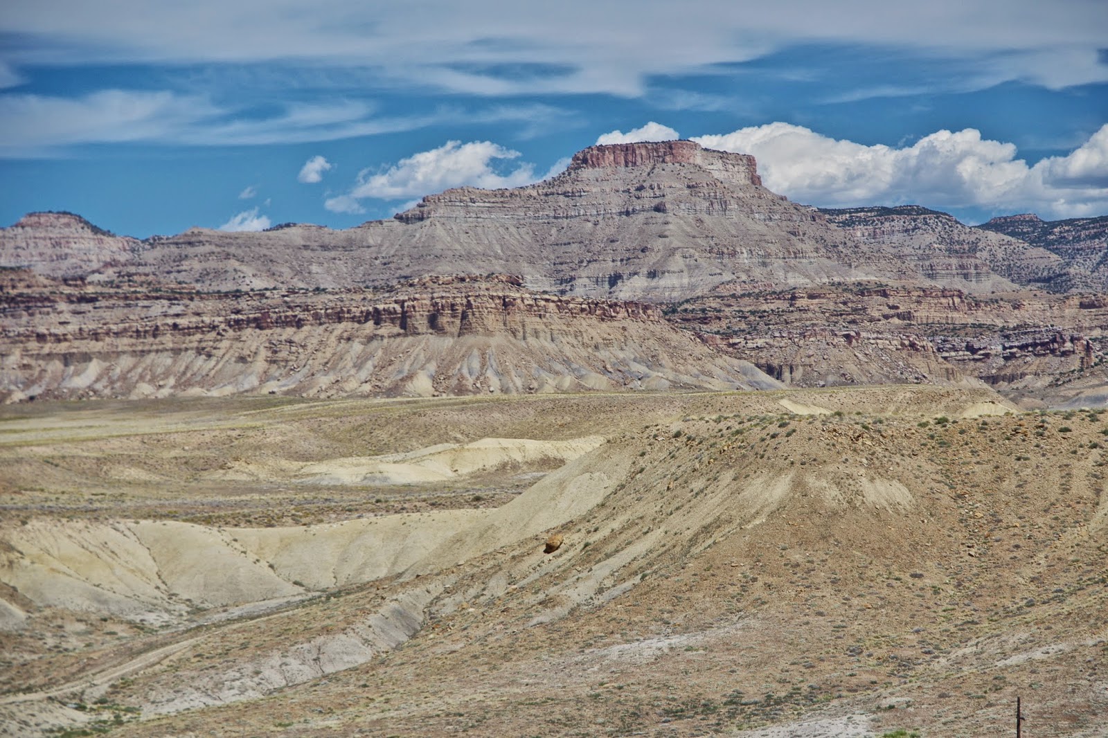
Colorado Canyon near Fisher Tower

Looking down on Vernal from Flaming Gorge

Untah tribal lands

Interstate 20 at Crescent Junction

Moab

La Sal Mountains from Arches NP

Balanced Rock, Arches NP

Balanced Rock and Balanced Harleys in Arches NP


South Window, Arches NP

Lost in Arches NP

The organ, Arches NP

Walking up Park Avenue, Arches NP

Looking back down Park Avenue in Arches NP

Looking through Mesa Arch towards La Sal mountains, Canyonlands NP

Tourist

Walking out to Murphy's Point

Murphy's Point, Island in the Sky, Canyonlands NP

Canyonland's NP near the Upheaval Dome

Stillwater Canyon, Canyonlands NP

Shafer's Trail, Canyonlands NP

Landscape Arch in Devil's Garden, Arches NP

Devil's Garden Trail, Arches NP

Fin Canyon in Devil's Garden, Arches NP

Diamond Window, Devil's Garden

Fin Canyon on Primitive Trail, Arches NP

Chipmunk  on the primitive trail

Fin Canyon

Three Gossips, Courthouse Towers, Arches NP

Newspaper Rock Historic Monument, Petroglyphs, Needles section, Canyonlands

North and South Six Shooter Peaks, Canyonlands Needles section

Driving into the Needles section of Canyonlands NP


Big Spring Canyon, Canyonlands NP

The Needles, Canyonlands NP

Utah contains the most remarkable and mesmerising landscapes but it is a state full of contradictions. As we arrived from the Flaming Gorge in Wyoming, we descended into the land of red sandstone. But the north of Utah is ravaged by mineral workings and the journey from Vernal via Roosevelt to Duchnesse was a highway from hell as we diced with massive oil tankers replete with matching trailers on a carriageway that exhibited all the bleak roadside decorative effects that define the USA. Massive signs for real estate, seedy motels, commercial premises spreading like cancer along the arterial highways, a clutter of scrap vehicles and equipment, a lack of grass and trees, an absence of any pedestrian infrastructure and a wirescape that shows no respect for Utah's magnificent bare red or grey landscapes.

We had driven 300 miles when we reached Duchnesse and decided to book into a motel. It was clean and new but when we asked for places to eat in Duchnesse, the County town, we were told the nearby pizza place was not very good, nor was the Chinese takeaway but there was a bar in the centre that served hot food. We went off to find it but rapidly retreated when we were confronted by a bank of one-armed bandits, men in stetsons and plates of food that could feed villages. We retreated to the cafe next door which was frequented by more men in Stetsons who shouted at their kids and wives and a menu that was high on calories and low on unprocessed foods. We escaped with the consolation that it had been cheap and returned to the motel to watch the adverts on TV which were occasionally interrupted by a programme.

The next day we headed up the scenic Indian Canyon on the 91 highway but we were once again tangling with the oil tankers on switchback roads that climbed to 9114ft.  We descended back to the plain passing a massive coal-burning power station and railways that told you that the earth was being extensively plundered. The town of Price held no attractions apart from observing the extraction and transport of minerals by rail and road. It was a drab and desolate mining country so we headed across the most tedious part of the route yet to Interstate 20 at Green River. We drew off the highway at Crescent Junction and took in the views of the Untah and Ouray Tribal lands to the north before continuing the journey south on the 191 to Moab. After the airfield the classic Utah landscapes beckoned, and we were confronted by massive red cliffs and monumental rockscapes, many of them familiar from a lifetime of browsing movies.

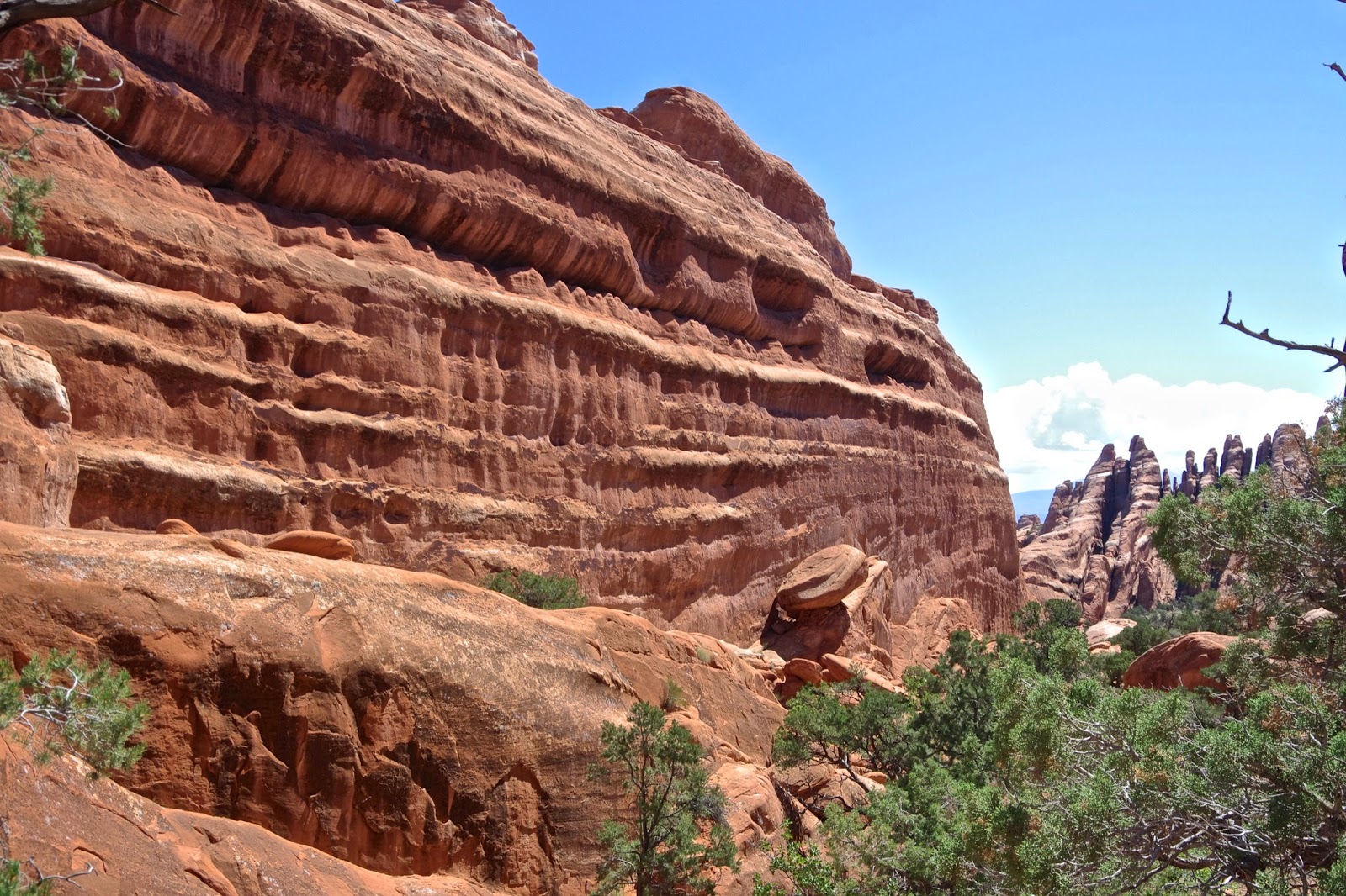
Moab is a tourist oasis and was fairly quiet in the late summer season. We had a light lunch in a vegetarian cafe before booking in at the hotel. Moab was to be our longest stop on the trip - 3 nights -  so that we could explore Canyonlands and Arches National Parks and enjoy some late summer heat. But we seemed dogged by Scottish weather, the pristine sunshine of the morning had given way to cloudy skies as we headed for Arches National Park. The quite staggering assembly of red sandstone arches and monuments did not have the wow factor that we were to witness a couple of days later on a return visit. Arches is a relatively small NP and after driving into the heart of the park we had a couple of walks around the Balanced Rock and Windows sections. On the return, we walked along the dry canyon floor of Park Avenue, a quite awe-inspiring dry river bed between massive rock architecture. The street was empty and it seemed a perfect end to the day.

The next day we had reserved for Canyonlands. It is split into three districts around the confluence of the Green and Colorado rivers and we headed for the northern section which is known as 'Island in the Sky'. It was 25 miles from Moab on empty roads. We were surprised on a perfect morning to be more or less the first to arrive at 8am. We decided to miss Dead Horse Point and drive to the highlights beyond the park entrance. We started at Mesa Arch and the views of the Colorado River canyon and La Sal mountains alone made the visit worthwhile. We were ahead of the crowds and had most of the sites to ourselves. We drove on to the Grand Viewpoint Overlook before walking out in the morning heat to Murphy's Point which gives stunning vistas to the Green River snaking its way through Stillwater Canyon. A superb walk and on our return we came across a racer snake as it emerged from a crack in the red sandstone pavement we were crossing.

We continued to the Green River Overlook and then the Upheaval Dome, a feature so complex that even geologists cannot explain its formation. Is it a meteorite crater or a dissolved salt dome? Whatever it made for good walking and we clambered to the far end of the walk. All the other walkers that made the trip were French or German and it did strike us that Americans seldom stray too far from their cars. A lady from Michigan had excused herself from the extra mile by saying that she had to get back for her dog which was gently baking in the car. We had overdosed on sandstone, sun and snakes by 3pm so headed back to Moab for ice cream but not before visiting the Schafer Canyon Overlook and the trail that sweeps down to the lower plateau and Colorado River.

In the evening we dined at a fine Japanese restaurant, Sabaku Sushi, and it served the best food yet. We met an amateur astronomer on the street and he invited us to view the moon through his telescope - it provided a remarkable view of the moon's craters, although we were a bit taken back when he asked for a dollar. Everything has a price in Utah apart from the landscapes, they are free unless they hold minerals in which case they are devastated.

The next morning brought sunshine and we headed back to Arches NP to seek out the more remote corners and eventually to take a long walk in the Devil's Garden. It was a spectacular outing and after visiting all the arches we decided to complete a 7-mile walk on the primitive trail that follows miniature stone cairns over and through fins of sandstone with some tricky scrambling involved. We completed this in the heat of the day and returned to Moab thoroughly spent from the exertions. However, a swim in the pool revived us sufficiently to explore the Colorado River east of Moab by a drive of 25 miles upriver to Fisher's Tower.

In the evening light, it was a glorious excursion and continued what had become a tour of the shooting locations for hundreds of movies including the Rio Grande, The Comancheros, Indiana Jones and the Last Crusade, Thelma and Louise, Con-air, Geronimo, Star Trek and 127 hours. We were fully sated with the scenery so had our final meal at the Twisted Sistas cafe, another good choice although it must be stated that Moab also has its share of dreadful eating places.

We left early the next morning and headed to the Needles section of Canyonlands NP, 70 miles south of Moab. The long road into the Needles from the I65 passed some remarkable scenery with early carvings on the rock, some inselbergs as well as the more famous needles themselves. We were time-limited as we wanted to visit Mesa Verde in the late afternoon before driving on to the accommodation in Durango that we had just booked. So we returned early in the afternoon choosing to take the forest trail route over another high pass to Monticello. The threatened electric storm had arrived and for the second time on the trip, it was a hard rain that was gonna to fall. We stopped for coffee at a gas station in Monticello to recover from the storm and then drove through the heart of the bean-growing district to Cortez in Colorado en route to Mesa Verde.

North Window, Arches NP

Thursday, 4 September 2014

Wyoming


Wyoming first time round in 1979
Strawberry Chiffon Pie in Cheyenne
Some relief from the monotony when crossing Iowa and Nebraska
Devil's Tower

Close Encounter with the Tower
Ascending into the Bighorn Forest Park
By Granite Mountain on the Bighorn scenic byway
Shell creek on the Bighorn scenic byway
Heading down to Cody
Cody shoe store
Shoshone Canyon
Shoshone river valley heading to Yellowstone
The Oregon Trail
Sweetwater County in search of a good cafe

Farson, Sweetwater county - home of the big cone
Flaming Gorge
Flaming Gorge
Flaming Gorge

Flaming Gorge Dam

Looking down on Utah from the Flaming Gorge

Wyoming was a revelation, we spent seven days there including our time in Yellowstone and Grand Teton but the whole state has an array of landscapes and features that ignited our curiosity. Wyoming may have the second smallest population of all American States, currently 582,000 and growing fast, but, with its rectangular boundaries defined by lines of latitude and longitude (the natural geography was too complex for the settlers), it is the tenth-largest state with 97,814sq mi. This is more than three times larger than Scotland and, with only 5 people per square mile, its population density is 3% that of Scotland. It is a big empty State with enough wildlife and mountains to keep you content for a lifetime. But the climate is pretty extreme in winter, most of the State is over 6000 feet above sea level and the winds carry some darned cold air.

Wyoming had been a welcome relief from the monotony of the prairies when we passed through on a Chicago to San Francisco Greyhound bus in 1979. It was where the prairies stopped, the cooler, fresher air and mountains began. The previous evening we had escaped the delights of Des Moines, a place that Bill Bryson had perceptively commented: "I come from Des Moines, someone had to." We had slept on the bus and the next morning passed through the interminable featureless plains of Iowa and Nebraska, the only notable features being when a lorry crashed and burst into flames and mile-long mineral trains hooting their way across the former buffalo lands.

The Greyhound bus had dropped us in Cheyenne, the capital of Wyoming, for a food break 35 years ago and we had enjoyed a strawberry chiffon pie in a downtown cafe, it remains a fond memory as it was our honeymoon. As we drove into a much expanded Cheyenne this time we looked for the cafe but in vain and settled instead on an Italian diner that provided good pasta and coffee. Cheyenne had a veneer of the 21st century about it, although like most American cities the centre had been hollowed out by all the commercial developments and trailer parks on the outskirts of the town. Wyoming, despite being more prosperous than most states, has amongst the highest proportion of its population, 13%, living in mobile homes on the edge of towns.

On the plane, I had read Annie Proux book of short stories, Bad Dirt, Wyoming Stories about wild and weird Wyoming characters from various eras. Prompted by other memories from 1979, when we had to escape a bar in Laramie as a Friday night brawl between unkempt cowboys and Mexican immigrants, I expected some of the same undercurrents of tension. But the towns we stopped at Cheyenne, Sheridan, Cody, Jackson all exuded a more cultured welcoming vibe. The hospitality and friendliness were tangible, we visited excellent museums in Cheyenne and Cody, and enjoyed the ubiquitous display of civic art celebrating the history of the Native American people and the pioneers. We discovered that Wyoming was the first state to introduce the vote for women in 1869 and to have a woman governor. There were few cowboys to be seen, although plenty of shops were selling cowboy boots.

The journey to Mount Rushmore and South Dakota had whetted our appetite for the Wyoming landscapes and this was refreshed as we made a detour from the town of Sundance to see the Devil's Tower in the northeast corner of Wyoming. I should have filled up with petrol but the Devil's Tower was only 25 miles north. There were no gas stations and I was getting worried about fuel when the Tower appeared like an object from outer space set in the lush yellow prairie lands. It is a vast magma intrusion 865 feet high and was designated as the first national monument in 1906 by President Theodore Roosevelt. It remains a powerful image for native Americans, with dozens of legends about its formation. The most common legend of the Kiowa tribe is that the tower had been a rock and, when 7 young girls were being chased by a bear, the rock pushed itself upwards and saved the girls from the claws of the bear, the marks of which are seen scoring the sides of the tower.

After a lazy walk around the tower, we had to drive 10 miles north, the wrong direction, to Hulett to fill up on gas. From there to Sheridan was a long drive of 170 miles along the Interstate 90. It charges across the high plains but the driving was embellished by the local 101.5 FM radio. It provided an authentic soundtrack of rock, blues and country music as we hurtled along the highway amidst the trucks and trailers; the Doors Roadhouse Blues was playing as we watched Pronghorns grazing to the right and the Cloud Peak mountains searing into the clouds on the left.

We rolled into Sheridan mid-afternoon, ate at the excellent Cowboy cafe in the high street, and then strolled around the clean wide streets taking photographs. We were asked by the local bank manager if he could help us as we were admiring the street furniture of sculptures of native Americans. He gave us a good tip for the next leg of the trip over the Cloud Peak mountain range to Cody. The road climbs relentlessly through dozens of switchbacks into the Bighorn National Forest and reaches 8860ft over the Granite Pass. We followed his advice took the road less travelled, the Bighorn scenic byway down Shell creek, rather than the more usual Medicine Wheel scenic byway via Lovell and Powell.  We were rewarded with another memorable drive as the afternoon sun cast long shadows over some spectacular mountain scenery. The road was a geologists dream and well provided with information notices in the many stop off parking areas.

We stayed for a couple of nights in Cody which is the eastern entrance to Yellowstone NP but also home to the quite excellent Buffalo Bill Center of the West museum, there are nightly rodeos and a melange of shoe shops that would blow the mind of shoeaholics. The place was recovering from the summer tourist invasion but nevertheless, it was difficult to get a seat in the restaurants. I went out for a run, the first time on the holiday, to Cedar Mountain and enjoyed the early morning sun, the crystal clear air and seemed to have no problems with the altitude. The next day we were off early for the trip to Yellowstone passing the Dam on the Shoshone River and seeing several American eagles riding the thermals. But the clouds were racing in as we drove up the Shoshone to enter Yellowstone NP.

After 4 days in Yellowstone and Grand Teton, we headed south from Jackson. We had to cover 600 miles to get to Moab and had wisely decided to split the journey over two days. Initially, the road was alongside the Bridger Teton range, yet another spectacular range of mountains. Beyond Pinedale, on the 191 highway, we were cruising empty roads on the high plains. We stopped to observe the Oregon Trail where it crossed our route and called in at Farson, a remote cafe/garage that had more police patrol cars than visitors. The coffee and food were good and the cafe prided itself on its reputation for the biggest ice cream cones in the State. Four scoops of ice cream for the price of two were on offer and tempted an American couple to take the plunge. "I can never resist a bargain" said the man, who put three scoops into the tub for his wife as she wobbled back from the restroom.

The drive for the rest of the day was down the east side of the Flaming Gorge, a national recreational area, with a remoteness that was extreme even in Wyoming. The Green river terminated at a dam and beyond to the south lay Utah. Vast escarpments of red sandstone were scarred with mine workings near Vernal, and the roads were full of oil tankers. Our time in Wyoming had run out but it had been a loop around some quite fantastic landscapes, Yellowstone and Grand Teton may have been the draws but the whole state oozes a raw untamed beauty.

Annie Proux's short stories about Wyoming had given an impression of harsh landscapes where everyone was involved in hard experiences such as erecting fencing, driving trucks and surviving the freezing lonesome winters on the high plain. I was more inclined to agree with the guy who sold me an iPad in New York. He had been a Project Manager for Solomons and was working at the Apple Store for a year until his wife retired. He was then off to retire to Wyoming and already daydreaming about the sublime landscapes, big skies and escape from urban life. He could keep in touch with the world through new technology whilst enjoying the great outdoors whenever he stepped out. This was a place that many folk want to retire to in order to fulfil their American dream. By all means, go to Jackson, and Yellowstone, but there is so much more about Wyoming.


Tuesday, 2 September 2014

Grand Teton

Grand Teton - 13770ft of Jagged Mountain
The journey from Yellowstone to Jackson Hole and Grand Teton is relatively short, the two National Parks are adjacent to each other but could not be more different. The caldera of Yellowstone provides a flat landscape with bright sparkling rivers, dense conifer forests and smoking geysers. Grand Teton is like Switzerland in miniature with near 14,000 ft mountains springing up from the sage wood flats of Jackson Hole. The jagged mountains were formed by the Teton fault only 10 million years ago, "they look like they were drawn by three-year-olds," I was told by a totally enraptured American hiker and I could see what he meant.

Unlike Yellowstone which had served us two days of rain and grey skies, Grand Teton was etched against a cobalt blue cloudless sky. We stayed at Jackson, a prosperous Wyoming town that is miles from anywhere. Judging by the shops and restaurants it caters for a wealthy clientele during both the ski season and the summer.  Jackson has spread rapidly like all small American towns but retained a quaintness and vibrancy that gave it an unusual self-assurance. The statues around the square, the ice cream shops, craft breweries, nearby Elk reserve, excellent Tourist office, well-stocked shops and a wide variety of restaurants give the impression of a place that people come to stay rather than pass through.

The ski resort of Jackson Hole is a dozen miles away and has been rated the best ski resort in the United States for the last few years. The awe-inspiring scenery is allied with steep challenging slopes, excellent uplift facilities and reliable snow cover. The airport has been recently revamped which makes Jackson Hole one of the most accessible resorts for the cities and has helped create a summer base for exploring the Grand Teton.

We had two superb walks in the foothills of the Grand Teton, one round Jenny Lake and the next day up the trails to Taggart and Bradley Lakes. The excellent trails wound through the sage bush, pines, alongside sparkling streams and took us to vantage points only a few miles from the summits. There is a 45-mile ridge walk along the Grand Teton range but, like much of wilderness Wyoming, it is bear country and the equipment and permits required made it impossible to sample the walk during our couple of days.

Grand Teton had not been high on the priority of places to visit on this trip but, if going back, they would be a number one attraction. The clear mountain air, gurgling streams, an abundance of wildlife, whirligig of raptors and relative solitude were in marked contrast to the crowded and commercialised honey pots of Yellowstone.


American tourists at Jackson Lake Lodge
Grand Teton from Jackson Lake
Taggart trailhead meadows
Taggart trailhead ranch
The trail to Taggart Lake

Across Taggart Lake to Grand Teton
Turkey Vulture
The trail to Bradley Lake
Grand Teton above Bradley Lake
Jackson, we're going to Jackson