Sunday, 25 October 2020

Applecross to Torridon

Graffitied road sign to Applecross

Friday, 23 October 2020

After a week of rain-drenched days, we decided to go to Applecross. The Met Office forecast suggested there would be some sunny periods between the showers, and the visibility would be good. Gregor had also decided to run from Loch Kishorn to Bealach na Ba, a 10-kilometre run up the highest public road in Britain, finishing at 626 metres or 2053 feet in imperial measure. 

The road has become a shrine for motorists, motorcyclists and nowadays convoys of camper vans. The sign at the start of the road is testimony to the craven desires of these tourists attracted by the North Coast 500 publicity. Cyclists and runners are different; they just want the buzz of secreting some endorphins and any graffiti is channelled through Strava. Gregor had checked the fastest time and although 44 minutes seemed about the time a camper van would achieve, he decided to make it his target. 

As we approached the start of the run at the junction of the road with the A896, dark clouds were skimming across from Skye, he decided to forsake the flimsy rain jacket and after a short warm-up, he started at 11:33 am. We drove on, stopping a couple of times for photos and arriving at the high point of the bealach just before noon. There had been a short shower but it had cleared and the views from the viewpoint were excellent. 

We had time to explore the various cairns and were pleasantly surprised when Gregor appeared at the top section in 44 minutes making the viewpoint and finish for the Strava route in just over 46 minutes, the second-fastest time ever, and having gained crowns (fastest times) on the lower part of the route. He was ecstatic and after pausing for some photographs and to take in the grandeur of the scenery for ten minutes, he began to run the descent to Applecross as his 'warm down'.

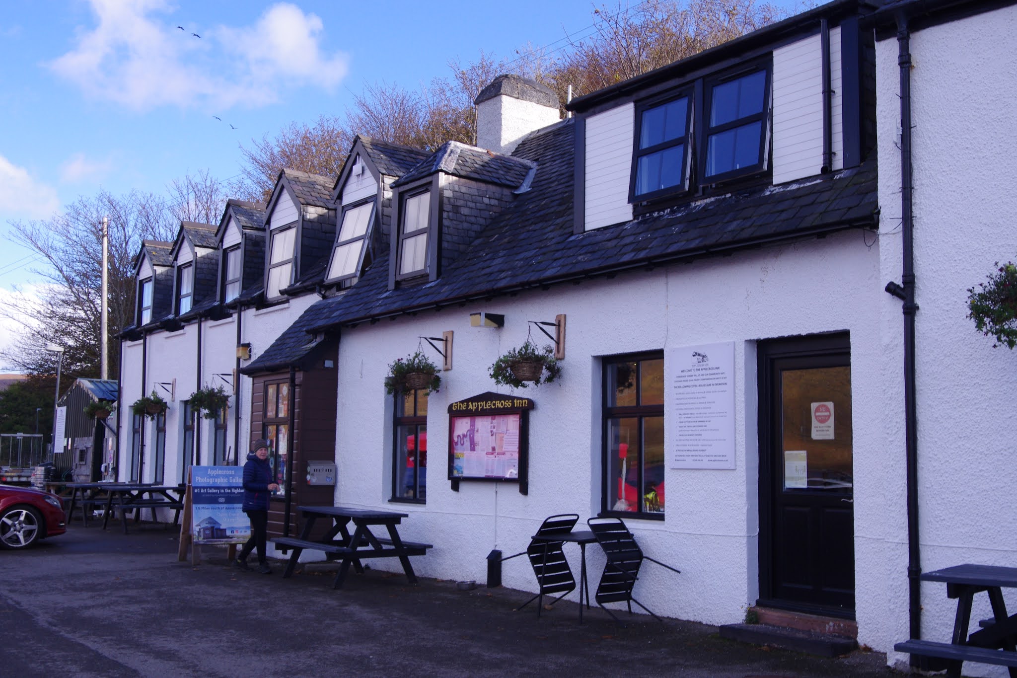
We picked him up after another 4 miles and drove down to the Applecross Hotel, which was welcoming and well-prepared to provide a socially distanced lunch. Another shower passed through and when we emerged at 2pm we decided to take the coastal road to Shieldaig. We were not alone, there was a steady stream of visitors in Morgans, Aston Martins, and Alfa Romeo sports cars as well as a Highland Council Lorry all pushing us along as we tried to take in the spectacular scenery with views of Raasay, Rona and Skye. We passed the place, Uamh Bheag, where the Prime Minister, Boris Johnson took his famous summer holiday, erecting his tent in a neighbouring croft. The road was patrolled by Highland cattle and maintained by grazing sheep.

I have a particular affection for the road having spent a week in the summer of 1970 as a student carrying out a traffic survey for Ross and Cromarty County Council. They were planning to extend the coastal road from Shieldaig, which terminated at Kenmore, a further 18 miles to Applecross but they needed some data for the funding claim. Our remit was to stop every vehicle heading south on the A896 leaving Shieldaig to establish whether they were heading for Applecross or Kenmore. We were camped at the municipal campsite at the north end of Shieldaig, which in those days was dotted with small tents of hikers and cyclists with the odd group of French visitors in their 2CVs. Aileen had first visited Shielding with one of these French Groups.

The road was built in two sections over the following five years and the number of new dwellings along the route is an endorsement of the economic benefits that have accrued. The best was yet to come as we began the last section of the road overlooking Loch Torridon and then Loch Shieldaig. As we stopped by Rhuroin, one of Aileen's favourite viewpoints, the dark clouds were cast over Torridon but clear blue skies were creeping in and a magnificent rainbow made a fleeting appearance over Shieldaig island. 

The timing had been perfect and we thought we had extracted every glorious view on this typical west coast day. Realising that our luck was in we decided to head north from Shieldaig towards the Upper Loch Torridon viewpoint. Just as we arrived, the great Torridonian mountains slipped their cloud cover. Beinn Alligin and Liathach beamed us their happy sides and in the middle stood Beinn Dearg, the highest Corbett in Scotland at 2999 feet. Hopefully, it will be my last Corbett during a visit sometime next year. We drove back to Lochcarron having salvaged a wonderful day despite the dire predictions from the Met Office. 


Kishorn Yard

The Bealach na Ba road

Beinn Bhan from Bealach na Ba

View of Skye from the summit of Bealsch na Ba


Gregor completing ascent

Applecross Hotel

Meallabhan beach with Raasay behind

Traffic warden

Uamh Bheag, the PM's summer hideaway?

Looking across to Rona

More traffic wardens

Fearnmore

Shieldaig and Torridons

Loch Shieldaig

Loch Torridon

Shieldaig

Beinn Alligin

Liathach

Beinn Dearg in middle - last and highest Corbett


Beinn Fhada

Beinn Fhada summit


Thursday, 22 October 2020

Ascent:       1015 metres
Distance:    14 kilometres
Time:          4 hours 43 minutes

Beinn Fhada   1029m      2hrs 43mins

It was another day of October rain with the cloud level down to 600 metres. I had originally intended to cycle 22 kilometres up Glen Elchaig from Kililan to climb the distant Corbett, Aonach Buidhe but 6 hours in the rain did not appeal. We looked at the alternatives and Gregor decided to climb A' Ghlas Bheinn and Beinn Fhada. At the last minute, I decided to join him but as I was not feeling great, I decided to restrict my climb to Beinn Fhada so that Gregor could charge round at his own pace. We parked at the car park for the Falls of Glomach at 11:30 am and followed the narrow but well-graded path up Gleann Choinneachain. 

After the first couple of kilometres ascent I suggested that Gregor should climb A' Ghlas Bheinn first, it looked to be emerging from the clouds and it would allow me to adopt a more sedate pace on the longer climb up Beinn Fhada. All being well, I could have a break at the summit before he arrived. He was in trail shoes and travelling light, I had boots and after the first hour, it was full waterproofs. The burns were in full spate but with the aid of a walking pole, I managed across the Allt a' Choire Chaoil with dry feet. Gregor was ten minutes ahead heading for Bealach an Sgairne for the ascent of A' Ghlas Bheinn.

The path from here is well-graded and contours upwards in Coire an Sgairne before rising more steeply over two sections to reach the ridge at 750 metres. The rains had started and the cloud level dropped down to 500 metres. From here it is a boggy tramp of a mile or so to the summit located on the less exciting east end of the mountain. I had managed a steady pace and it was just after 2pm. It was quite warm and the wind was less than forecast so I settled down in the substantial shelter and spent twenty minutes of mindfulness, whatever that is, whilst eating and drinking a little. 

There was no rush and I had descended about 150 metres before I met Gregor on his ascent. He told me to push on and that he would set off back straightaway from the summit. I did apart from a couple of stops for photos and I got back to within the last half kilometre before he caught up and ran past me. We were both quite pleased with the outing despite the rain and generally poor visibility and to be back at the house before 5 pm was a further luxury.


The path below Allt a' Choire Chaoil


Allt a' Choire Chaoil crossing

Looking back down Gleann Choinneachain

A' Ghlas Bheinn and Bealach an Sgairne

Coire an Sgairine path

Faradh Nighean Fhearchair


Saturday, 24 October 2020

Beinn Loinne (Cluanie)

The walk up Beinn Loinne

Tuesday, 20 October 2020

Ascent:        607 metres
Distance:    19 kilometres (11km on bike)
Time:           3 hours 26 minutes

Beinn Loinne        789m     2hrs 11mins (45mins on bike)

It was another wet day in Lochcarron, Aileen, Gregor and I had driven over to Shieldaig in the morning and had a walk in the rain on the peninsula north of the village. We were back at Lochcarron at 1:30pm and after a quick lunch, I put the bike on the car's roof and set off for Cluanie to climb Beinn Loinne, the Corbett south of Loch Cluanie. I had always intended to climb it when either travelling north for a few days walking or on the return. I had assumed it would take less than 3 hours, which might have been twenty years ago. It took 40 minutes to reach the Cluanie Inn and I parked at the start of the track, which is a private road to Cluanie Lodge. It continues as a disused track that ascends a bealach at 410 metres between Creag a' Mhaim, the most easterly of the Cluanie ridge Munros, and Beinn Loinne. 

It was dry for the first time in days and a wintry-looking sun was emerging as I set off on the bike. The rough road surface and over 200 metres of ascent did not make for an easy cycle, although for the only time in the day, the views opened up and even a couple of stags seemed intent on taking in their domain. They provided some photo opportunities and a welcome chance to stop pedalling for a few minutes. I rode a few hundred metres beyond the high point of the road so that I could take advantage of a slight ridge that was preferable to starting the walk through a rain-soaked bog, it was worth the extra distance. The views back down Glen Shiel and northwards to Ciste Dubh and A' Chralaig were a bonus after the last couple of days when the hills had been wrapped in low grey clouds. The underfoot conditions were dire but that had been factored in so my expectations of a mind-numbing ascent were confirmed.

I headed for the rounded shoulder of Druim nan Cnamh and only when above 650 metres did the terrain become drier with a scattering of exposed rock giving better traction. By this time the cloud level had dropped and there were no views from the summit. There was just a desolate-looking Vanessa trig point on a rock ledge over a sea of grey nothingness. 

The rain started as I began the descent, the main aim was to get back to the bike before nightfall. The clouds made navigation tricky and, in attempting to avoid the worst of the bogs, I ended up about 800 metres south of where I had dumped the bike. I was glad I had worn my cycle helmet because the ride back was all downhill with the brakes constantly in use as I fought gravity, potholes and bad light. I arrived at the car at 6:30pm, having barely turned a pedal but with arms and hands burning from the constant pummeling from the front suspension. It was dark and still raining but with only a 40-minute drive for a shower and some food, this was a rare treat compared to most outings on the hills.


Stag above Loch Cluanie

Looking east over Loch Cluanie

Aonach Meadhoin and Am Bathach from the track

Am Bathach and A'Chralaig

Beinn Loinne summit


Thursday, 8 October 2020

Shelloch Burn Wind Farm, Campsies


Shelloch Burn
Looking over the Campsies we can see the tips of several wind turbines rotating slowly. The Earlesburn wind farm has been operating since 2007 with 15 original turbines and a further 9 to the west at Kingsburn. They have been a successful installation not least because of the partnership with the local Community of Fintry, which, through the Fintry Development Trust that has the ownership of a turbine, provides a funding stream that has been used with imagination to fund energy efficiency measures, children's play provision and funding for subsidising transport. These initiatives are part of the community's objective to become carbon neutral.

A new application was submitted for a further five turbines to replace eight that already had been granted planning permission. The applicant claims that the five new turbines will not be visible to the nearest village, Kippen, but I suspected that they probably will be from Thornhill. We decided to take a walk to the Moor where the Shelloch Burn runs and which will be the site for these turbines. The Glinns Road runs alongside the Boquan Burn from the A811 before the Kippen roundabout and climbs steadily below the Campsies on its way to Fintry. I dropped Aileen at the start of the track at Ballochleam leading to the Campsies and parked a mile north at the nearest space on the narrow road. 

It was cool and breezy as we set out, it is a steady incline at first but ramps up after a gate by a lone pine tree for the final kilometre towards the Spout of Ballochleam. I had plotted the position of the proposed turbines on an OS map, they were located on the moorland to the south of the Spout where the Shelloch Burn flows in a north-easterly direction. My initial impressionion had been that the turbines would be hidden by Lees Hill, which at 411 metres is up to 100 metres higher than the moorland where the five new turbines are to be positioned. 

Closer examination of the application by Force 9 Energy, shows that three of the new turbines would be 180 metres high and the other two turbines 149.5 metres high. The applicants state that by increasing the height and length of the blades there will be 83% more electricity generated than by the eight turbines that previously had been granted permission. Although the developers have not produced a visualisation of the turbines from Thornhill, it is the only village apart from the Port of Menteith from where the turbines will be visible, an intrusive presence overlooking Flanders Moss. The extra height of the proposed turbines will also make them visible from Thornhill over Lees Hill. In itself, this is not a major issue but one that should be examined in considering the application.

The access route for the construction of the new wind farm is via the narrow road from Arnprior. A new track that starts from the Glinns Road will follow the Boqhan Burn to the Spout of Ballochleam through a splendid unspoilt landscape. Whilst the proposals by Force 9 Energy are well presented and the arguments in favour of the development are cogently argued, it is these two issues: the size of the turbines and the access route for construction that give the most concern. 
 
Force 9 Energy have offered local communities the chance to invest in up to 10% of the development and to receive an annual income stream. It appears to be a positive support of local communities and Gargunnock and Kippen both seem to have been given additional funding despite neither of them having the turbines in the line of vision. However, few communities have more than a few £'000 to invest so the prospect of them investing in the scheme is limited unless this could be offset against a future income stream such as negotiated by Fintry for the Earlsburn wind farm. The application will be submitted late this year and it would be worth discussing with the developers if more appropriate community benefits could be negotiated..
 
Notice at Spout of Ballochleam

Looking North to Ben Ledi and Stuc a' Chroin

The existing turbines


Shelloch site looking south


Tuesday, 6 October 2020

Ben Gullipen, again and again

Rainbows over Kilmahog

As the year begins to peter out, I made a visit to Ben Gullipen yesterday during a spectacular rainbow fest. It prompted me to post some photos from the early summer when it was a beacon of inspiration during the first lockdown. Ben Gullipen is the nearest hill to home and during a year when trips longer than 5 miles were ruled out until July and we have not been allowed to leave the Council area since late October, it has become an essential place for exercise. It is a five-mile drive away and during May, Gregor and I would go every few days until he captured the Strava record for its ascent and I managed to rupture some part of my knee when running down. 

Since June, I have used it a couple of times a week to slowly recover some leg strength. It is well frequented with walkers, runners, cyclists - although the majority of cyclists are on electric bikes. As a spot to observe the highlands and the backyard of my life it is perfect. I have walked it with Aileen, old work colleagues but most often alone, it has been a means of escape from the house and chance to let thoughts and memories sweep me along. It takes just an hour on most days unless the sun is out and I dither about looking over Loch Venachar to the hills or I decide to explore other routes or batter through the heather to the adjacent hill, Beinn Dearg. 

The price of mobile technology

Loch Venachar and Ben Ledi

Loch Venachar with Ben Venue top left

Beinn Dearg and Lochan Balloch

Rain approaching

Loch Venachar dam and rainbows 


Saturday, 3 October 2020

Meall Corranaich

Meall Corranaich (right) from Meall a' Choire Leith


Friday, 2 October 2020

Ascent:     790 metres
Distance:  10 kilometres
Time:        3 hours 34 minutes

Meall Corranaich            1069m     1hr   20mins
Meall a' Choire Leith        926m     2hrs 29mins  

The forecast suggested a rare fine autumn day but there was a morning fog as I drove up to Killin, although by the top of Glen Ogle, the fog had dispersed and the Tarmachan and Ben Lawers were tantalising against the cloudless azure skies. I headed along the Loch Tay road and then over the Ben Lawers road towards Glen Lyon. It had seemed far too good a day to waste so I had decided to climb the two Munros north of Ben Lawers, there would be less climbing starting at 550 metres and my knee had flared up again during gardening duties in recent days. 

Although it was still quite early, all the parking spots beyond Lochan na Lairige had been taken so I had to head down towards Glen Lyon before finding a suitable spot that was not a passing place on the single track road. Timber lorries and vehicles servicing the hydroelectric infrastructure use this narrow road so the passing places are vital. I have noticed that there are a lot more people out and about on weekdays with better weather than was the case before the pandemic changed the pattern of work. Perhaps it is those working from home taking advantage of the more flexible working conditions to enjoy the outdoors.

I had intended to climb the lower Munro, Meall a' Choire Leith, first but the path from the cairn at the top of the pass curved to the south and before I realised I was heading for Meall Corrannaich. I decided to stick with it rather than trampling over the boggy heather covered ground towards the old shielings below Meall a' Choire Leith. It was probably a good decision although the path had to double back and crossed several bogs before reaching the foot of the north-west ridge leading to the outlying tops of Meall Corranaich. The views over the Tarmachan with Ben More and Stob Binnein were superb.

Apart from the wet underfoot conditions, the day could not have been better, a gentle cool breeze and perfect visibility with the whole of the West Highlands coming into view as I gained height.  There is a steep final pull to the summit and despite the cars parked below, there was no one else on the hill. The views across to Ben Lawers and An Stuc were excellent as were the views across Loch Tay to the fine range of Corbetts and Grahams that litter the watershed of Glen Almond. I spent some time enjoying this splendid viewpoint before beginning the 3-kilometre trek across to the adjoining Munro.

The walking is easy along a grassy ridge with a gradual descent of 300 metres before beginning a slightly steeper climb to the much lower Meall a' Choire Leith. I had almost caught up with a group of six younger walkers and their dog by the time that they reached the summit. They walked past the flat summit with a paltry pile of stones and made a descent to the south-west, I found a rock facing towards the west highlands where I stopped for 15 minutes to eat some lunch, take photos and admire the spectacular skyline. The dam at the foot of Lochan na Daimh was the focal point for the array of familiar hills that extend towards Ben Nevis. Another lone walker had parked himself on another rock a couple of hundred metres away, social distancing is magnified by a hundred in the hills and has become an art form.

I headed off to the south-west, there were no paths shown on the map and I could not recall any when I previously climbed this hill from the Cairn by Lochan na Lairig. I expected a steepish descent down the heather but to my surprise, a well-used dirt path wound its way down to the 600-metre contour where the path crossed the burn. The group of six walkers were having a break on a large erratic boulder. Their Staffordshire Bull Terrier seemed upset by my approach and raced up the hill to bark ferociously at me, I was pleased that I had brought a walking pole and was ready to use it as a defence when one of the walkers came charging up to put the frenzied dog on its lead. He said it was just trying to protect them. I did not realise that I looked so threatening to a group of men who were not even half my age, perhaps I should have shaved before setting out. I thanked him, shouted my hellos to the others, leapt over the burn and upped my pace along a very boggy route to the old shielings. The group set off to follow me and were a couple of hundred metres behind. I changed up another gear and crossed the next swollen burn without a pause. There was no time to worry about slipping as I did a hop, step and jump across some mid burn boulders. There was a slight climb along the boggy path for the final kilometre before it descended back to the road.

An elderly couple on a tandem had stopped by the Cairn, I had seen them early in the day as they were leaving Killin. They had cycled along Loch Tay and up Glen Lyon before making the 400-metre climb to the high point of the road. They were from Essex and were on a three-week cycle tour of Scotland, they had a camper van for overnight stays and cycled every day, moving the van every few days to explore different locations. They seemed completely content and mesmerised by the Scottish scenery. I bade them farewell as the Staffordshire Bull Terrier and its chums began their final descent to the road.  It had been a good outing and my knee had held up apart from two occasions on the descents when it locked up. 

Killin was busy as I passed through on the way home but the roads were comparatively clear and by 3pm, I was sitting in the garden feeling quite relaxed after an easy two Munros.  

Cairn at the top of the Glen Lyon road

The Tarmachan from the ascent of Meall Corranaich

Meall a' Choire Leith from Meall Corranaich

An Stuc and Beinn Lawers from Meall Corranaich

Meall a' Choire Leith - looking towards Ben Nevis and Grey Corries

Lochan na Daimh dam and Glencoe Mts.

Meall Garbh and An Stuc from Meall a' Choire Leith

Glen Lyon Munros

Socially distanced lunch spots on Meall a' Choire Leith
Meall Corranaich from Meall a' Choire Leith

Meall a' Choire Leith from the Old Shieldings