Showing posts with label Grahams. Show all posts

Sunday, 9 June 2024

Amulree Grahams

Meall nan Caorach and Meall Reamhar

Sunday, 9 June 2024

Ascent:              525 metres
Distance:          10 kilometres
Time:                2 hours 50 minutes

Meall nan Caorach      623m.     1hr 12mins
Meall Reamhar.           620m.     1hr 48mins

After leaving Dunkeld following a Sunday brunch with Emily and Gregor the day after their wedding, I drove to  Amulree, crossing the A9 was like stepping into a skipping rope going like pepper. I had planned to climb two Graham Hills that faced each other at the head of the Girron Burn, I figured that they would be manageable after a couple of days of indulging in wedding celebrations.  There is parking space for a couple of cars at the start of the track to Girron, an empty farm building, and then a tricky path that leads to a track that continues for 3 kilometres to the bealach between the two Grahams and is named Grouse Butts on the OS map. I met a walker coming down, he was from a walking club in Lancashire and had opted out of climbing Meall nan Caorach, the second hill, leaving it for his younger colleagues. He was eighty but looked in fine fettle and had managed 210 Munros but had declared from finishing a Munro round.

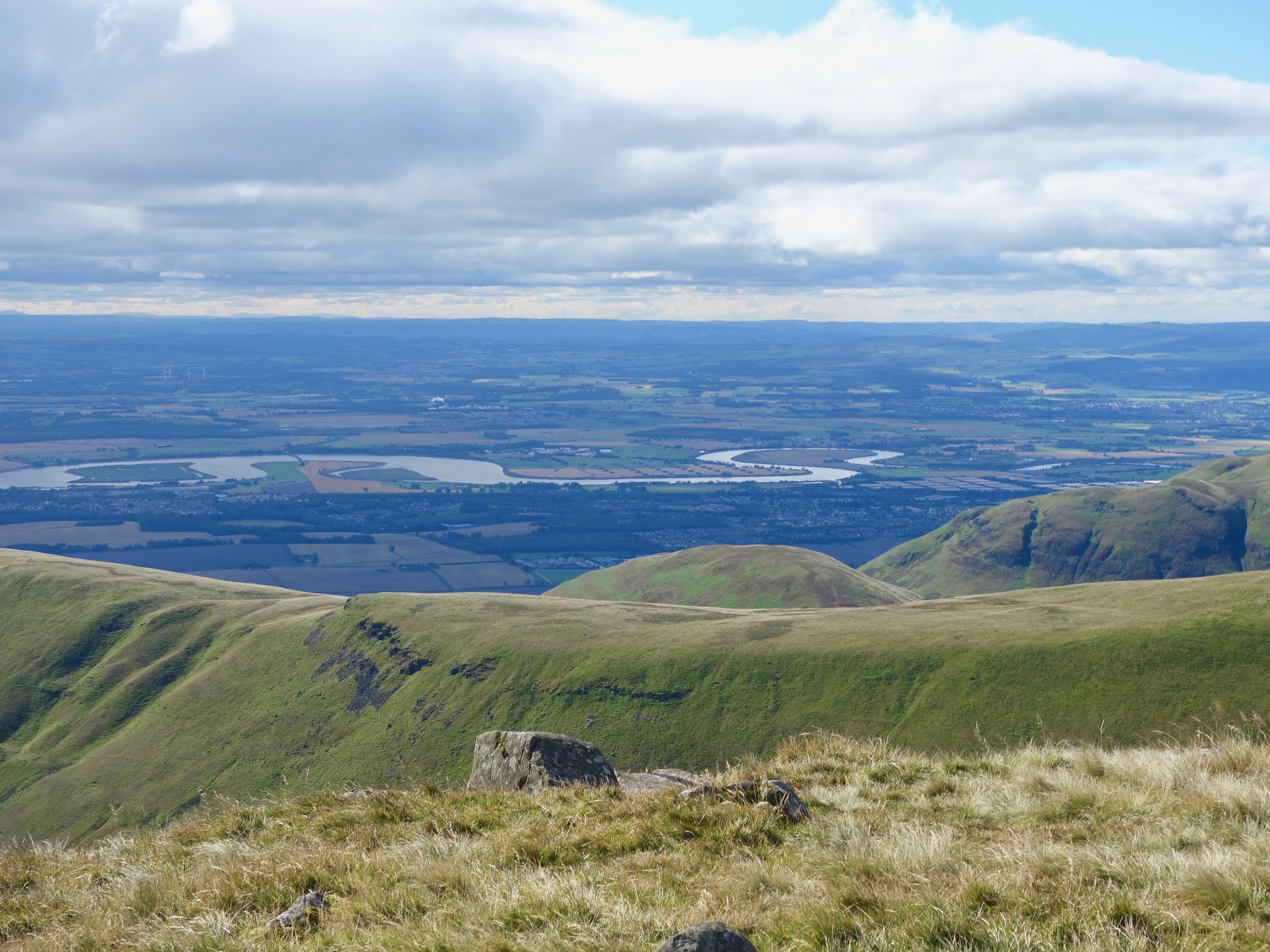
Shortly afterwards, I left the track and made a rising traverse to the summit of Meall nan Caorach. It was steep but mainly over grassy and heather-covered ground. The visibility was good but it was quite cool for June. I dug out my wind top at the summit and admired the 360° views. I was staggered at the number of hill tracks festooning the hillsides, presumably built to give access to grouse shooting. It was a steep drop of 160 metres to Grouse Butts and a similar steep climb to Meall Reamhar. I was making reasonable time and after a break for a drink and some photos, I decided to descend down the ridge to the northwest rather than dropping down to the track. Three Land Rovers were making their way down one of the tracks to the west of the summit. The descent was less straightforward than I had expected with several boggy sections but the compensation was the prolific bird life with dozens of meadow pipits and lots of grouse in the heather.

Some large erratic boulders provided a picturesque foreground for the Griffin wind farm about 10 kilometres away.  A large and healthy-looking rowan tree was growing out of another large boulder and opening its fissures in the process.  I made a beeline for the car but came across Girron burn that was slow-moving and about 2 feet deep. It took an extra 10 minutes or so to double back and cross it upstream where it was running faster and shallower, but I still ended with wet feet. The walk had been the perfect way to recuperate from the food and drink of yesterday. I was home by 6pm for a bath to remove any ticks as I had been wearing shorts whilst walking through long grass, bracken and heather in deer country.
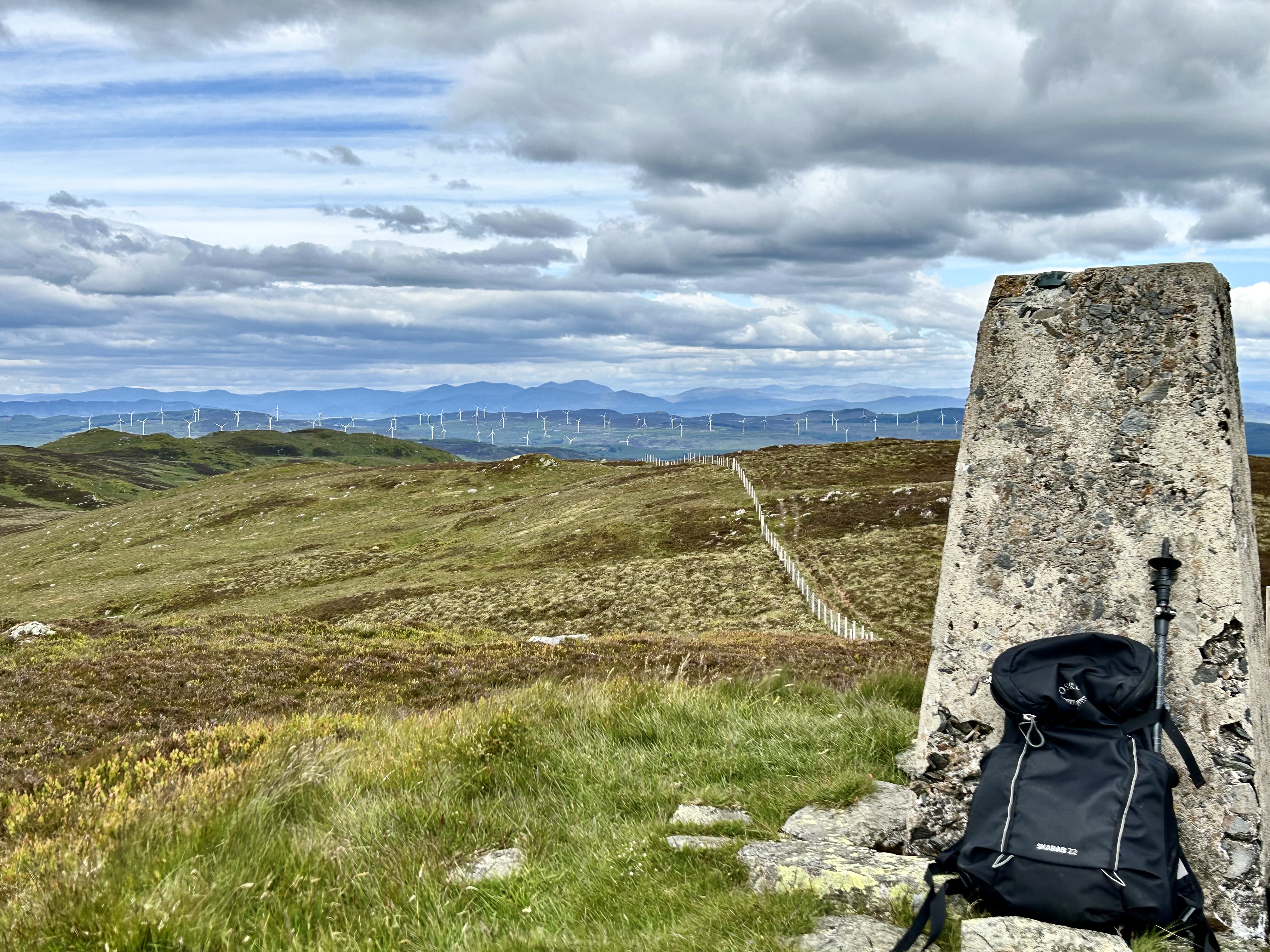
Summit of Meall nan Caorach

Meall Reamhar from Meall nan Caorach

Meall nan Caorach from Meall Reamhar

Looking north to the Griffin Wind Farm

Lomond Hills from Meall Reamhar


Erratic boulders

Rowan Tree on the descent

Sunday, 30 May 2021

Meallan a' Chuill

Meallan a' Chuail from the north

Saturday, 29 May 2021

Ascent:       195 metres
Distance:     7 kilometres
Time:           2 hours 10 minutes

Meallan a' Chuail       750m   34mins

I was awakened at 4am by the sun and the calling of the dotterel and golden plovers as they circled the tent, and then dozed until 5am when I decided to make an early start. Despite a dry night, it had been coldish, 4°C, and there was condensation on the tent. I ate a roll and an orange before packing and starting to walk at 5:45am. The light was perfect, and a temperature inversion had filled the glens with cloud to a level of 500 metres. Although the lack of comfort in a small tent has become more noticeable in recent years, the pure beauty of mornings like this, with the magnificent Sutherland peaks emerging from the blanket of cloud, makes it a worthwhile sacrifice. The rucksack seemed heavier with the wet tent, but the steady climb to the nearby Graham was no bother; I spent much of the time taking photos.

Meallan a' Chuail is a really fine mountain.  I sat at the summit for a while imbibing the views, the birdsong, the last of my water and the clarity of the air. The descent was enjoyable over some rocky ground whilst watching the cotton wool clouds sink slowly into the glens. I almost stepped on a Ptarmigan that was sitting on a nest with seven eggs. The mother gave me a rendition of a broken wing routine and circled back to the nest as soon as I had moved on. 

It was a far easier route down than the diabolical ascent of yesterday, with no peat hags or contouring required. When I eventually reached the path, I decided to give the second Graham, Meall an Fheir Loch, another miss. As I headed down to the car, the cloud was finally disappearing. I changed shoes, grabbed some food from the boot of the car and began the drive to Dundonnell. There should be time to climb Creag Rainich by Dundonnell and get home in time for the European Champions League Final.

It was just after 8am, and en route to Ullapool, every small lay-by and quite a few passing places were occupied with camper vans. It is becoming impossible to find parking for hill walking on the North Coast 500.

A 5am shot of Beinn Leoid from the tent

Looking north from Meallan a' Chuail

Ben More Assynt above the cloud

Am I really here?

Looking back at Beinn Leoid

The descent from Meallan a' Chuail

Heading down Meallan a' Chuail, Ben Stack prominent

Ptarmigan's nest at 650 metres

Loch More and Arkle


Saturday, 26 September 2020

Ochils: Ben Cleuch


Ben Cleuch from Ben Ever


25 September 2020

Ascent:     955 metres
Distance:  11 kilometres
Time:        3 hours 31 minutes

Ben Ever          622m    1hr   11mins
Ben Cleuch      721m    1hr   37mins
The Law           638m   2hrs  20mins


John had phoned and suggested a walk in the Ochils. He was trying to complete the Donalds, all the hills and their tops between 2000 and 2500 feet south of the Highland boundary fault. He had not climbed The Law during his previous outings in the Ochils because it was only a top but since 2018 the completion of the Donalds has required the tops to be included in the round. Keith Adams was to join us but his car had been assigned to the scrapyard and he was unable to get out from Glasgow. We met at the Ochil Hills Woodland Park. John observed that it was our first walk together in 2020. It would have been the first year we had not climbed together since we had climbed Ben More and Stob Binnein in 1978, starting at Crianlarich and finishing at Inverlochlarig by Balquidder.

There is a footpath from the Woodland Park back to the Silver Glen where it joins a well-made track that zig-zags upwards and then follows the Silver Burn climbing quite steeply, as is the way in the Ochils. At 370 metres we left the track and followed a wide grass path directly to the summit of Ben Ever. The bright skies with a loose cover of high white clouds made for an enjoyable ascent but towards the summit, the strong northerly winds chilled us. The visibility was excellent and Ben Ever was a good viewpoint for the familiar skyline from Ben Lomond round to Ben Chonzie. Tinto Hill was visible to the south, the Forth Estuary to the east and the links of the River Forth with the vast expanse of bonded warehouses at Manor Powis and former MoD site at Bandeath also prominent.

It is an easy saunter across to Ben Cleuch, although another 140 metres of ascent. We passed a group of four hill runners, two men and two women. We reluctantly admitted that now in our seventies, we would not be doing that again. I had run from Dollar to Bridge of Allan on a few occasions twenty odd years ago and that will remain as part of the happy memories of hill running days. At the summit of Ben Cleuch, three women had seven dogs with them in the wind shelter that surrounds the trig point. It would have made a remarkable photo but we retreated down to a sheltered position to sit and have some food, One of the dogs followed us down carrying a large stone that it dropped in front of me. I threw it and the dog retrieved it. This went on for ten minutes or so, John had finished eating and we were still playing. I sat down to have a drink and was promptly barked at for being a wimp. Fortunately, the women were about to leave with the pack of dogs so I finally had some peace. 

We continued the walk over to The Law and passed a dozen or so other walkers, mainly groups of what I assumed were students from Stirling University; skipping their house parties, online lectures and tutorials, and why not. Covid is not just for freshers week! On the steep descent from The Law, we passed the dogs again and I did get a photo but it lacked the group dynamics of the summit shelter. As we entered the Mill Glen and crossed the footbridge we discovered that the footpath back to the Woodland Park was closed owing to a landslip. It meant a diversion to Tillicoultry where we picked up the Hillfoots Diamond Jubilee Way back to the car park. It had been a good, if short, hill walk and a reminder of the well-tended, grassy but steep paths that abound in the Ochils. Looking at the way Covid cases are rising again, we will soon be in lockdown again, I doubt there will be many chances to get further afield this year.


The Law from Ben Ever

Stuc a' Chroin and Ben Vorlich from Ben Ever

Ben Lomond to Ben Ledi from Ben Ever

The Law from Ben Cleuch

Burnfoot Hill Wind Farm from Ben Cleuch

Ben Cleuch summit


Add caption

Forth Links from The Law

Some dog photos for the benefit of John

Mill Glen above Tillicoultry


Wednesday, 4 March 2020

Creag Mhor, Balquidder

Creag Mhor from Clach Mhor
Wednesday, 4 March 2020

Ascent:      575 metres
Distance:   8 kilomotres
Time:         3 hours 3 minutes

Creag Mhor     687m   1hr 39mins

February served us more wind and rain than ever before so it was with some relief that a second dry day was forecast. I had made four or five excursions up my local hills, Lime Craig and Ben Gullipen, in foul weather but they take only an hour to walk up and run down. I needed to ease myself back into some proper hill walking. The snow at the weekend had left the hills glazed like meringues so it would be hard going but sweet. I headed for Creag Mhor, a Graham, overlooking Loch Voil and Balquidder. The walk starts from Ballimore in Glen Buckie. I had not been here since 1984 when I was training for the Glasgow Marathon with a 20-mile circular training run from Brig O' Turk. 

I made a late start and it was 10:30am when I parked half a mile before Ballimore where a broad track climbs to the right and there is a large bellmouth capable of taking half a dozen vehicles. I climbed the track to a high point above Ballimore from where another track arrived and there was an enormous dump of tyres and timber. There is a gap in the high deer fence here and I began the long climb through the sodden grassy ground aiming for the corner of the tree plantation to the north. It was going well until I reached the snow level at 400 metres after which the double jeopardy of steeper slopes and soft snow put a brake on progress. There is another deer fence to breach and I managed to squeeze between the wires. The snow thickened so that each step became an exercise in punching deep holes in the snow. It looked like a pleasant ridge on the map, so I decided to take in all the tops along the ridge but it meant a lot of extra effort up and down through deep banks of snow.

The compensation was the splendid weather, there was only a slight breeze and the visibility was improving all the time. Creag Mhor's summit was tantalisingly close and a lodestone but I had to kick my way through every bank of pristine snow to get there. The sun and snow were a shock for the eyes, who would have thought that sunglasses were necessary in 2020 when any brightness of vision has been absent I arrived at the summit, it was warm enough to sit down for ten minutes, drink my flask of coffee and admire the surrounding hills that were beginning to dispense with their cloud cover. Ben Vorlich and Stuc a' Chroin appeared, as did Cruach Ardrain but Ben More and Stob Binnein remained reclusive.

I continued westwards along the ridge for a while but then decided to head down to the Allt Fathan Glinne and the large cattle shed next to a conifer plantation. I followed some fox tracks until the snow became too soft and I fell waist-deep into the snow on a few occasions. I eventually arrived at the cattle shed and decided to follow the 2 miles long seriously wide track that lies to the north of the river in Gleann Dubh. It provides access to the cattle shed and is the sort of road built by a man with no money, lots of time, a bulldozer and a shed load of red diesel. Who needs engineers, surveyors, accountants and other hangers-on? The man could probably build the HS2 line in a couple of years, there would be no tunnels, or culverts rather than bridges and the government would have some change from £10 million.

The guidebooks tell you not to use this track, which does require two 10-foot high gates and a high deer fence to climb but compared to the extra 2 kilometres to cross two bridges and return via the path from Glen Finglas, it seemed a better option. It had been a good outing and I was back at the car for 1:30pm. I spoke to a woman from Balquidder who was passing with her dog. We both observed the social distancing that is now recommended and observed in most European countries to limit the spread of Coronavirus. Why is the UK so tardy in following suit? This will not end well.

The track above Ballimore

The southeast slope of Creag Mhor

Looking down on Ballimore and Glen Buckie

Creag Mhor summit from Clach Mhor

Snowfield just below the summit

North-west towards Ben More and Stob Binnein

Ben Vorlich and Stuc a' Chroin from summit

South towards Benvane and Loch Drunkie


Tuesday, 31 December 2019

Uamh Bheag

 
Uamh Bheag summit looking towards Ben Vorlich

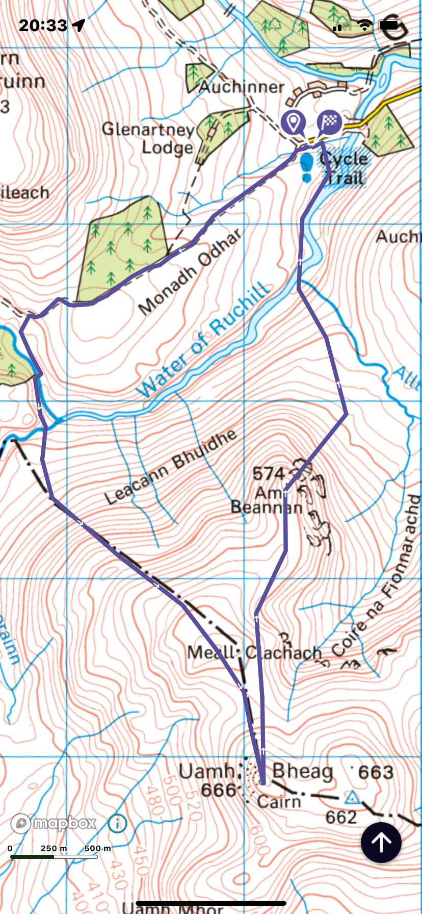
Route anti-clockwise

Tuesday 31 December 2019

Ascent:           640 metres
Distance:        11 kilometres
Time:              3hrs 40mins

Am Beannan    574m      1hr   29mins
Uamh Beag      666m      2hrs 16mins

The morning brought a hard frost and a clinically bright day. I had agreed to pick up Gregor from Stirling at 8:30am, his car was to get a minor repair. We had decided the previous evening to drive up to Glen Artney so that I could climb Uamh Bheag, a nearby Graham, and he would attempt to run Stuc a' Chroin and, if possible, Ben Vorlich. We had to be back in Stirling by 2pm to collect his car.

Glen Artney via Braco was sparkling and we were parked at Auchnashelloch and moving by 9:30am. Gregor was running the first 6 kilometres and then climbing Stuc a' Chroin via its southeast ridge beginning at Tom Odhar. I had a 2-kilometre walk to the bridge over the impressive Water of Ruchill from where I began a slow plod through frozen mud, long grass, moss, and stunted trees towards the Allt Ollach, There is a bridge that crosses the deeply incised burn about 400 metres above its confluence with the Water of Ruchill. It was covered in netting, just as well because it was far from level and the timbers were sheathed in ice, it would have slid me in the burn otherwise.

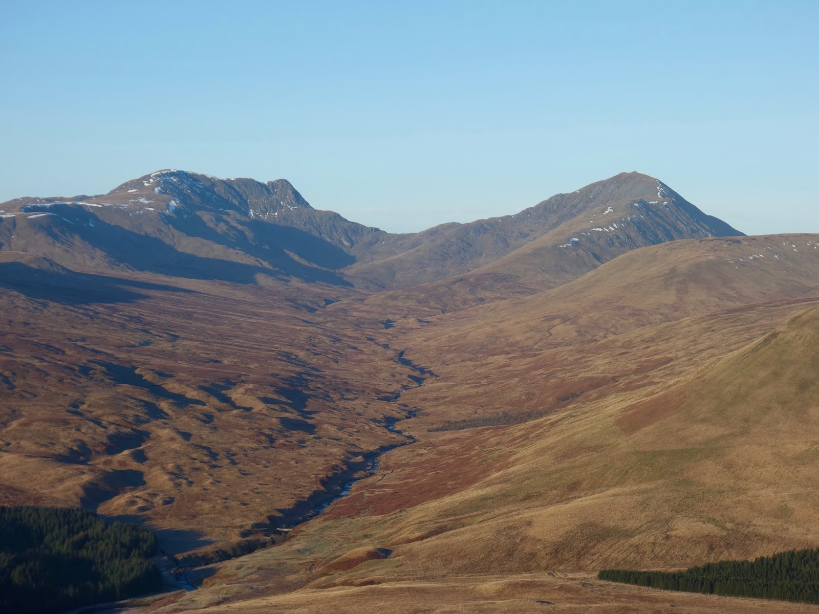
The next obstacle was Am Beannan, a shapely hill with an increasingly steep 300 metres of ascent over grass, moss, heathers and outcrops of pudding stone, all lubricated by a hard frost. Despite the blue skies and pristine air quality, it was north-facing, there was no sun to sustain my movement. My heavy cold of the last few days was further reducing the lungpower for the climb. Against this the views back to Stuc a' Chroin and Ben Vorlich were stupendous. Once I made the summit and topped up some water the walking became much easier, a short saunter to Meall Clachach and then over to Uamh Bheag alongside some fenceposts. The summit is graced by a face on a carved post that sits jauntily on a metal fence post. It provides some glee on this otherwise very ordinary summit. I spent ten minutes having a coffee and taking in the grand sweep of the surroundings, most of which I knew intimately. Uamh Bheag had been one of the very few local hills that I had never got around to climbing. 

Instead of completing a round of the other tops like Beinn Odhar, which involve a notoriously tedious slog over more peat hags and mossy tussocks, I decided to make a more direct descent to the east of Am Beannan. It worked well at first until I was confronted with Auchnashelloch Hill and two kilometres of bog and moss with only the splendid views to the hills of the north to relieve the tedium. I was back in good time and spent 10 minutes or so chatting with the man in the next car who had made much the same circuit as me. Gregor then zipped in from his 26-kilometre run. He had managed both hills and discounting his non-moving time at the top of Stuc a' Chroin and Ben Vorlich, it had only taken him 3 hours and 6 minutes. We were both pleased with our end-of-year outings and back to collect his car on time.

Brae of Auchnashelloch

Bridge over Allt Ollach

Am Beannan

Stuc a' Chroinn and Ben Vorlich from Am Beannan

Braes of Doune Wind Farm

Ben Lawers Group from Uamh Bheag

Stuc a' Chroin and Ben Vorlich from descent

Wednesday, 23 January 2019

Sgiath a' Chaise


Sgiath a' Chaise at far right from the Glen Ample track
Wednesday 23 January 2019

Ascent:      573 metres
Distance:   8 kilometres
Time:         3 hours 34 minutes

Sgiath a' Chaise     645m      2hrs  12 mins

After the first snowfall of this winter and with the mercury showing -5°C, the skies were clear and the hills were calling. I decided to climb a nearby Graham, a hill between 2000 and 2500 feet with a drop of at least 500 feet to the next adjacent hill. There are 219 of them and as I have almost completed the Corbetts, they should provide some sport in the next few years and help me recover some fitness in the meantime. Sgiath a' Chaise is one of the nearest Grahams, a mere 11 miles from the new house. It sits above Strathyre and the most usual route is from Ardchullarie Mor on the A84 midway along Loch Lubnaig. This large stone lodge is where Jim Kerr of Simple Minds lived with Patsy Kensit in the early 1990s.

Conditions were perfect but extremely cold as I set forth and climbed the steep path through the forest plantations that runs through to Glen Ample. There were quite a few trees that had fallen and blocked the path but eventually, the path joined a landrover track and continued to climb at an easier gradient to a gate leading to the open hillside. A burn had to be crossed and it was sheet ice skimmed with freezing water that made it dangerously slippery. I had to grab some protruding rocks in the burn  to inch my way across. Beyond was a picture book signpost directing the routes to Glen Ample or Beinn Each, the nearby Corbett. A couple were digging out their crampons for the ascent of Beinn Each, we eulogised about the perfect winter conditions. I continued for another 400 metres to the watershed of the track that coincided with the boundary of the plantations west of the burn.

I had the map on my phone but it wasn't loading so I decided to head directly up the snow slopes to gain the long ridge that runs south to north. A collie dog bounded up behind me and we began the climb together. Its owner was about 300 metres behind and was following my tracks. The snow was a foot or so deep and every step was a contest with gravity augmented by soft snow. I fell into my often used technique of climbing for a hundred steps and promising myself a break but then making it two hundred steps. The dog was shuttling between myself and its owner, who was falling behind. After twenty minutes of effort, I had reached the apex of the ridge and I headed for Meall Mor, the nearest top on the ridge and then Creag a' Mhadaidh. It was an extra kilometre or so from the direct ascent and a bit of a slog. The dog and its owner had given up and retreated to the glen.

The views across to Beinn Each and Stuc a' Chroin were quite spectacular against the clear blue skies to the east but clouds were heading in from the north and west. Despite the flatter terrain along the ridge, the snow was still a pernicious obstacle to progress. I continued northwards using some old fence posts to guide me on what may have been the route of a path. There were lots of deer tracks and three or four deer appeared and quickly scarpered. A couple of ravens were patrolling the top of the hill and made a couple of flypasts squawking at me with menace. The summit was flat and a lone iron post had been installed at what I took to be the high point. I sat on my rucksack retrieved my flask of coffee and regretted that I had brought no food or even chocolate with me. I had wrongly calculated that the walk would be less than 3 hours but it had already taken more than two hours to reach the summit. Tramping through the deep snow seems to double the time during ascents. Conversely,  it sometimes speeds the descent.

Having taken a longer route to the summit than necessary, on the return I headed straight down to Glen Ample from a dip in the ridge before I reached Creag a' Mhadaidh. There were large rock outcrops and the ground was full of lumps and hollows but they were deceptively lubricated with soft snow. After quite a bit of rolling and tumbling I reached the drystane wall that runs down to the track. A landrover was parked at the highpoint and two men were admiring the views but they had left by the time I reached the track. The descent was quick and easy, the landrover had broken the ice in the burn so I paddled across between the chunks of broken ice that were about 3 centimetres deep. I entered the spruce plantation through the gate and sped down the needle covered path to Loch Lubnaig. It was a mere twenty-minute drive home, a pleasing variation from the usual three hour drive from Munro bashing trips.

Track to Glen Ample at the watershed
Beinn Each

Stuc a' Chroin and Beinn Each

Stuc a' Chroin

The Last Leg

From summit to Loch Earn