Wednesday, 24 February 2016

Rob Roy Way: Killin to Acharn

Dochert Falls, Killin

Tuesday, 23 February 2016

Ascent:          780 metres
Distance:       27 kilometres
Time:             6 hours 7 minutres

Creag Gharbh    637m     2hrs 13mins
Ardeonaig                        3hrs 38mins
Ardtalnaig                        4hrs 42mins
Acharn                             6hrs   7mins

After the coldest night of the year, there was the promise of a dry sunny day, although further north, there would be clouds and strong winds. I had hoped to climb some Corbetts, but the ones that I have left to climb are all in the north-west. I did not relish the prospect of a long drive and missing the rare chance of a decent day, so I decided to make some more progress on the Rob Roy Way. We had started three years ago on a north-to-south walk, but the next stage from Aberfeldy to Acharn was difficult to arrange as the public transport did not fit unless we left home at 6:30am to catch the school bus from Killin to Aberfeldy. So it had been put on indefinite hold. 

I decided that I should do the third section from Acharn to Killin on my own, as it includes a long road section and the highest climb of the route, which would also allow me to climb an adjacent Graham. The transport was still awkward, so I reversed the route so that I could start from Killin and hope to catch the school bus back from Acharn to Killin. This would also allow me to do the climbing first and leave the 15 kilometres along the road for the afternoon.

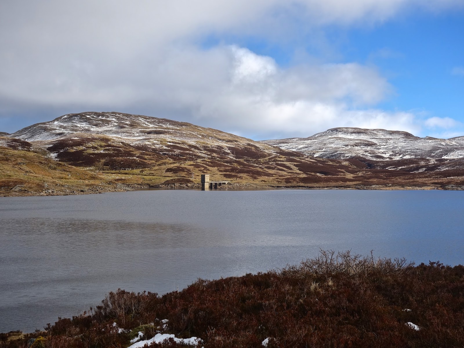
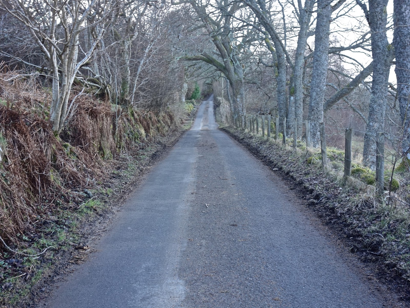
I parked in Killin just after 9:30 a.m. and began the walk by crossing the bridge over the River Dochart. It was still below freezing, and the falls were sparkling in the morning sun. The first couple of kilometres on leaving Killin were along the single-track road to Ardeonaig, and I was pleased to see that it had been resurfaced, although the timber lorries were making short work of wrecking the road edges again. At the bridge where the Achmore Burn descends to Loch Tay, there is a forestry road that climbs steeply for 4 kilometres to the Lochan Breaclaich reservoir. There were quite a few forestry operations in progress, and the views over to the Ben Lawers range were restricted by the plantations. There is a gate at the end of the forest and a radio mast before the final winding section of the road to the reservoir. I followed a path to the south end of the dam so that I could walk across it before climbing the rough track that runs alongside the reservoir, before climbing under Creag Gharbh.

Creag Gharbh is not on the Rob Roy Way, but a Graham nevertheless, so it deserved a visit. I left the track where it veers sharply to the right and began to climb through deep, soft snow. Despite the cold, I was soon sweating and found a sheepfold beneath the summit to put on some gaiters and take a drink. The final climb was hard work; each step was a thigh-deep plunge into the snow until I reached the summit ridge. The prominent cairn is a splendid viewpoint where I spent 10 minutes enjoying the views and taking photos. Unfortunately, the early morning sun had given way to a layer of cloud, but visibility was still very good. I had intended to return to the track, which would have given me an easy route down to Ardeonaig, but the long ridge to the northeast was too tempting. The descent was a tough workout through deep snow, peat hags and rough ground before I was able to cut under Stuc Mhor and reach the track down to Brae farm and from there the road down to Ardeonaig.

I knew Ardeonaig from my time as a returning officer. It had a polling station for elections, and when I organised an October by-election following the resignation of a Councillor in 1999, I visited the polling station, which was in an annexe of the hotel. There were only 49 voters on the register, and there was a poor turnout. My two polling clerks complained of boredom, the darkness of the location and the fact that the outside toilet was unusable as it was full of leaves. I spoke to a farmer's wife, from Ardeonaig, whom I knew; she was the polling clerk in a nearby village, where she always provided fresh fruit as a thank you to those who had voted. She told me that most of the locals in Ardeonaig went into Killin most days, and those who didn't could use a postal vote. Much as I was committed to providing everyone the chance to vote, I decided to close the polling station for future elections. There was no opposition from the local community.

My descent into Ardeonaig was new territory for me, I passed the large Outdoor Centre with its magnificent stand of trees and through farmland where sheep, goats and cattle were grazing before arriving at the Ardeonaig hotel on the Lake road. Although it was 1:20pm, I decided to push on; there was a long 14-kilometre walk along the single-track road to Acharn. The cloud cover had pushed in from the north, and it seemed cooler than it had been on the tops in the morning. There was little traffic, but nowhere to stop and enjoy the views and have some lunch. I kept walking until just before the next settlement of Ardtalnaig; I found a bridge with a dry stone parapet where I emptied my rucksack of food and drink.

Ardtalnaig does not have many houses, but a tennis court and a major waterworks pipeline project was in progress. I was walking at a fast pace as I began the last leg of the walk to Acharn. It was almost 3pm and I had no time to waste if I was to catch the one bus of the day from Acharn at 4:05pm. There were several expensive modern houses under construction near Kepranich, all taking advantage of the spectacular views down Loch Tay and across to the Ben Lawers range of mountains. The sun had also reappeared, and the afternoon had a springtime feel about it. The catkins were providing a hint of fluorescent green on the willow trees, which had colonised the badly broken stone walls that lined the road. Several people were gardening, and the traffic increased as the construction workers finished their day and the school car runs began.

I ran most of the last couple of kilometres to be sure of catching the bus, but I made it in good time, although the bus was early as it disgorged the local children and began its journey back to Killin. The bus is primarily for the pupils attending Aberfeldy Academy, and I was the only non-school passenger. The journey to Killin allowed me to observe my route for the day from the opposite side of the Loch and realise that, whilst it may have been a relatively flat walk apart from the Graham, 27 kilometres is still quite a distance.

Ben Lawers range

Tarmachan ridge across Loch Tay

The long winding road to Creag Gharbh

Across Lochan Breaclaich to Creag Gharbh and Meall Odhar

Lochan Breaclaich looking west

Ben Vorlich and Stuc a' Chroin from Creag Gharbh

Looking northeast to Loch Tay

Stobbinnein and Ben More from Creag Gharbh

Loch Tay looking east from the summit of Creag Gharbh

Killin and the Glen Lochay Mountains

The road between Ardeonaig and Ardtalnaig

Heading towards Acharn

Loch Tay and Lawers range are still in the cloud

The clouds lift

Fearnan across Loch Tay with the Glen Lyon hills in snow

Acharn

Thursday, 11 February 2016

Beinn Bhan, Gairlochy

Summit of Beinn Bhan from the Coire Mhuilinn ridge

Inverskilavulin House and the slopes to the ridge

Looking northeast from the south cairn of the Coire Mhuilinn ridge

Towards the summit

The last leg to the summit

Job done

Our fellow walker's car

Wednesday, 10 February 2016
Ascent:       810 metres
Distance:    9 kilometres
Time:         3 hours 47 minutes

Beinn Bhan - western top    771m          1hr   50mins
Beinn Bhan summit             796m          2hrs  26mins


We had expected a cloudy wet day after the downpour of last night but there were signs of a blue sky, it felt as if the rains may hold off in the morning. Our choice of hills was either a return to Glen Roy to climb the remaining two Corbetts at opposite sides of the glen or to drive across to Gairlochy and climb the isolated Beinn Bhan from Glen Loy. We chose the latter, it would be a shorter day and the steep climbs of the two hills in Glen Roy might be quicker on a summer's day in lightweight gear.

We passed through Gairlochy with its collection of new kit houses and started from Inverskilavulin House. We had parked at the foot of a forestry track to Stob a' Ghrianain, a splendid-looking Graham, that is opposite the bridge that crosses the river Loy. Inverskilavulin house has been renovated and a couple of holiday chalets have been built in the grounds. They are fenced in which requires the walker to turn left just before the entrance to the house and follow a muddy path around the property. It sets you at the start of the unforgiving slopes to Coire Mhuilinn. It is a 680-metre climb up the steep grass-covered slopes with no respite. The faint path reminds you that others have managed it this far.

The snow level was down to about 600 metres but it is only when you reach 750 metres that the gradient decreases. Once on the curving and graceful ridge, we were in our element. The snow held up most of the time and the 2-kilometre ridge around Coire Mhuilinn to the trig point and summit at 796 metres is a perfect high-level winter walk with a total ascent of only 65 metres as you follow the beautiful cast iron fence posts to the summit. The cornice to the north of the ridge was quite impressive and we kept our distance from its edge. Even with lots of stops for photos, it is little more than half an hour along the ridge.

There was a sharp cold breeze at the summit so we took in the views before beginning our descent to the south. The Grey Corries looked ominous below the grey cloud in the east, Gulvain occasionally slipped its mantle of cloud in the west and Loch Arkaig and Loch Lochy were glints of blue radiating from Beinn Bhan. We dropped down to about 550 metres just below the snow line and found some rocks to provide seating for some lunch, a cheese and tomato roll, orange and a coffee.

As we set off again we fell in step with the lone walker who had set off five minutes behind us and was following the same route. He was a web developer who lived in Skye and was taking a few days to tackle the more remote Munros and Corbetts from his home. We had one of those half-hour conversations that reassure you that the younger generation of walkers have sound values. I was pleased to discover that creative thoughtful people are taking advantage of the internet to locate their business in a place that satisfies their love of the great outdoors. He was the proud owner of a Citroen 2CV and this fitted his lifestyle perfectly.

We had some trouble finding our way around the fences that surround Inverskilavulin house at the foot of the hill. They are a deterrent to the right to roam, but we eventually crossed a fence and found an open gateway leading to a ford to cross the burn just before the bridge over the river Loy. It was not yet 2pm and, and as we started the drive home, the rains arrived. I was home by 4:30 p.m. after a thoroughly enjoyable two days of winter hillwalking.


Glen Roy Carn Deargs

Looking up Glen Roy

Along the river Turret, Parallel roads centre

Chimney Stack before Gleann Eachach

KY on the ascent to Carn Dearg (SE)

From Carn Dearg (SE) towards Loch Lochy Munros

KY descending Carn Dearg (SE) towards Carn Dearg (NW)

Carn Dearg (SE) from Carn Dearg (NW)

John descending from Carn Dearg (NW)

View south from Carn Dearg (NW)

Carn Dearg (NW) to Carn Dearg (SE)

Tuesday, 9 February 2016

Ascent:      895 metres
Distance:   16 kilometres
Time:         5 hours 27minutes

Carn Dearg (south east)     768m      2hrs 15mins
Carn Dearg (north west)    815m     3hrs  21mins


It was a bit late in the year for first footing the Scottish hills but this was my first foray into the mountains in 2016. After the successive storms from Frank to Imogen, there was a brief respite and the Met Office forecasts, which are now available for individual mountains, were invaluable in deciding where to go. John was on standby for a two-day walking trip to build our hill fitness and to collect some Corbetts. As soon as we spotted a couple of days with some prospect of reasonable visibility, we made arrangements to travel to Spean Bridge. We decided to tackle the two Corbetts both called Carn Dearg at the head of Glen Roy. Glen Roy is famous for the parallel roads, remnants of the last ice age that provide real physical contour lines in the glen.

We were walking by 10:30 a.m. after a 3-hour drive north. The road in Glen Roy was quite icy and after almost falling on the walk up to Brae Roy Lodge I briefly considered going back to retrieve my crampons from the car. The Lodge at the head of the glen was unoccupied although the nearby cottage had signs of life; a generator was working and the dogs were barking. We crossed the old Turret Bridge, an 18th-century humped-back bridge and remnant of the military highway. We then turned to the west to follow a track alongside the river Turret for a couple of kilometres until it narrowed to a boggy path. The sun was casting glorious shadows on the hillside and the blue skies created that feel-good factor that can make or break any walk. We passed a couple of chimney stacks, all that remained of former cottages.

We stayed on the east bank rather than crossing the footbridge and began to climb up Gleann Eachach aiming for the bealach at 570 metres. The ascent was a tough battle through long grass recently flattened by snow and lacking any path. By the time we reached 400 metres, we turned and headed for the ridge leading to the southeastern Carn Dearg, despite the gradient it was a lot easier than crossing innumerable deeply incised burns that carved into the hillside. By 550 metres we were walking in soft snow but as we reached the more gentle slope of the ridge the snow had hardened in the wind and our speed over the ground increased as we targeted the distant cairn. To the east, we could see the lower slopes of Beinn Teallach and Beinn a' Chaorrain but Creag Meagaidh was lost in the clouds. As we neared the summit a golden eagle glided directly above us, as always it was a mile or so away in less than a minute and before cameras could be retrieved for that closeup.

A biting wind from the north-west had made it progressively colder, we put on another layer at the summit where we had some lunch and goggled at the snow-covered peaks in all directions. The cloud level was down to about 1000 metres so we were denied views of the higher summits such as the Grey Corries and Ben Nevis. The descent to the bealach between the two hills was a leisurely slither through the mainly soft snow. The ascent to the NW Carn Dearg was slightly steeper but with good footing and sheltered from the cold wind it gave us time to enjoy the white mountainscapes although dark clouds were beginning to come in from the northwest. The summit was a small cairn in the middle of a snowfield where we finished the coffee before beginning the long walkout.

On days like this, there is a jauntiness about your step as you begin the descent down the snowfields, finding sections that hold the boot and then on the lower slopes twisting and turning through the long grass on the descent towards Gleann Eachach. We made good time to the footbridge beyond which is an easy final 5 kilometres back along the path and track to the Lodge. With just a couple of kilometres to go, the rain arrived and became progressively heavier as we wound our way back to the car. All the light of the day had dimmed and Brae Roy Lodge had a desolate appearance. Another walker arrived at the head of the glen but showed no intention of getting out of his car to walk.

We stripped off our boots and waterproofs and headed back down the long winding road to Roy Bridge where we booked into the bunkhouse. It was my fifth visit and it has not improved since the first visit in 1991, nor is there a shop in the village any longer but the hotel has reasonable food and the Wifi code is given free when you buy a drink. The bar was busy with a remarkable number of men with a beer and a laptop, it certainly augmented the silence.

Saturday, 30 January 2016

The life and death of Birmingham's suburbs

Bournville, when Birmingham was booming and Cadbury was philanthropic
Bournville, still an example of 'good' suburbs
Birmingham suburbs today - fuzzy cartopia
Halesowen shopping centre
Smethwick town hall
Amber Tavern in Quinton

I made a rare visit to the West Midlands to visit my father's brother who had been diagnosed with terminal cancer. It made me reflect on people and places and how lifestyles have changed dramatically since the war. I managed four long conversations with my uncle over 2 days and we covered everything from childhood in the war years, the importance of apprenticeships, inventive engineering, families and photography. In between visits to the newly opened and well functioning NHS palliative care centre, the remainder of the two days I used to explore the tapestry of urban growth and decay in the West Birmingham suburbs of Dudley, Smethwick, Halesowen and Quinton. They are not places that I know well, they are a black hole in my knowledge of the geography of England.

I had attended conferences in Birmingham and Warwick Universities and seen the odd football match at the Hawthorns. But the West Midlands has been mainly a region to pass by on the M6 or pass through on the train at New Street station. Birmingham city centre has benefitted from densification and some higher quality residential and commercial developments but Birmingham's once salubrious suburbs seem to be in decline. New flats and commercial developments less a tribute to architecture and more a dirge to the ascendency of land surveyors and accountants as the scourge of design. Planners have ceded the control of the built environment to the road engineers and the commercial pressures that are dictated more by the price and availability of land than any attempt to safeguard or enhance the functioning of the urban morphology.

The aspirational suburbs of the inter war years: solid brick built semi detached houses with gardens and splendid tree lined roads have faded as gardens have been converted to parking lots, roads have been widened, trees removed whilst incongruous commercial developments have disturbed the synergy of urban design. Large hypermarkets are dotted about served by vast roundabouts. The M5 cuts an ugly swathe of noise and pollution as it strides through the suburbs on stilts. In these circumstances it is perhaps no surprise that pedestrians and cyclists are notable for their absence.

People don't seem to live in the urban environment, they pass through it clad in vehicles or buses. The high car ownership and crowded roads suggest that there is some wealth but the shopping centres tell you otherwise. The skilled workers from the manufacturing sector are a diminishing breed and the warehousing, retail and third sector jobs that sustain the social care sector do not provide the same level of salary or work benefits or, just as importantly, the self esteem that comes with a skilled occupation.

I visited the centre of Halesowen, it epitomised the worst combination of a new shopping mall bolted onto a pedestrianised high street. The high street was occupied primarily by charity shops, many advertising their January sales. The new shopping centre was occupied by low end retailers, when Greggs and Savers occupy prime space in a centre you know that its rental rates are in sharp decline. Getting to the centre from the nearby car park was an exercise in dodging the traffic and avoiding the puddles. No wonder the majority of the population go to the drive-in soulless large supermarkets that are the epicentres for suburban life. Their monopolised tedium excludes the spirit of community and adventure and offers little scope for retail therapy.

In the evening I did find a splendid 1930's pub on Hagley road that provided a locally brewed beer and fillet steak dinner for £6.90 in an attractive clean lounge with the league cup semi final showing on 3 large flat screen TVs. It was quite full for a Wednesday evening despite the competition from dozens of ethnic restaurants in the vicinity. I walked back to my rather faded hotel in the pouring rain and passed dozens of small restaurants, all appearing empty of customers suggesting that the local economy was not as strong or buoyant as the car ownership implied.

These suburbs were not thriving and the occasional block of new flats gave no indication that housing conditions were improving. The highest common factor was a parking space; any distinctive or sympathetic urban design was absent. Unlike the splendid garden city developments at Bournville by Cadbury that have been preserved by a trust, the pride and confidence that epitomised the 1930's suburbs had been eradicated as gardens were converted to parking spaces and the successive trends in house improvement created a motley collection of sub prime properties.

The West Midlands is not alone in this respect, most of our conurbations and cities have suffered from similar shoddy new commercial developments, poor quality new housing and an over enthusiasm to cater for the car. We have lost the sense of the built environment being for people. Walking and enjoying the high streets, the parks, the gardens and maintaining places to meet in a convivial urban environment seems to be a casualty as our urban areas have been retro fitted to keep the traffic moving. Jane Jacobs had it right about the decline of American cities in the 1960's and her diagnosis is just as apposite when looking at the decline of our city suburbs today.

Thursday, 14 January 2016

Running Frozen in Time

Along the Duchray Water
Round to  Lochan a' Ghleannain
A frozen Lochan a' Ghleannain 
Loch Ard
Looking across Loch Ard from Rob Roy's Cave
Running Nirvana
Ben Lomond in the distance

At last a day to celebrate winter. The snow of yesterday evening had been welded to the ground by an overnight frost and whilst at first light the mists concealed the winter snowscape, by late morning the panorama of sculpted white mountains was magnified by the still crisp air. I had an impulsive urge to get out and run.

It was still below freezing and the thin cover of snow on the hard frozen ground had a crunch that made it ideal for running. I decided to take the track up by the Duchray Water and beyond the newly converted cottage the trail was virgin snow apart from the deer, squirrel and fox prints. Despite the early afternoon sun it was still freezing and it was hard to generate any speed but this was a day to absorb the surroundings and to hell with the time. I rounded Lochan a' Gheannain and came across three people and a dog enjoying a picnic on a table overlooking the lochan, they hollered me a greeting to the effect that aren't we the lucky ones. The uphill section that follows had deeper snow and was followed by a longer downhill section to the shores of Loch Ard. I followed the recently opened loop to Rob Roy's cave, a narrow undulating path with views that make you intensely happy, it is running nirvana.

And then just three kilometres running alongside the loch feeling the sun dip and the temperature drop even further. I had covered 12 kilometres and it had taken well over an hour but time is a meaningless measure on days like this. I had the photographs to remember that winter days are the very best for running, walking and enjoying the great outdoors. The memory of this run is now frozen in time online. 

Sunday, 3 January 2016

M6, my life on the tarmac

That's me leaning on the post as PM Harold MacMillan drives past

PM cortege on the return trip on the opening of Preston By-pass

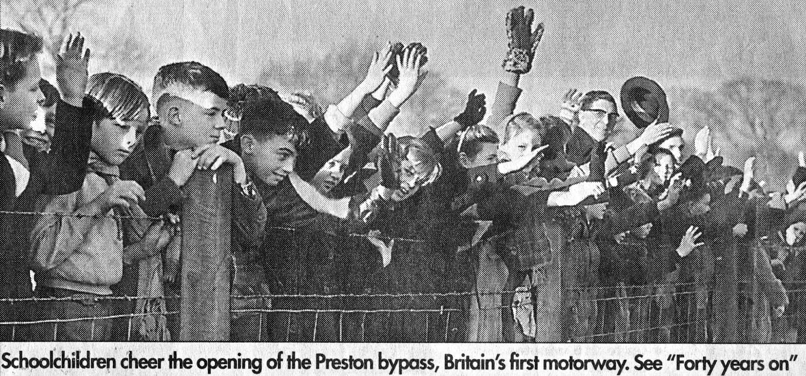
Driving north on the M6 in the post-Christmas traffic congestion prompted me to reflect on the thousand hours and more that I have spent on this seductive but damnable 230-mile long tarmac strip. The first section of motorway in Britain, the Preston By-pass, opened on 5 December 1958 and became the M6 as the tarmac spread north to Gretna and south to Rugby.

The M6 passed within a mile of where I lived and two classes from our primary school were frog marched to the nearby park to witness the opening of the Preston By-pass. It was opened by the Prime Minister, Harold MacMillan, who drove past in what looked like a funeral cortege. Mr Wilson, our headteacher (waving his hat in the photograph), thought it would be something we would always remember. He was right, it was a cold damp day and Brian Nixon had got to stand next to Valerie Lee. It also meant that I could no longer cycle down the unopened motorway to go fishing in the River Ribble at Samlesbury. Freewheeling down the pristine, well-graded tarmac slope to the river carrying a fishing rod and tackle on a bike with dodgy brakes was dangerously exciting and we once reached 39mph, according to the odometer on my friend's bike.

An alternative activity over the next few months was to watch the traffic on the new motorway in the hope of spotting rare cars. There was no speed limit on the motorway and, as it was then the longest stretch of dual carriageway in the country, it was used as a test track for new models. The highlight one evening was watching a shortly to be launched E type Jaguar in British Racing Green speeding past at well over 120mph on the near-empty road. The following spring the by-pass became a mecca for open-top car enthusiasts - Austin Healeys, Triumph TR3s and MG Midgets speeding at full throttle along the motorway with scarves flailing from the passenger seats Isadora Duncan style. There were many breakdowns, usually involving lots of steam and waving of arms, the hard shoulders were yet to be introduced so the broken down sports cars were colourful hazards (all sports cars seemed to red, green or blue) on the carriageway.

My first journeys on the M6 were trips to the Lake District when the family including grandparents and favourite Aunts crowded into a hire car at weekends. I was mesmerised by the bridge at Scorton that had been designed and engineered in sympathy with the rolling landscapes on the edge of the Forest of Bowland. It was in stark contrast to most of the bridges on the M6, which looked as if they had been bought as a job lot from a catalogue. Trips north on the M6 became more frequent as a teenager when friends acquired cars and we went walking and climbing to the Lake District during school and university holidays.

When I left school the M6 had been opened up between Birmingham and the Lake District and I began to take advantage of the Samlesbury intersection to make hitchhiking trips around the country. It was the quickest and cheapest way to travel and it opened up my knowledge of distant places as well as the cast of characters that inhabited Britain. I was bought meals and drinks by friendly drivers, delivered to my final destinations and even taken home by one lorry driver to meet his daughter. Most of my journeys were south to North Wales, London and South Wales to go climbing, visit friends or university field trips.

Oxford became my next regular destination when I lived there for a year or so. By this time I was the owner of two Morris Minors, don't ask, bought for £40 and £30 respectively. I travelled over 40,000 miles in them and much of it on M6 journeys to the Lake District, Liverpool, the Cotswolds and then Oxford. On moving to Oxford, I broke down near Stone and was towed off to a local garage to have a new distributor fitted. Hurtling along behind the breakdown truck at 60mph separated by a 15-foot chain and with brakes that were barely any better than those on my bike was one of those truly life-threatening events. Each time the truck slowed down the tow chain slackened and I feared a mighty crash. I pumped the brakes and was relieved to have a proper steel bumper. Surprisingly the car and driver survived although I was berated by my girlfriend on arrival at our rented accommodation 4 hours later than promised. I would not have arrived at all had I not used the M6 and a night in Staffordshire has never really appealed to me.

On another occasion travelling back from Oxford I picked up a hitchhiker at Birmingham only to discover after a few minutes conversation that it was my best friend from when we were 3 and 4 years old. He lived across the street from my grandparents, where we lived at the time. I had not seen him for a dozen years and he was now an accountant at a London Bank. We reminisced about our early years and both remembered that on a rare hot day we had sat in the cobbled street, there was no traffic other than the milk float in the morning, and popped the tar bubbles that miraculously appeared between the cobbles in the heat of the day. It was presumably my first brush with tar and both of us had to be scrubbed clean with substances that would be banned today. We were forbidden to play together or to touch the tar ever again. Thank goodness for bubble wrap, the clean alternative to tar bubbles for today's children and, ahem, adults.

Although my Morris Minors could barely reach 60mph, it was a quicker journey up the M6 from Birmingham in the 1970s than in the Christmas rush of 2015 and there was no M6 toll road to avoid Spaghetti junction in those days.

My relationship with the M6 changed after 1973 since when it has been the journey south from Gretna five or six times a year as I visited my family, the Lake District or occasionally drove south for holidays in Cornwall. Journeys to London and the south stopped in the 1980s when train times and then flights became a quicker and often cheaper way to travel south. Only recently have I taken to travelling down the M6 to London a couple of times a year to visit family and grandchildren in London. The only reasons are that we can deliver spare furniture and other items, visit interesting places and call in on old friends en route.

The M6 had made such a difference to journeys when it opened, no queues for the swing bridge at Runcorn when travelling south (although it was a lot more fun and occasionally quicker than crossing the Thelwall viaduct) or mile-long traffic jams on the A6 to the Lakes. The changes have been remarkable to the M6 as well: hard shoulders, crash barriers, speed distance chevrons, from 2 lanes to 4 lanes, from empty roads to nose to tail jams. Lane closures are now an everyday feature and accidents cause major blockages that prevent ambulances and rescue vehicles from reaching the incidents. The only thing that has remained the same is the detestable service stations. The quality of food and prices still generate angst and frustration by encapsulating all that's worst about Britain's obsessive overdependence on franchised retail and service operators.

Scorton Bridge
As it is today, forever and ever
The M6 junction at Birmingham
Isadora Duncan style