Sunday, 20 March 2016

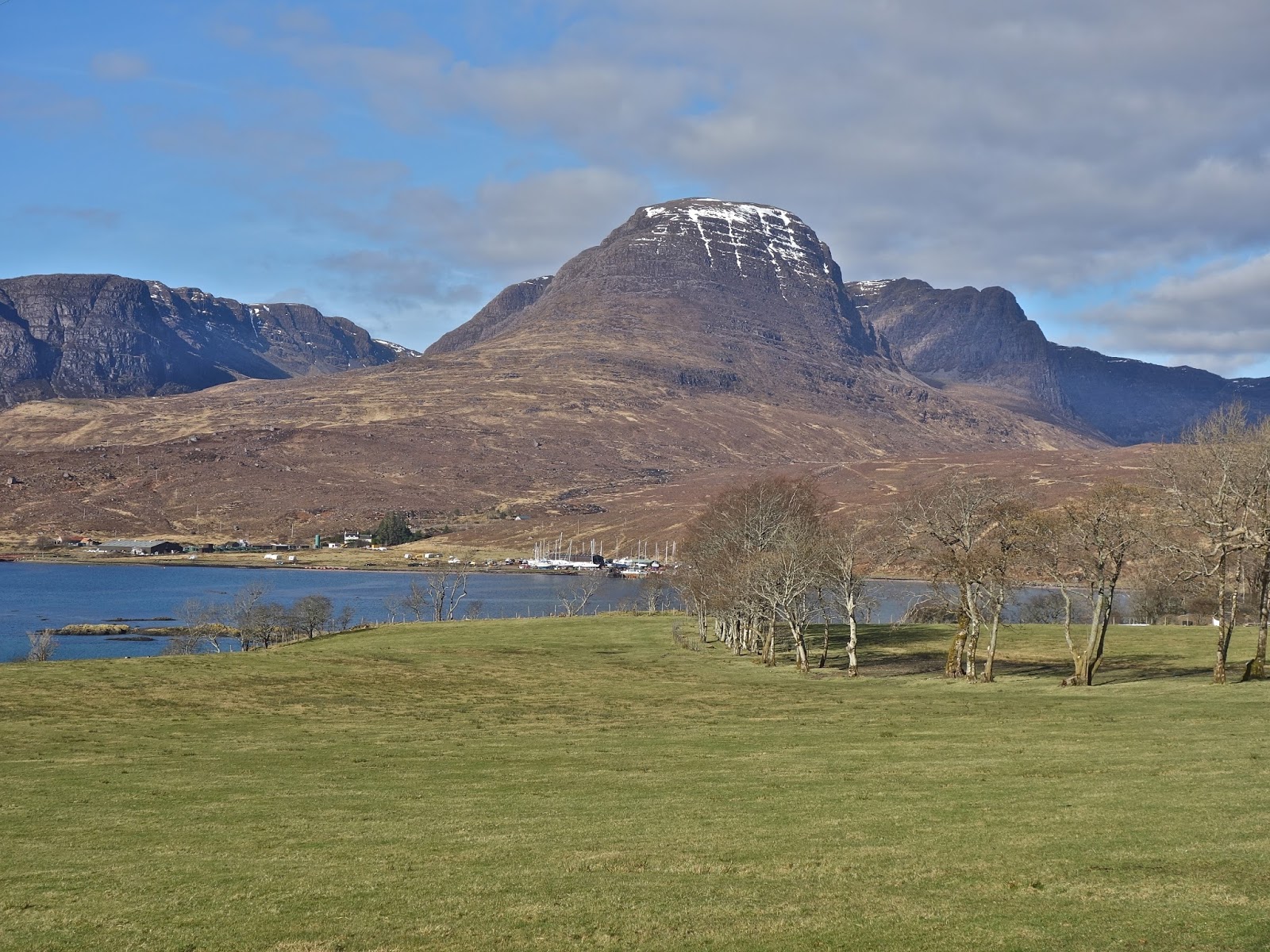
Strathcarron

Tigh Braeintra
 
I have long had the view that three districts in Scotland provide the finest scenery. These are the north-west highlands north of Ullapool, the Torridons and the Ardnamurchan and Moidart areas between Mull and Mallaig. They have been my destinations of choice since I arrived in Scotland in the 1970's. Other areas come close, the Argyll coast south of Oban, but it lacks mountains and the Knoydart peninsula, which is too remote for regular visits. This week I spent a week in the Lochalsh area between Glen Shiel and Shielding, and I have to admit that it is now one of my favourite areas and only 45 minutes away from the Torridons and Skye.

We arranged to go at a few days' notice to my brother's cottage at Achmore, close to Plockton. It would be my birthday, and we invited John and Bridget to come along. We met them at Invergary for a light lunch, after which John and I  started as we meant to go on by climbing Meall Dubh, a shy Corbett amidst the Millennium Wind Farm and then went out for my birthday meal in Plockton. We would be able to climb some of our remaining Corbetts in the vicinity, whilst Aileen and Bridget visited Applecross, and other parts of Lochalsh, with all of us visiting Shieldaig and Raasay on other days. We were rewarded with 6 days of March sunshine. The views had a Leica-like clarity that was mesmerising.  We spent 4 days in the mountains, with the other days giving wonderful walks near Shieldaig and then Aileen, John, and I having a splendid day exploring Raasay.

View from the cottage

Winter is over

Loch Carron

Above Strathcarron

Hot Totty on wheels

Beinn Bhan, a sublime walk

Plockton Bay

Plockton sunset


Sgorr nan Lochan Uaine and Sgurr Dubh

Sgorr nan Lochan Uaine

Wednesday, 16 March 2016
Ascent:           1134 metres
Distance:         11 kilometres
Time:               6 hours 35 minutes

Sgorr nan Lochan Uaine         873m     2hrs 41mins
Sgurr Dubh                             782m     4hrs  55mins     

Another perfect day, so we decided to tackle the two Corbetts in the Coulin forest from the Glen Torridon road. We knew that these hills were capped by steep rocky summits, and we preferred not to tackle them in winter conditions; apart from anything else, it would mean lugging up crampons and ice axes, and I thought an SLR camera would be more useful on a day like this. Our walks earlier in the week had convinced us that conditions would be favourable, the snow had largely melted in the heatwave and only garlanded the northern slopes. We were less sure when we passed through Achnasheen and drove into low cloud, the Fannaichs and Fisherfield were invisible figments of our imagination.

Leaving Kinlochewe on the Loch Torridon road, we emerged from the clouds, and Glen Torridon was revealed in all its stupendous glory. The face of Liathach was fully made up in the winter sun, with the rocks highlighted in shadow and its summit ridge outlined in snow and contrasting with the impossibly azure skies. We parked by the path that leads to the triple buttress behind Beinn Eighe and took the path crossing the river and heading for the Ling hut. It was still cool, but half an hour later we were stripping down to shirts as we climbed the excellent path that heads towards Beinn Liath Mhor.

The path eventually ran out at 420 metres, so we made a beeline for the summit of Sgorr nan Lochan Uaine, its pointed peak overlooking the eponymous lochans below that shimmered in the strong sunlight. The lower slopes had been recently covered by snow that had tamped the grass and heather flat, and the ground was liberally littered with old red sandstone outcrops and blocks. I stopped for 15 minutes to catch up with an urgent e-mail and took the opportunity to tantalise friends confined to their workplaces by sending them a few photos. The final 50 metres of ascent was a steep haul up some shattered quartzite. We arrived at the magnificent summit with amazing views in all directions. The conditions were quite benign, so we had a good half hour in the sun, which is rare at any time of the year to be able to relax like this on the summits. Today was recompense for all those wind/rain/snow-lashed days when my hands were numb and my body was telling me to keep moving.

The next stage of the walk looked a bit complex as we observed the 3 kilometres of geological minefields over to Sgurr Dubh. There were dozens of small lochans dotted amongst the rock bands, and a direct route was as improbable as the OS contours giving us a true picture of terrain crafted by the last ice age. The start of the descent was down the quartzite blocks on a rough path, and then we followed our noses, passing around rock outcrops, down snow chutes and around the lochans. They were mainly frozen and provided the scintillating foreground for more shots of the Torridon peaks to the north.

As we started the climb, we were confronted by dozens of lochans nestling between the exposed sandstone pillows. We came across a stag who held his ground and provided more photo opportunities, posing beneath Liathach.  The final climb to Sgorr Dubh was a scramble along a quartzite ridge with massive fractured boulders before dropping to the final deep blue lochan and then finding another steep path rising to the summit peak. Despite the fact that we had been blessed with unrivalled views all day, there is something special about this summit overlooking Glen Torridon. Again, we relaxed, emptied our rucksacks of any food, took photographs and then began the descent. We had taken over an hour longer than we needed to walk these hills, but we had absorbed every aspect of some wonderful hills on a perfect day. It was after 4pm before we topped out.

The guidebooks had said the quickest descent was to head west towards the Ling hut, we did and had to turn a large crag to the left. There was then a steep ramp down to a wee lochan, and after that, it was a series of rock bands to negotiate by slithering and sliding down the rock outcrops. It required concentration and took longer than we had anticipated to cover the 3 kilometres back to the hut and then out to the car park. We had been granted an exquisite day for the walk. On the journey back to Lochcarron, we were eulogising about whether this had been our best walk ever.
  
Liathach from the Ling hut

Liathach, King of the Scottish Mountains

Beinn Eighe ridge

Liathach from the slopes of Sgurr nan Lochan Uaine

Liathach and Beinn Eighe from Sgurr nan Lochan Uaine

Guess

Summit of Sgorr nan Lochan Uaine with Liathach and Beinn Eighe behind

Moruisg and Maoile Lunndaidh to the southeast

Descent of Sgorr nan Lochan Uaine

Not a care

Liathach in Excelsis

Liathach and Beinn Eighe from the Lochans on the bealach

Stag holds its ground

Sgurr Dubh from below the summit

Beinn Eighe and Loch Claire from Sgurr Dubh


Saturday, 19 March 2016

Raasay

Approaching Raasay from the ferry

Thursday, 17 March 2016

After three days in the mountains we sought some respite by taking a trip to the island of Raasay off the east coast of Skye. We had made attempts in the past but were thwarted by lack of suitable ferries on Sunday or poor weather that would have given little scope for exploring the island. Today was another splendid March day with the high pressure making the north west highlands the sunniest and warmest part of the UK. The ferries run frequently and the 15 minute journey in the well maintained Cal Mac ferry was a treat with the ferry crew extending courtesy and sage advice on where to go.

We headed to the north end of the island and in the incomparable luck of the week we were entertained by a golden eagle circling us above Manish Mor. Our intention was a walk to the small offshore island of Fladday and to drive on Calum's road. This three kilometre section of road was built by hand with barrow, pick and spade by Calum MacLeod over a period of ten years and has been the subject of TV documentaries and books as well as a tune, Calum's Road.

Calum was one of the last remaining residents in the small settlement of Torran, 10 miles north of the ferry terminal and main settlement at Inverarish. He had been the postmaster and lighthouse boatman and his wife had taught at the small local school. He was frustrated by the failure of increasingly centralised organisations to understand and respond to the needs of remote communities so built the road that the Council refused to build. As a testament to willpower, bloody mindedness, public spiritness and sheer endeavour he has few peers. He died a couple of years after it opened in 1988 and one of the locals who had lived there until 1966 told me that he had left a hell of a legacy. There remain some cottages occupied mainly by the families of former residents. The area around the beautiful sea loch at Arnish were always isolated from the more populous south of the island by poor roads and they forged closer links with Portree just five miles away by boat.

Calum's road was no better maintained than the rest of the island. We returned to the south as the heathers were being burnt and passed through the forest plantations that were being felled following an outbreak of Phytophthora ramorum to larch trees above Raasay House. A new distillery has been built on the island and a Raasay 'While We Wait' bottle is available prior to the arrival of the finished product. The Hotel and Outdoor Centre provide some employment and the island seems well populated with sheep. Raasay had suffered greatly when owned by the London retired GP, Dr Green or Dr No as he became known. When the Scottish Office took over the ownership in 1995, the local population made heroic efforts to generate new businesses.

There are a number of community based initiatives and there is evidence that the steady population decline over many years has now been reversed. Work on the walled garden, a new ferry in 2013 and some community run enterprises as well as various cultural and outdoor activities suggest that the island could be on the cusp of  a sustainable regeneration.

We were told that the sea fishing in the Sound of Raasay by larger vessels bottom trawling has had damaging consequences for the seabed ecosystem. The number of rabbits on the island is much reduced since the arrival of mink, it is thought from the Uists. There are two pairs of golden eagles on the island as well as sea eagles, otters and a seal colony.

Sailing back on the evening ferry and enjoying the views of Skye we felt elated about our day on the island. At the same time the alleged criticisms of insensitive national organisations and the lack of support by the Scottish Government agencies and Highland Council compared to other smaller islands seemed to suggest that the potential of Raasay as a place of sustainable growth has yet to be realised.

Golden Eagle over north Raasay

Brochel beach
The start of Calum's Road
On Calum's Road
On the path to Fladday, also built by Calum and his brother
Fladday Path
The three remaining cottages on Fladday, access at low tide

Heading back toInverarish, Red Cuillin in distance

Red Cuillin from Suisnish

Looking west to Skye

Raasay House Hotel

Tuesday, 15 March 2016

Beinn Bhan, Applecross

Beinn Bhan and its Coires from the east
Monday,14 March 2016
Ascent:      791 metres
Distance:   15 kilometres
Time:         5 hours 44 minutes

c   Sgurr a' Chaorachain     792m              1hr   3mins
c   Beinn Bhan                   896m              3hrs 34mins

This was the finest morning of the year so far as we woke in the superb cottage by Loch Carron. We decided to climb the two Applecross corbetts, Beinn Bhan and Sgurr a' Chaorachain. The drive round Loch Carron gave us the chance to see the north west highlands at their scintillating best. There were two couples so we took both cars to the foot of the Applecross road and dropped one there. The Bealach Bhan road was quite busy for an early March morning with a few cyclists testing themselves on gradients that used to defeat cars in the 1950's. My father had to reverse his ageing Rover 75 up the steepest section in the early 1970's on one of my parents many incident packed Scottish holidays.

Arriving at the summit we soaked in the views across to Skye and then booted up for the day's walk. Our wives continued on to Applecross to explore the shell sand beaches and to have an al fresco lunch in the excellent hotel whilst John and I began the climb up the track to the TV transmitter. I had been here a couple of years ago in the evening after travelling on the coast road from Shieldaig and I decided to run out to the corbett, Sgurr a Chaorachain, or so I thought. It was only on checking on a map later that I realised the cairn that I had reached beyond the TV mast, whilst almost the same height as the summit, was two kilometres of undulating ridge away from the true summit.

A couple of four wheel drive vehicles passed us going up the track to the TV mast before we turned off the track to head south to find the real summit. There were large patches of snow between the old red sandstone outcrops and the walking was illuminated by spectacular views into Coire a' Chaorachain including the massive cliffs that had been first climbed by Tom Patey and Chris Bonnington. Arriving at the summit was to reach the perfect perch for a long lazy lunch. It was still too early so we spun out the time taking photographs and then taking some food before the long leg over to Beinn Bhan. We retraced our steps to near the TV mast and then headed north for 3 kilometres over tricky rocky, boggy and heather strewn ground to Bealach nan Arr. It took a long time with constantly undulating ground, hidden dips, rock ledges, boulders and bog impeding our way.

The next leg was a 300 metre climb to the summit of Beinn Bhan climbing over rocky ground that was interspersed with long bands of soft snow. The gradient lessened as we climbed and eventually we arrived at the large cairn sitting on the long north to south summit ridge of Beinn Bhan. It had taken two and a half hours so we finished whatever food we had and began to take in the views and then explore the eastern edge of the ridge where the famous five corries scallop out the ridge. There were cornices all along the edge and the A' Chioch ridge looked unscaleable in the conditions.

We eventually and reluctantly started the long descent to the south, exploring the edge of the ridge and viewpoints as we dallied at each point on the ridge as the late afternoon sun cast longer shadows. We heard the distant call of a plover,  the only wildlife of the day.  The descent gets steeper the further along you walk but we remained in the sun until the last kilometre of the ridge. We had a further kilometre along the road to the car and were surprised at the amount of traffic returning from Applecross.

The views over Kishorn were impressive and generated a conversation about why Kishorn had been built as a deepwater site for the construction of offshore drilling rigs. I had been working with the economists in the Scottish Office who were evaluating alternative sites for rig construction and my contribution had been to tell them not to mess up this spectacular part of Scotland. They dismissed my arguments as giving too much weight to environmental factors, these were not perceived as important in the 1970's. Nevertheless no rigs were built here despite the initial site works being constructed. Nigg Bay and Ardersier were far nearer the oilfields in the North Sea and had a far better transport infrastructure for bringing in materials as well as accommodation for workers. And the damage to the  environment would be far less intrusive, although Nigg Bay does now look like a graveyard for some of Andrew Gormley's sculptures on steroids.

But enough of bashing economists, they are fallible, unlike the walk today. It fulfilled the ultimate goal of well being that economists generally dismiss - sheer pure happiness.

Sgurr a' Chaorachain from Kishorn
Skye Cuillins across the Inner Sound
Lookong along the ridge to Sgurr a' Chaorachain 
TV masts above Coire a' Chaorachain from the summit
Rough going on the route to Beinn Bhan
The route up Beinn Bhan

Afternoon shadows

Looking north to the Torridons
Torridons from Beinn Bhan summit
Overlooking Coire na Poite

Last of the winter white on Beinn Bhan
Beinn Bhan from the south ridge

Monday, 14 March 2016

Meall Dubh

Meall Dubh Summit Cairn, not easily missed

Route from Glen Moriston
Sunday, 13 March 2016
Ascent:     670 metres
Distance:  10 kilometres
Time:        3 hours 44 minutes

Meall Dubh        788m      

Birthday or no birthday, this is the year of the Corbetts, and by that strange fluke of mathematics, I now have as many left to climb as I have years on the clock of life. Time waits for no man and I would happily reverse the direction of age and Corbetts. Meall Dubh is a modest hill that sits alongside the A87 on the road between Invergarry and Loch Cluanie. John and I have talked about climbing it for the last twenty years. We were always either charging north to climb some Munros or driving back too late or tired after several days of walking to tackle this Corbett that sits alongside the extensive Millennium wind farm. We were heading for a week at Strathcarron and after meeting up for a light lunch at Invergarry we had time to complete the hill before nightfall.

Instead of parking at the dam on the A87, we decided to follow the route from Glen Moriston which is the more usual route nowadays utilising the track to the Millennium wind turbine field that sits east of the hill. The starting point is 3 miles east of the junction with the A87, with a large parking area on the opposite side of the road. There is a walker's gate onto the track that twists its way up the hill and passes through some plantations. At about 400 metres, a junction and the road to the right head towards the outlying northern summit of Beinn an Eoin. At the high point of this track, we turned off to the left, climbed up and over some boggy ground, and eventually found a place to cross the still-swollen Allt Coire na Gaoith an Ear. Then we headed for the southern ridge of Meall Dubh climbing up steeper heather-clad slopes until we found the drier ground of the ridge.

It was a grey afternoon but the views were good, we were close to the massive wind turbines, some of which were turning lazily in the whisper of a breeze. We had a couple of snowfields to cross before reaching the massive summit cairn. We had watched a lone walker disappear from here to the south about 5 minutes before our arrival, a sure sign that the Corbett bagging season had started. The views to the west were impressive. Loch Cluanie was trapped between the snow-capped peaks of Glen Shiel whilst Loch Quoich pointed towards the Knoydart hills, indistinct peaks on the hazy horizon.

After a break at the summit, we took a more direct route down the ridge, taking advantage of some snow chutes and arrived at a recently erected footbridge over the Allt Coire Gaoith an Ear. From here a rough track climbs 50 metres to where we had veered off on the ascent. The light was fading as we retraced our route down the track and arrived at the car just before 6pm. The sense of accomplishment was along the lines of 'well that's got that one out of the way'. The real birthday treat was an hour or so later when we indulged ourselves with a fine seafood meal in Plockton. The weather forecast for the next few days was just as exciting as uninterrupted sunshine as forecast in the northwest highlands and this in mid-March.

On the start of the ascent from Glen Moriston

Millennium wind farm

Loch Quoich, Loch Loyne and Loch Cluannie from summit

The bridge over the Allt Coire Gaoith an Ear

The track above the bridge


Friday, 11 March 2016

Race Marshall

Forth Inn the registration point

I spent last night marshalling for the Trossachs Night Trail race, spending over an hour in freezing conditions and then collecting tape and signs before walking back from my marker point, I was the last man back to the pub which acted as the registration point and prize-giving space. I collected my free beer and gel (do I need to declare these?) and watched as the results were churned out for the three-race series. I wished I had entered there was an M60 prize and it would have been less cold than marshalling but I have been down with a heavy cold all week and not running.

It has been a long time since I was involved in race organisation. In the 10980s I had set up an employee-running club for Strathclyde Regional Council, partly as a campaign to have workplace showers for those of us who ran to work. We organised five or so races a year, mainly 10k races in Pollock Grounds using the Strathclyde Police Sports facilities. We had a staff of over 100,000 and the events would have entries of up to 200 runners. We also entered the UK local government national championships with some success and we were asked to host the national championship. We organised the event in Strathclyde Park and I set the route, made the announcements on the day and ran as part of the team which won the team prize.  I don't think I appreciated the loneliness of race marshals or their stoicism.

The Trossachs Night Trail series was the brainchild of Angela Mudge, who lives locally and is a legendary figure in the hill racing circuit. When she calls and asks you to marshal you don't argue. Anybody who cycles across Europe from north to south, because she was injured and could not run, is not to be disobeyed. 65 runners turned up for the last race in the series of three. Over five miles around the forest with tricky twists and turns and a fast grassy descent down to the finish. It is not an easy route in the daylight but the hill runners lapped it up with their unbounded thirst for adventure aided by head torches that strobed the ink-black night.

Standing on the forest track waiting for the runners to appear was an eerie experience, there was little light pollution and I had to direct them from the fast downhill gravel track around a sharp bend and onto a steep descent with another marshal at the bottom shining his clockwork lantern. I expected the first runner half an hour after the start and he appeared slightly early, his bobbing head torch visible when half a mile away. Twenty-five minutes later the last runners passed through and it was time to gather the tape and signs and make the way back.

After the prize giving I spoke to the winner on the night and of the series. Joe Symonds was the first winner of the Glencoe Skyline race last year and has an impressive palmare of wins in mountain marathons, and hill races as well as some impressive times on the road. His father, Hugh Symonds, had written a book in 1991 about his 83-day epic run around the Scottish Munros. It was one of the books that inspired me on my first Munro round but it took me 92 days over four and a half years. Hugh Symonds had taken time off his work as a teacher and was accompanied by his wife and three children in a camper van; Joe was six at the time. Hugh also had help from the band of fell runners from the Lake District including Mick Walford, an old acquaintance from my school cross-country team. 

Joe told me that the trip was the best part of his education, it taught him so much about living simply, the environment, and how to set goals. It also nurtured his love of the Scottish mountains where he moved on leaving school to study and then work. His father had retired from teaching and spent his time cycling around the world with his wife. There was a sense of fulfilment from Joe, not the sort that emanates from an Amazon parcel, but the sort that comes from someone who has set out clear goals and works and plays hard to achieve them. He also has values that are focused on the environment and an active lifestyle.