 |
| Beinn a' Chrulaiste |
Tuesday 9 October, 2012
Ascent:
Distance:
Time:
c Beinn a' Chrulaiste 857m 1hr 19mins
I had driven back from the earlier climb on Bidean nam Bian and it was 3:30pm by the time I had parked at the Kingshouse and changed shoes for the short outing. I took a long drink of water for what I thought would be a quick couple of hours climbing Beinn a' Chrulaiste. I had decided to go unhindered by any rucksack. The late afternoon was near perfect although the warmth of the sun was beginning to wane as I walked over the bridge and up the track from the Kingshouse. At the end, there is a gate to the right and immediately afterwards a faint boggy path heads northwards alongside the burn which has exposed some wonderful rock features in the Diorite. The path is very boggy and even my old but sound Goretex trainers struggled to keep out the water.
The guidebooks had said to go north for a mile or so and then head west up the ridge. The path was distinct and I assumed that it would eventually curve into the hill. Wrong again, it continued along the side of the Allt a'Bhalaich and eventually when I had walked at least a couple of miles and reached an altitude of 520 metres I had to assume that there was no path to Beinn a' Chrulaiste. I crossed the burn to head south-eastwards towards the summit. It was an unforgiving climb and the eastern slopes of the hill were in the shadow of the sun. It was a steep climb through boggy long grass with random pockets of moss and rock outcrops. I have done this sort of things hundreds of times so I had to find a pace and just keep going. By 750 metres the convex slopes were becoming gentler, the views to the west had opened up, the late afternoon sun was warming and the sense of a nearby summit hastened my pace.
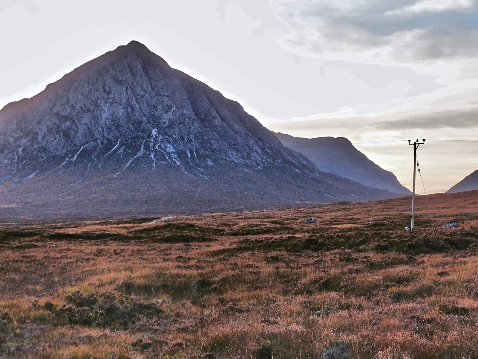
As a hill walk, this is a bit of a plod with no discernible paths. As a summit, it is magnificent with a panorama as good as any in the western highlands. The Blackwater reservoir was just below the summit to the north, beyond which all the Mamores and the Grey Corries were visible. To the east the shapely Schiehallion and to the south and west Glencoe was crinkling with familiar peaks. The great isosceles triangle of Buchaille Etive Mor dominates the view. I enjoyed an orange and loitered, this was an exquisite moment as the sun created a shadow-filled landscape of the western highlands. I tried to capture as much as I could on camera but the reality was so much better.
My descent was straight and direct to the Kingshouse. It was rough ground but I had decided against trying to find an easier route. I avoided most of the bogs of the ascent and arrived at the West Highland Way in decent time. Outside the Kingshouse some deer were grazing as the sun was dipping beyond the Glencoe peaks. I was away by 6pm and home by 7:30pm after two splendid walks in Glencoe and for the second time of the day, it was a near-empty A82.
 |
| Ben Nevis and Mamores |
 |
| Glencoe |
 |
| Looking north from summit |
 |
| Kingshouse on descent |
 |
| Buchaille Etive Mor |
 |
| Kingshouse deer |
 |

No comments:
Post a Comment
thanks