Monday 30 September 2013

Carn Mor Dearg and the Aonachs


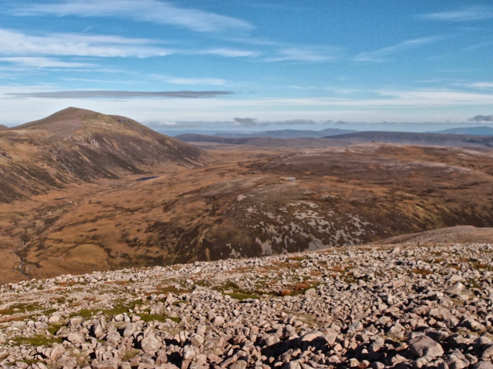
Carn Mor Dearg from the Aonach ascent

Route from Torlundy - anti-clockwise

Monday, 30 September 2013
Ascent:      1835 metres
Distance:   19 kilometres
Time:         6 hours 21 minutes

t      Carn Dearg Meadhonach   1179m     1hr   57mins
m    Carn Mor Dearg                 1220m     2hrs 10mins
Bealach Coire Giubhsachan        820m    2hrs  51mins
m   Aonach Beag                       1231m    3hrs  45mins
m   Aonach Mor                         1221m    4hrs  15mins

A reasonable forecast got me thinking, should I go to Fort William and climb Carn Mor Dearg and the Aonachs, three of the nine four thousand-foot mountains in Scotland? I had already climbed Ben Nevis a couple of times during this round of munros and it would be a relief to give it a miss. I had usually climbed these three mountains along with Ben Nevis but I had never ascended from the North Face car park at Torlundy. I had a new car that I wanted to take for a first spin to the hills so I decided against catching the bus to Fort William. It is a 7-kilometre walk from Fort William to the start at Torlundy and there would be no guarantee of a seat on the bus back to Crianlarich given it is the end of the Glasgow September long weekend.

I parked at the North Face car park and chatted to a local who had been walking her dog. She told me that there was a path back to the car park via the cycle trails from the foot of the Nevis Range ski slopes. With that knowledge my route plan was complete. I followed the excellent path up to the Allt a' Mhuillin which lies in the glen below the north face of Ben Nevis. You cross a fence and reach open ground at 280 metres and a less travelled path then splits off for Carn Mor Dearg at about 330 metres. It was boggy but I managed to keep my feet dry and I was walking well.

A strong south-easterly wind slowed progress but the north face of Ben Nevis was showboating its intricate profile of gullies and black crags beneath its cap of cloud. There were quite a few groups ahead and I used them as magnets to propel me to the summit. There is a fast-flowing burn 200 metres before the top of Carn Dearg Meadhonach and I filled up with crystal-clear water before the final burst to the summit.

The view across to the Aonachs showed that they were both still in the cloud as was the summit of Ben Nevis. During a short break for some food, there were a couple of glimpses of the summit plateau as the clouds scudded away in the strong winds. I headed off the summit and down the east ridge to the bealach below the Aonachs. The wind was gale force, each footstep had to be carefully planted and during the gusts, I had to hunker down. It took 41 minutes to make the descent of 425 metres to the bealach. I carried on across to the intimidating west wall of the Aonachs opposite. There is a good but very steep path that twists its way to the summit ridge. I made far better time on the ascent than the descent down to the bealach. At least Aonach Beag gave protection from the south-easterly gale.  Towards the top of the path, I began to contour to the right to reach the flat ridge below the final climb to Aonach Beag.

The climb to Aonach Beag curves through some rock bands before making a gentler climb to the bleak bare summit. I had spent 20 minutes searching for the modest cairn on a previous visit in the mist. Today I hit it first time helped by the voices of a couple of other walkers who were taking photos. I finished my food and shared it with a snow bunting that came nearer with each thrown crumb. The Wensleydale cheese and Branston pickle did the job. It is an exposed featureless and lonely summit so I was soon on the way back to the connecting ridge over to Aonach Mor.

Apart from the low point, both hills were still in clouds. Aonach Mor is reached by a well-defined path deeply scored into the grass-covered south-facing incline. The cairn is an ugly pile of stones sitting in the middle of another featureless plateau. I took a bearing and headed off to the north avoiding the steep rock ribs below the western lip of the summit. Eventually, the ugly ski tows and their ancillary huts and fences came into view. The ground was littered with wires, broken posts, lubrication cartridges and other debris but the fences helped me find a way down before I emerged from the cloud. I had skied these slopes in the 1980s but they never had the attraction of Cairngorm or Glencoe. Their development for downhill biking is probably a better use of this desecrated hill. Nevertheless, the vast area of the ski pistes gave a good route down with the gradient perfect for descending.

I decided to head for the outlying hill of Meall Beag which had a trail leading over to a viewpoint. I stopped to remove my wind top and for a drink at the viewpoint and scoured my rucksack for some morsels of food before making a steepish descent through the heathers to the Allt Daim. There is a dam which I crossed and then a track down to the top of the conifer plantations. My map was a bit unclear about the tracks from here but I followed various downhill cycle trails until I found a dismantled railway track which contours around the hillside and eventually meets the path down from Allt a'Mhuillinn that I had walked up in the morning. I was back at the car just after 5pm. A couple from Glasgow arrived back shortly afterwards full of the joys of their climb over the Carn Mor Dearg Arete to Ben Nevis. The upbeat demeanour of fellow hillwalkers at the end of the day never fails to lift your spirits.

Looking back to Loch Eil and Corpach during ascent

Carn Mor Dearg from Carn Dearg Meadhonach

Aonach Mor and Aonach Beag from Carn Mor Dearg 

Ben Nevis from Carn Mor Dearg

Carn Mor Dearg and Carn Dearg Meadhonach from the east ridge

Aonachs in the cloud, route up by central buttress

Mamores from Aonach Beag

Allt Daim between Carn Mor Dearg and Aonach Mor

Snow Bunting on Aonach Beag

Moody Mountains

Aonach Mor ski paraphernalia

Sunday 29 September 2013

Chuckles

Four generations of the family have been united in happiness by this short clip. Tova's chuckles are echoed by her papa every time he watches it.  After seeing it Great Granny is even tempted to acquire an iPad after years of resisting new technology.

In case I ever need a pick me up when away from home, I now have ready access on the blog.


Friday 27 September 2013

Autumn Drift

Lawn invaders

Autumn reds

Bramley crumble
It has been a fine summer and even September has been warm but today heralded autumn with a vengeance: the steady rain, low light, turning leaves, toadstools on the lawn, red creepers and apples ready for covering in crumble mix. The man came to service the boiler and questions are being asked about Christmas.

I have enjoyed the summer, exercising hard virtually everyday and going out on the hills more than in recent years. I feel well and have found time to read more books than ever before. I have relished being a grandparent and almost forgotten what it was to work 70 hours a week. But autumn brings not just short days but a sense of sadness about other things. Friends who are suffering from ill health or uncertain about their future as jobs disappear and pensions are inadequate,  an economy which is still stuttering and a world that is struggling with global warming as well as political and religious conflicts.

I read the paper and perused the BBC news as I do most mornings but could find no optimism to latch onto. The news is about foreign construction workers being treated like convicts in Qatar, Syria still at war with itself, the corporate sector lobbying for more government funds whilst shirking corporate responsibilities like tax and the absurd obsession with celebrity that dominates much of the media. Only the emergence of Iran seeking international inclusion at the United Nations offers some hope.

Meanwhile several people in recent days have spoken about their foreboding of the imminent autumn drift; they have only the steady drip of short dreary days in prospect to ride out the winter.

Autumn mists, acquaintances, apple crumbles, adventures in the mountains and active ageing will keep me happy.

Wednesday 25 September 2013

Creag Mhor, Beinn a' Chaorainn and Beinn Bhreac


Fords of Avon below Beinn Mheadhoin
Breakfast Brew

Bynack Mor from Creag Mhor

Blue Sky and Pink Granite on Creag Mhor summit
Bynack Mhor from Creag Mhor


Beinn Mheadhoin from Creag Mhor

Dubh Lochan and Beinn Mheadhoin
Bynack Mor and Creag Mhor from Beinn a' Chaorainn

Beinn Mheadhoin from Beinn a' Chaorainn


Beinn Mheadhoin

Ben Macdui from Moine Bhealaidh plateau

Looking back to Beinn a' Chaorainn from Beinn Bhreac

Monday 23 September 2013
Ascent:         850 metres           
Distance:      22 kilometres
Time:            6hrs 22mins

c     Creag Mhor                 895m       1hr 02mins
Camp by Fords of Avon     685m       1hr   55mins
m   Beinn a' Chaorainn     1083m       2hrs   42mins    
t     Beinn Bhreac w. top    927m       3hrs   54mins              
m   Beinn Bhreac               931m       4hrs   05mins 

Dawn was accompanied by the sound of red grouse, the skies were clear and the air still. Visibility was excellent, the ground was dry and after a brew and some food we set out at 7:30am to cross the Fords of Avon before climbing Creag Mhor. We were only five minutes away from the bothy which had been rebuilt by the Mountain Bothy Association with help from Cairngorm Mountain Rescue in 2011. A Doctor from Crieff was standing outside admiring his domain, sleeping bag draped over the granite boulders that surround what is no more than a large garden shed. We chatted for a while aware that we were immensely privileged to be in such a pristine location on a perfect autumn day. 

We continued and crossed the Allt Dearg and then set about the steep lower slopes of Creag Mhor. The low angled sun was illuminating the sparse plant life; burnt hombre grasses mingled with pink granite beneath the hooloovoo blue skies. The walk over the plateau to the distant tor was walking at its best: the cool of the early morning, the superb views in all directions and the feelgood that comes from feeling hill fit all intensified by the colour palate that this season provides. We climbed the granite block to the summit, there were sinks in the flat top which you could sit in or take a wash. It was one of those mountain moments that is seared in the memory. We returned taking a more direct route back to the bothy and then crossing the Fords of Avon again to reach the tents. 

We had a brew and packed before tackling the steep 400 metres of climbing to the summit of Beinn a' Chaorainn. This was the only hard part of the day so it was head down and push hard. It worked in that we were on the summit in 47 minutes despite the heavy sacks. It was still before noon and it was all plain sailing from here. We stopped and had 45 minutes sitting at the summit looking over at Ben Macdui and soaking up the warm sun. What a contrast from most summits when it is 3 or 4 minutes to take a drink and a photograph and then on with the walk. 

We descended down to the vast plateau of Moine Bhealaidh but the views of Ben Macdui and down to Beinn a' Ghlo made it a rare treat. Fortunately conditions were dry and the heathers were less fatiguing than they could have been. I decided to take in the west top before turning back to the summit.  We arrived on the summit and took another 20 minutes to eat some food and enjoy the last hill of the past two days. From here we could see down Deeside to Lochnagar and Mount Keen and observe the massive bulk of Beinn a' Bhuird, probably the least distinguished summit in the Cairngorms.

The descent is by a good path to the bealach below Meall an Lundain. Thereafter the normal descent is down to Derry Lodge but I elected to go over Meall an Lundain and subjected us to 3 kilometres of heather battering. We both fell into heather concealed ditches during the descent to the track along the Lui Water. Climbing out was not easy with a heavy rucksack and I had to scramble back down to retrieve my sunglasses. I then made the mistake of going down to a burn for water and found myself in a deep gorge with the only way out to descend the course of the burn. I emerged just above the track along the Lui Water for the final 3 or 4 kilometres back to the car park. 

The Mar estate, owned by the National Trust, had been taking down deer fences and surprisingly we had seen no deer on either of the two days. The native caledonian forest seemed to be rejuvenated with hundreds of scots pine seedlings thriving at up to 500 metres above sea level. We were down by 4pm despite a lazy day when we had spent a couple of hours resting at the camp and the three summits. This had been a superb two day outing and I now need only one more day to complete my two remaining munros and last corbett in the Cairngorms.


 Cairngorm Panorama


Monday 23 September 2013

Ben Macdui

Derry Lodge autumn carpets

One of the real advantages of retirement is the chance to select the days that you walk. The longer-term forecasts are not always right but they greatly increase the probability of avoiding those wind-assisted miserable days that were such a familiar occurrence on the weekends when walks had to fit in with time off and family life. An email from John on Wednesday evening had suggested two days in the northern Cairngorms walking into Ben Macdui and then camping by the Fords of Avon before collecting the remote Corbett of Creag Mhor and coming back over Beinna' Chaorrain and Beinn Bhreac.

I unhesitantly said yes before checking the forecast. Our optimism was rewarded with a mainly clear and dry day on the four munros from Carn a' Mhaim to Ben Macdhui, Derry Cairngorm and Beinn Mheadhoin. Even the gale-force winds forecast for the summits were less than expected. Then a dry night with a full moon and a perfect day for Creag Mhor and the two munros. I have split the walk into two days, the second of which was the best day ever in the Cairngorms.

Crossing the Lui

Deeside from Carn a' Mhaim

The Devil's Point from Carn a' Mhaim

Braeriach and the Lairig Ghru from Carn a' Mhaim

Corrour Bothy in the Lairig Ghru

Bein MacDui from Carn a' Mhaim summit

Ben Macdui from Carn a'Mhaim ridge

Final steps - summit of Ben Macdui

Braeriach from Ben Macdui

Looking north to Beinn Mheadhoin from Ben Macdui

Loch Etchachan and Cairngorm beyond

Beinn Mheadhoin summit Tors

Topping out on Beinn Mheadhoin

Sunday, 22 September 2013
Ascent:         1805 metres
Distance:       28 kilometres
Time:             9 hours 11minutes


m Carn a' Mhaim         1037m 2hrs 54mins
m Ben Macdui             1309m 4hrs 52mins
m Derry Cairngorm     1155m 6hrs 08mins
m Beinn Mheadhoin   1182m 7hrs 54mins


We arrived at the Linn of Dee at 10:30am, the hills were still in cloud but the forecast was for sunny periods and clear tops by midday. We spent some time adjusting our packs before setting out at 10:45am, the National Trust car park was full and the familiar trail through the plantations and then the native Scots Pine conjured up many memories of the walk along the banks of the Lui Water to Derry Lodge. The walk today was to be very similar to that in 1997 when I had taken my then 13-year-old son on a two day trip over the six munros on a dull August weekend.

Crossing the Luibeg burn was the first obstacle but we managed to dance across without getting our feet wet, not easy with a 45-litre rucksack. The two Polish walkers who we had just caught up with waited for us to find a way before following.  The path into the Lairig Ghru begins to climb more steeply from here and after 400 metres the excellent path up Carn a' Mhaim takes the direct route up the hill.

We climbed steadily to the summit stopping only to talk to a couple returning from the hill and telling us that the winds were a lot less severe than predicted. We had some lunch at the summit and then began the long but spectacular walk along the ridge with Ben Macdui out of cloud and displaying its full southern profile. Braeriach and Cairntoul were still wrapped in cloud but this dispersed as we continued the walk. The Devils Point looked impregnable and the Lairig Ghru was like a Harvey's map below us with the same colour tones at this time of the year. The light conditions were first class and if anything they got better as the day progressed.

We began the long (400 metres) ascent of the flank of Ben Macdui as a lone female climber came down from the screes. She had completed three munros already and was returning to Derry Lodge where she had discovered the joys of wild camping. We were a bit ruthless on the ascent hopping across the field of tumbling granite boulders until we reached the source of the Tailor's burn where we slaked our thirst and filled our water bottles. The walk from here to the summit of Ben Macdui is easy going over short heathers and grasses interspersed with granules of granite. The summit has a collection of cairns and shelters as well as a trig point mounted on a pedestal. It provides superb views over Braeriach and its massive corries to the west,  with Cairngorm and our next set of hills - Derry Cairngorm and Beinn Mheadhoin to the north and east.

Leaving Ben Macdui we were a bit lazy and headed northeast instead of east and then had to climb over another ridge to find the path down to Loch Etchachan. It had not cost us much time but we were beginning to realise that we would need to push on to avoid descending Beinn Mheadhoin in the dark. We dumped our sacks on the path to Derry Cairngorm by a small Lochan and hammered on, the winds had begun to make walking difficult and we were in cloud for the first time all day. I cannot recall ever being on this hill in clear conditions and this was my fifth visit. The wind made the return tricky at first but as we descended conditions began to improve, we grabbed our sacks, found the Etchachan path and made our way to the lip of the Loch which we crossed with the aid of a walking pole.

The climb up Beinn Mheadhoin starts with 200 metres up a steep path before you arrive on the long summit plateau and are drawn to the granite tors that signify the summit. We arrived at 6:45pm and allowed ourselves 15 minutes to climb the Tor despite hands cold from the strong winds. I had descended to the north on a previous visit and we did the same again, keeping the minor tops to our right before turning below them and descending down steep heather slopes to the Dubh Lochan. John went a rolling and tumbling in the twilight. We just about managed the descent before nightfall and the moon had not yet risen. We then had an awkward walk over boggy ground alongside the lochans to reach the Fords of Avon.

We found a good camping spot close to where the path crosses the burn leaving the Dubh Lochan. It was a struggle to pitch tents in the strong wind but once up the full moon arrived and provided a spotlight for our meal of soup, pasta and couscous. It was washed down with a brew of tea to dilute the monosodium glutamate. It was a warm night and sleep came easy on the mattress of grass and sedges. A helicopter was hovering over Cairngorm but the night was quiet apart from the gurgling of the burn and the regular squawking of grouse.  The star-studded skies suggested that we were in for a treat tomorrow.

Thursday 12 September 2013

Yorkshire Three Peaks


Pen-y-Ghent
Another long overdue objective on my walk list has been the Three Peaks at the head of the Ribble Valley in North Yorkshire. It is a favourite area with its tantalising limestone scenery, stone-built houses, straight-talking folk and fine local food and drink. As a boy, I had often been to Settle with a friend to visit his grandparents and later as an eleven and twelve-year-old travelled to Hellifield and Settle to watch the trains on the Settle to Carlisle line. I had climbed Ingleborough on several occasions as a teenager either on school trips or with friends who were into potholing and underage drinking.

I was due to drive down to London to see our daughter and granddaughter and then collect a new car that I had bought online. It seemed a waste of a journey without an expedition en route so I decided it was time to attempt the Yorkshire Three Peaks challenge. The forecast was a bit mixed but I drove down in the previous afternoon and arrived in Horton-in-Ribblesdale at 6 p.m. on a beautiful evening with Pen-y-Ghent beckoning in the evening sunlight. I arrived at the Holme Farm campsite and found the owner who had just come out of a hospital after a major operation and was recuperating in authentic Yorkshire style by returning to work immediately. He welcomed me to the site and told me to put up my tent and pay later when he would be down at the reception marquee which was adorned with all sorts of paraphernalia. A campsite on a flat field with cut grass and facilities has its advantages over my more usual wild camps in remote locations.

I had a lazy walk around the village in the evening sun before going into the Golden Lion for a pub meal and a couple of pints of Timothy Taylor, one of my favourite beers. It was Ukraine versus England live on the television and the pub soon filled with locals and visitors. The barmaid served everyone with a courtesy, zest and efficiency that was exceptional. The football match was not that entertaining so I bailed out at halftime to get an early night. I planned to start at 7:30am as I was feeling fairly fit and anticipated getting well under the 12-hour challenge. I had prepared a schedule for a 10-hour round after consulting the 3 Peaks Forum but then discovered that the race record was less than 3 hours by Geoff Norman in 1974. He had only beaten me by 20 minutes in the Snowdon marathon 25 years ago, so I figured I could manage the 10 hours.

Horton in Ribblesdale church and Pen-y-Ghent

Pen-y-Ghent path into the cloud

Pen-y-Ghent looms out of the cloud

Looking across to Ingleborough from the Pan-y-Ghent descent

Ribblehead Viaduct over Blea Moor

The most famous signal box in Britain?

Settle to Carlisle railway with Ingleborough in the background

Friendly Yorkshire Red Grouse on Whernside ascent

Limestone pavement being laid below Whernside summit ridge

Whernside trig point

Ascent of Ingleborough

Yorkshire Grannies on Ingleborough
Yorkshire Three Peaks
Wednesday, 11 September 2013
Ascent:        1525 metes
Distance:     39 kilometres
Time:           7 hours 41 minutes
Pen-y-Ghent                  694m                57mins
Long Mires                                    1hr   53mins
Aqueduct                                     3hrs  31mins
Whernside                     732m       4hrs  17mins
Old Hill Inn                                   5hrs  14mins
Ingleborough                 724m       6hrs  13mins
Horton in Ribblesdale cafe            7hrs  41mins

After a rare dry night in the tent, I was awoken at 5am by a party of campers setting out for their Three Peaks walk. It was still dark and I dozed off again but by 6am I was awake and thinking that perhaps I should start earlier than intended as the forecast was for rain in the afternoon. I had a snack, packed the tent and camping gear into the car and managed a 7am start from the campsite. It is next to the cafe which records Three Peaks rounds but the cafe was closed at this early hour. Pen-y-Ghent was still visible but ominous grey clouds were heading in. I assumed that it would be a mostly wet day and thought it would be a bonus to climb Pen-y-Ghent in the dry.

I had downloaded the split times for a 10-hour round from Mac.hawk's email in response to my request to the 3 peaks forum. Walking past Horton in Ribblesdale's Ofsted-rated 'Outstanding Primary School' I soon reached the path which climbed through the bright green fields decorated with sheep and limestone blocks. The final 200 metres of the climb up Pen-y-Ghent is a steep staircase up to the scarp edge of the hill. I was slightly surprised that I had broken the hour for the ascent and I was 23 minutes ahead of the split time for the 10-hour schedule. The summit was in cloud so I wasted no time in starting the next leg of the walk.

The descent was quick and easy down a muddy path from the summit at first and then an excellent path which encouraged me to run as I began to think that a 9-hour round was possible. The paths continued to be well made with an excellent new section at Whitber Hill which includes some fine dry stane dyking in progress. By Long Mires, I had made another 10 minutes on the schedule and at Nether Lodge I had caught the four walkers who had made the 5 a.m. start from the campsite. The next section crossed the river and then climbed up to Lodge Hall before a couple of kilometres along the road to the Ribblehead T junction. There was a car park here and another batch of walkers was setting out for Whernside. I was mesmerised by the approaching view of the Ribblehead Viaduct.

The Ribblehead viaduct across Blea Moor is one of the must-visit places for steam locomotive photographers but this was the first time I had been up close. A three-car diesel unit grumbled past having no presence whatsoever. The Blea Moor signal box is one of the most photographed in Britain set a mile or so before the eponymous tunnel. My pace was not slowing and I overhauled a number of walkers as the gradient increased. A lone female runner appeared out of the mist on her descent from Whernside. In the still air, there were echoes of heavy machinery at work on the hillside.

The summit of Whernside was in the cloud and I came across a digger and two men laying vast limestone slabs on the boggy ground leading to the summit. There had been a staircase of limestone slabs up to the summit ridge and the men were surrounded by stacks of slabs that had presumably been helicoptered in. As a stairway to heaven, it was a good attempt. Again the summit was in the cloud and there was no one around to occupy the generous shelters which overwhelmed the trig point.

I passed five people on their ascent from the south during my descent to Brunscar which is helped by more man-made limestone pavements. As I continued across the grazing land I was charged by a cow with a calf. I met another two of the 5 a.m. starts before I called in at Old Hill Inn to fill my water bottle and then rescued some lunch and waterproofs from my rucksack as the rain began to fall steadily.

The path from here up to Braithwaite Wife Hole is through more grazings and at times the trail was not immediately obvious. Beyond is the famous Ingleborough staircase which steepens as it climbs viciously towards the summit. I was on a charge by this time realising that I was now on a schedule of 8 hours. From 500 metres the hill was in the clouds so I had to sense my way across the plateau which is festooned with random cairns to the summit. There are four seating areas circling the summit, two of which were occupied by a bevvy of Yorkshire grannies.  I am deeply fond of Yorkshire grannies but they are formidable people; I know as I had one from Denby Dale. "Would you like us to push up and let you in luv," sounded like a deal I should give a miss, although I suppose they are my generation nowadays. I took a photo of them instead and they wished me good luck as I headed down into the mist.

Initially, I was disorientated as I escaped the grannies and could not refind the path so I had to retrieve my compass and take a bearing to find the route down. There is a long descent to Horton over wet muddy ground which is studded with smooth slippy limestone blocks. It meant the descent had to be more cautious than I would like but I seemed to be well ahead of 8 hours so I walked most of the way apart from the last mile into Horton. I was back at the campsite by 2:45pm for a total time of 7 hours 41 minutes. I called in at the cafe to see if I could get a certificate but as I had not posted a card into the cafe in the morning this was not possible. This was a bit of an anticlimax to a day that had gone far better than I had expected.

I changed alongside the car and then the really difficult part of the day began. It took 2 hours to reach the M1 via Skipton and Bradford. The West Yorkshire conurbation was gridlocked with traffic in the late afternoon. I had intended to travel down to London via the M6 but I had been warned by a fellow walker that it was cluttered with roadworks. I made it down the M1 from Wakefield to London in two and a half hours and then it took another hour and fifteen minutes to get across London to the south side. The Three Peaks was a lot easier than the driving nightmare that followed but I arrived by 10pm feeling quite relaxed and not at all stiff after a long day on the Yorkshire hills.

Real limestone pavements on final descent to Horton in Ribblesdale