 |
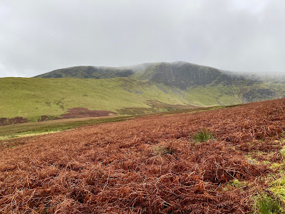
| Bannerdale Crags |
Sunday, 19 November 2023
Distance: 12 kilometres
Time: 3 hours 7 minutes
Bowscale Fell. 702m. 1hr 8mins
Bannerdale Crags 683m 1hr 37mins
Souther Fell. 522m. 2hrs 37mins
Before retirement, I often took a few days off in late November for some hillwalking. The conditions were invariably foul but allowed us to capture a few Munros and prepare for winter. I had not repeated this after retirement, it was preferable to select the days of better weather if that is not an oxymoron in November. Keith had suggested a trip to the Lakes, staying at Keswick Youth Hostel. Both Keith and I were well into our second round of Wainwrights and I was charged with selecting the routes. John agreed to come as well although he is less enamoured by the charms of the Lake District. I collected him from Selkirk and we drove down the A7 through Langholm and Eskdale on a Sunday morning.
The rain started at Carlisle and by the time we reached Mungrisdale, it was low clouds and steady rain. Keith had already arrived and nipped off to climb a Birkett. We put on waterproofs but stuck to trainers, our feet would be soaked whatever we wore and boots are even heavier when wet. We took the path alongside the Bullfell Beck, the path was waterlogged and even large slabs of sandstone paving were mere islands in what would be paddy fields in warmer climes. Nevertheless, it was not cold and the winds had abated. Even Wainwright in his Guide to the Northern Fells describes the path to Bowscale as one of the easiest paths in the Lake District to a mountain of over 2000 feet.
We met Keith on the path and he went off to collect another Birkett on the northeast ridge of Bowscale. He would meet us later at the summit of Bowscale Fell. He arrived a few minutes after John and I, clutching his map and compass, despite having OS maps online loaded on his large smartphone. Keith is never knowingly underequipped on the hills and provides a reassuring presence when the conditions are tough.
There was nothing to see or do at the summit so we began the easy tramp over to Bannerdale Crags. The path was deeply etched into the grassy summit ridge. Keith has an app that pinpoints the summit of hills to the nearest couple of centimetres. After we arrived at the pile of stones at what we assumed was the top of Bannerdale Crags, Keith summoned us to a spot 80 metres or so to the west where a flat embedded stone was the highest point. We stood on the as we cursed Keith's app. A family from Penrith who reached the pie of stones didn't bother, they were more concerned about getting down out of the rain as the woman's insulated jacket was not as waterproof as she had assumed.
It was a steepish descent to the River Glenderamackin before a steady climb to Souther Fell. Again we were guided to the highest point by Keith's app and then made a transverse descent through the bracken to the road leading back to Mungrisdale. The rain had finally dispersed as we arrived at the community hall that has an honesty box for parking, at a modest £2, a relative bargain as many landowners across the Lakes are charging for any parking spot that they may or may not own.
It was only a 10-minute drive to the Keswick Youth Hostel. I had not visited it since I was 17 and on my first holiday with friends. Although the Hostel is in the same place it has been well modernised, and warm, with good showers, beer on tap, well-equipped and with friendly staff. All I can recall from my previous visit to the hostel is a brief but enjoyable encounter with Lynn from Liverpool who was also on a walking holiday with her friends
 |
| Bowscale Summit |
 |
| River Glenderamackin below Bannerdale Crags |
 |
| Mill Inn - Mungrisdale |
 |
| Mungrisdale - walk end |

No comments:
Post a Comment
thanks